Global Information Lookup Global Information

Tullparaju information


Tullparaju
Tullparaju mountain from the entrance of Quilcayhuanca ravine
Highest point
Elevation5,787 m (18,986 ft)[1]
Coordinates9°24′00″S 77°19′00″W / 9.40000°S 77.31667°W / -9.40000; -77.31667
Geography
Tullparaju is located in Peru
Tullparaju
Tullparaju
Location in Peru
LocationPeru, Ancash
Parent rangeCordillera Blanca
Climbing
First ascent1-1962 via W. ridge: E. ridge-1979[1]

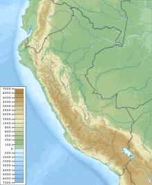
Tullparaju[2][3][1][4] (possibly from Quechua tullpa rustic cooking-fire, stove, rahu snow, ice, mountain with snow)[5][6] is a mountain in the Cordillera Blanca in the Andes of Peru, about 5,787 metres (18,986 ft) high.[2][3][1][4] It is situated in the Ancash Region, Huaraz Province, Independencia District, and in the Huari Province, Huari District.[7] Tullparaju lies southeast of the mountains Pucaranra and Chinchey and northeast of Andavite. It is situated at the end of the Quilcayhuanca valley, northeast of the lake Tullpacocha.

  1. ^ a b c d Neate, Jill (1994). "Peru". Mountaineering in the Andes (PDF). RGS-IBG Expedition Advisory Centre. p. 12. ISBN 0-907649-64-5.
  2. ^ a b Alpenvereinskarte 0/3b. Cordillera Blanca Süd (Peru). 1:100 000. Oesterreichischer Alpenverein. 2005. ISBN 3-937530-05-3.
  3. ^ a b "Tullparaju - Peakbagger.com". www.peakbagger.com. Retrieved 2016-06-23.
  4. ^ a b Ricker, John (1977). Yuraq Janka: A Guide to the Peruvian Andes. The Mountaineers Books. p. 99.
  5. ^ Vocabulario comparativo quechua ecuatoriano - quechua ancashino -- castellano - English (pdf)
  6. ^ babylon.com Archived 2014-12-29 at the Wayback Machine
  7. ^ escale.minedu.gob.pe - UGEL map of the Huaraz Province (Ancash Region) showing the contours of Tullparaju southeast of Chinchey

and 9 Related for: Tullparaju information

Request time (Page generated in 0.57 seconds.)

Tullparaju

Last Update:

Tullparaju (possibly from Quechua tullpa rustic cooking-fire, stove, rahu snow, ice, mountain with snow) is a mountain in the Cordillera Blanca in the...

Word Count : 186

Huandoy

Last Update:

wantuy, to transfer, to transpose, to carry, to carry a heavy load) or Tullparaju (possibly from Quechua tullpa rustic cooking-fire, stove, rahu snow, ice...

Word Count : 404

List of mountains in the Andes

Last Update:

Cordillera Real  Ecuador 5,787 Tullparaju Cordillera Blanca 9°24′S 77°19′W / 9.400°S 77.317°W / -9.400; -77.317 (Tullparaju)  Peru 5,780 Allincapac Cordillera...

Word Count : 174

List of first ascents in the Cordillera Blanca

Last Update:

Hauser [de], Berhard Huhn, Frieder Knauss, and Horst Wiedmann 24 Jul 1962 Tullparaju 5787 18,986 West Ridge David Bernays, Leif-Norman Patterson and Charles...

Word Count : 239

Cordillera Blanca

Last Update:

5,810 metres (19,062 ft) Santa Cruz Chico, 5,800 metres (19,029 ft) Tullparaju, 5,787 metres (18,986 ft) Pisco, 5,752 metres (18,871 ft) Paccharaju,...

Word Count : 1780

Tullpacocha

Last Update:

Blanca, southeast of Palcaraju and Pucaranra, southwest of Chinchey and Tullparaju and northwest of Andavite, at the very end of the Quilcayhuanca gorge...

Word Count : 106

Quilcayhuanca

Last Update:

the Santa River. The river originates in the Cordillera Blanca west of Tullparaju near the lake Tullpaqucha. Its direction is to the southwest. It flows...

Word Count : 296

Huaraz Province

Last Update:

Pucaranra Puma Waqanqa Carhuascancha Ranrapalca Rima Rima Rúrec Shacsha Tullparaju Tuctu Tuctopunta Ocshapalca Uruashraju Vallunaraju Wamanpinta Huamashraju...

Word Count : 426

Andavite

Last Update:

provinces in Ancash. Andavite lies northwest of Cayesh and southeast of Tullparaju. It is situated at the end of the Quilcayhuanca valley, southeast of a...

Word Count : 143

PDF Search Engine © AllGlobal.net