 Global Information
Trstenik Airfield information
Trstenik Airfield Аеродром Трстеник Aerodrom Trstenik | |||||||||||
|---|---|---|---|---|---|---|---|---|---|---|---|
| |||||||||||
| Summary | |||||||||||
| Airport type | Public | ||||||||||
| Operator | Civil Government | ||||||||||
| Location | Trstenik | ||||||||||
| Elevation AMSL | 525 ft / 160 m | ||||||||||
| Coordinates | 43°36′51.08″N 021°01′48.78″E / 43.6141889°N 21.0302167°E | ||||||||||
| Map | |||||||||||
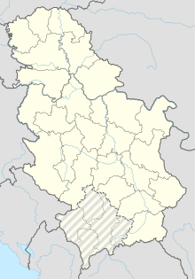 LYTR Location in Serbia | |||||||||||
| Runways | |||||||||||
| |||||||||||
Trstenik Airfield (ICAO: LYTR) (Serbian: Аеродром Трстеник, Latin: Aerodrom Trstenik) also known as "Odžaci" is a recreational aerodrome in Serbia, 2.5 km from the town of Trstenik and 12 km from the spa of Vrnjačka Banja. The airfield is within the closest vicinity (60 kilometres-about 50 minutes by Bus, instead 2 hours 45 mins from Niš Constantine the Great Airport transfer) to the famous Kopaonik mountain ski resort, and is also 20 kilometres from the Goč mountain.
The grass runway is 80 meters (260 feet) wide with concrete runway beginnings on both thresholds 30 meters (98 feet) in width and 300 meters (980 feet) in length.
In 1990, construction work came to a finish on the building of both a new control tower and underground fuel tanks.[citation needed]