 Global Information
Tanjung Simpang Mengayau information
Tanjung Simpang Mengayau | |
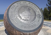 The bronze globe. | |
 | |
| 7°2′4″N 116°44′54″E / 7.03444°N 116.74833°E | |
| Location | Kudat Division, Sabah, Malaysia |
|---|---|
| Opening date | 2004 |
| Dedicated to | Marks the northernmost point of Borneo island |
The Tip of Borneo (Malay: Tanjung Simpang Mengayau) is the northernmost tip of Borneo located in Kudat District, Sabah, Malaysia. The tip marks the meeting point of the South China Sea and Sulu Sea.[1][2]
- ^ Joshua Hendry (5 August 2011). "Tanjung Simpang Mengayau, northernmost tip of Borneo, a place like no other". The Star. Retrieved 21 May 2019.
- ^ "Tip of Borneo". New Sabah Times. 17 February 2017. Archived from the original on 21 May 2019. Retrieved 21 May 2019.