 Global Information
Tanggulashan information
Tanggula
唐古拉山镇 · གདང་ལ་གྲོང་རྡལ། | |
|---|---|
Town | |
 Tanggula railway station | |
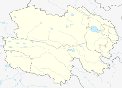 Tanggula Location in Qinghai | |
| Coordinates: 34°13′53″N 92°26′33″E / 34.23139°N 92.44250°E | |
| Country | China |
| Province | Qinghai |
| Autonomous prefecture | Haixi |
| County-level city | Golmud |
| Area | |
| • Total | 47,540.08 km2 (18,355.33 sq mi) |
| Elevation | 4,535 m (14,879 ft) |
| Population (2020) | |
| • Total | 1,750 |
| • Density | 0.037/km2 (0.095/sq mi) |
| Time zone | UTC+8 (China Standard) |
| Postal code | 632801101 |
| Tanggulashan / Danglarong | |||||||
|---|---|---|---|---|---|---|---|
| Chinese name | |||||||
| Chinese | 唐古拉山 | ||||||
| |||||||
| Tibetan name | |||||||
| Tibetan | གདང་ལ་གྲོང། | ||||||
| |||||||
| Tanggula / Dangla | |||||||
|---|---|---|---|---|---|---|---|
| Chinese name | |||||||
| Chinese | 唐古拉 | ||||||
| |||||||
| Tibetan name | |||||||
| Tibetan | གདང་ལ་གྲོང། | ||||||
| |||||||
Tanggulashan (simplified Chinese: 唐古拉山镇; traditional Chinese: 唐古拉山鎮; pinyin: Tánggǔlāshān Zhèn; lit. 'Tanggula Mountains town', Standard Tibetan: གདང་ལ་གྲོང་རྡལ།), or Dangla Town, is a town in the southwest of Qinghai province, China. It forms the southern exclave of the county-level city of Golmud, in Haixi Mongol and Tibetan Autonomous Prefecture, partially administrated by Amdo County, Tibet Autonomous Region since 1963 and still officially a territory of Yushu Prefecture, Qinghai under trust administration of Golmud, Haixi Prefecture, Qinghai. Before the local administrative reform of 2005, it was known as Tanggula Township (唐古拉乡). It is the only place in China simultaneously under jurisdiction of three prefectures.
The town spans an area of approximately 48,000 square kilometres (19,000 sq mi), and has a population of 1,750 as of 2020.[1]
- ^ 唐古拉山镇基本情况 [Tanggulashan Basic Overview]. www.geermu.gov.cn (in Chinese). The People's Government of Golmud. 2021-06-24. Archived from the original on 2021-10-21. Retrieved 2021-10-21.