 Global Information
Taetan Airport information
T'aet'an-pihaengjang Airport | |||||||||||||||
|---|---|---|---|---|---|---|---|---|---|---|---|---|---|---|---|
| |||||||||||||||
| Summary | |||||||||||||||
| Airport type | Military | ||||||||||||||
| Serves | Taetan, North Korea | ||||||||||||||
| Elevation AMSL | 246 ft / 75 m | ||||||||||||||
| Coordinates | 38°07′48.50″N 125°14′34.90″E / 38.1301389°N 125.2430278°E | ||||||||||||||
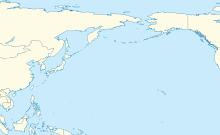
| Map | |||||||||||||||
 Taetan  Taetan  Taetan  Taetan | |||||||||||||||
| Runways | |||||||||||||||
| |||||||||||||||
| Taetan Airport | |
| Chosŏn'gŭl | 태탄비행장 |
|---|---|
| Hancha | 苔灘飛行場 |
| Revised Romanization | Taetan-bihaengjang |
| McCune–Reischauer | T'aet'an-pihaengjang |
T'aet'an-pihaengjang Airport is an airport in Taetan, Hwanghae-namdo, North Korea. It is sited in a valley approximately 42 km west-northwest of Haeju.