 Global Information
TNTmips information
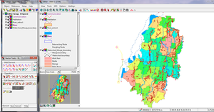 Line editing with Tntmips Pro 2013 on Windows 7 | |
| Developer(s) | MicroImages, Inc. |
|---|---|
| Initial release | March 3, 1986 |
| Stable release | 2021
/ January 5, 2021 |
| Operating system | Mac OS X Microsoft Windows |
| Type | Geographic information system |
| License | Proprietary commercial software |
| Website | www |
TNTmips is a geospatial analysis system providing a fully featured GIS, RDBMS, and automated image processing system with CAD, TIN, surface modeling, map layout and innovative data publishing tools. TNTmips has a single integrated system with an identical interface, functionality, and geodata structure for use on Mac and Windows operating systems. The interface, database text content, messages, map production, and all other internal aspects of TNTmips have been localized for use in many languages, including, for example Arabic, Thai, and all romance languages. The professional version of TNTmips is in use in over 120 nations while the TNTmips Free version (restricted in project size) is used worldwide for educational, self learning, and small projects (e.g., archaeological sites, neighborhood planning, and precision farming).