 Global Information
Syltefjordstauran information
| Syltefjordstauran | |
|---|---|
| Stauran | |
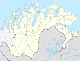 Syltefjordstauran Location of the mountain  Syltefjordstauran Syltefjordstauran (Norway) | |
| Highest point | |
| Elevation | 222 m (728 ft) |
| Coordinates | 70°35′46″N 30°18′40″E / 70.596082°N 30.311107°E[1] |
| Geography | |
| Location | Finnmark, Norway |
Syltefjordstauran is a mountain cliff in Båtsfjord Municipality in Finnmark County, Norway. It is located along the northern coast of the Syltefjorden, about 10 kilometres (6.2 mi) northeast of the abandoned village of Nordfjord. The 222-metre (728 ft) tall mountain cliff runs for a length of about 3 kilometres (1.9 mi) along the shore. It is among the largest bird cliffs in Finnmark county.[2][3]
The cliff hosts the largest colony of black-legged kittiwake in Northern Europe as well as a large colony of northern gannet.[3][4]
- ^ "Stauran, Båtsfjord (Finnmark)" (in Norwegian). yr.no. Retrieved 24 May 2018.
- ^ Mehlum, Fridtjof. "Fuglefjell". In Godal, Anne Marit (ed.). Store norske leksikon (in Norwegian). Oslo: Norsk nettleksikon. Retrieved 13 October 2013.
- ^ a b Evensen, Knut Harald, ed. (2010). NAF Veibok 2010-2012 (in Norwegian) (29th ed.). Oslo: Norges Automobil-Forbund. pp. 147, 517.
- ^ Askheim, Svein. "Syltefjordstauran". In Godal, Anne Marit (ed.). Store norske leksikon (in Norwegian). Oslo: Norsk nettleksikon. Retrieved 2 August 2013.