The South East London Green Chain, also known as the Green Chain Walk, is a linked system of open spaces between the River Thames and Crystal Palace Park in London, England. In 1977 four London boroughs and the Greater London Council created this Green Chain of 300 open spaces to protect them from building activity. The four London boroughs are Bexley, Bromley, Lewisham and Greenwich. More recently it has been extended to include sections in Southwark. Many parts of the system are also part of the Capital Ring route.
The system begins at three places on the River Thames: Thames Barrier, Thamesmead, and the riverside at Erith. There are various circular walks along the route, and there is an offshoot from the main route to Chislehurst; and the next section reaches Crystal Palace via Bromley.
From there it goes north with branches to Dulwich and Nunhead.
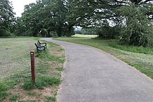
Shrewsbury Park, with Green Chain Walk marker post
The major open spaces in the Chain are:
Lesnes Abbey
Bostall Heath and Woods
Parks in Charlton including Maryon Park, Maryon Wilson Park and Charlton Park
Woolwich Common
Plumstead Common
Shooters Hill area, including Shrewsbury Park, Eaglesfield Park, Oxleas Wood and several other woods and open spaces
Eltham Park and Common
Eltham Palace
Avery Hill Park
Grove Park Nature Reserve
Chinbrook Meadows
Elmstead Wood
Parks around Beckenham, including Beckenham Place Park
Parks around Bromley including Sundridge Park and Chislehurst Common
Crystal Palace Park
The complete list and the routes are to be found on TfL's Walk London site.[1]
^tfl.gov.uk
and 28 Related for: South East London Green Chain information
The SouthEastLondonGreenChain, also known as the GreenChain Walk, is a linked system of open spaces between the River Thames and Crystal Palace Park...
(SE18), south-eastLondon. It is part of the SouthEastLondonGreenChain. Plumstead Common is bound to the north by Old Mill Road and to the south by Plumstead...
The London Borough of Bexley (/ˈbɛksli/ ) is a London borough in south-eastLondon, forming part of Outer London. It has a population of 248,287. The main...
grounds. Some of the open spaces form part of the SouthEastLondonGreenChain. As a borough in Outer London it also contains some open countryside in the...
the SouthEastLondonGreenChain, the Ridgeway (Thamesmead), the Capital Ring and the Parkland Walk. The planning of long-distance routes in London began...
Capital Ring comprises three walks, 1 to 3. These are part of the SouthEastLondonGreenChain. It starts from the Woolwich foot tunnel and ends in Crystal...
Heath. Bostall Woods (part of the SouthEastLondonGreenChain) includes one of the few camping and caravan sites in London, which is owned and operated by...
during the winter months and across London and the SouthEast during the summer. The SouthEastLondonGreenChain, a long-distance footpath, crosses through...
its original end in Islington, London. The path is waymarked and all signs display the words "New River Path" on a green background. The New River itself...
conservation area. It is part of the SouthEastLondonGreenChain. It is also the name of a street on the east side of the common, as well as an electoral...
near-continuous chain of green spaces in Westminster that includes St James's Park, Hyde Park, and Kensington Gardens. To the northwest of Green Park is the...
groups: the "blue" group in SouthLondon, the "green" group in north-west London, and the "yellow" group in north-eastLondon. The sections vary in length...
South Woodford is an area of EastLondon, England, within the London Borough of Redbridge. It adjoins Woodford Green to the north, Walthamstow to the west...
eight miles. The Waterlink Way connects a number of parks and green spaces in SouthEastLondon – including Ladywell Fields and Brookmill Park – while following...
The East End of London, often referred to within the London area simply as the East End, is the historic core of wider EastLondon, east of the Roman and...
with a notional starting point of Woolwich. The SouthEastLondonGreenChain, also known as the GreenChain Walk, is a linked system of open spaces between...
East Dulwich is an area of SouthEastLondon, England in the London Borough of Southwark. It forms the eastern part of Dulwich, with Peckham to the east...
Reserve, and, along with nearby Charlton Park, forms part of the SouthEastLondonGreenChain. The park is a remnant of ancient forest once known as Hanging...
Chinbrook Meadows – on the River Quaggy east of Grove Park railway station and part of the SouthEastLondonGreenChain. Deptford Park – owned by the Borough...
Tolworth centre the walk leaves the Hogsmill River and continues on a narrow green strip between houses and beside a stream to reach the Horton Country Park...
The Beverley Brook Walk is a walking route in the south-western suburbs of London, England. It is 11.5 km (7.1 mi) long, of which the last 10.5 kilometres...
(/ˈɪərɪθ/ ) is an area in south-eastLondon, England, 13.3 miles (21.4 km) east of Charing Cross. Before the creation of Greater London in 1965, it was in the...
site, from a footpath named Railway Children Walk, part of the SouthEastLondonGreenChain and is joined with reserve's circular path by a shorter path...
The Parkland Walk is a 3.1-mile (5.0 km) linear green pedestrian and cycle route in London, which follows the course of the railway line that used to run...
 Global Information