Global Information Lookup Global Information

South Dakota Highway 20 information


Highway 20 marker

Highway 20

South Dakota Highway 20
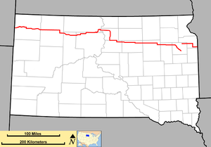
Map of South Dakota with SD 20 in red
Route information
Maintained by SDDOT
Length385.079 mi[1][2][3] (619.725 km)
Existedc. 1930[citation needed]–present
Tourist
routes
  • South Dakota Highway 20 Lewis and Clark Trail
  • South Dakota Highway 20 Native American Scenic Byway
Western segment
Length346.065 mi[1][2][3] (556.938 km)
West endMontana state line near Camp Crook
Major intersections
  • South Dakota Highway 20 US 85 from Buffalo to south of Buffalo
  • South Dakota Highway 20 US 12 from near Mobridge to south of Selby
  • South Dakota Highway 20 US 83 from northwest of Selby to southwest of Lowry
  • South Dakota Highway 20 US 281 in Mellette
East endSouth Dakota Highway 20 US 212 in Watertown
Eastern segment
Length39.014 mi[3] (62.787 km)
West endSouth Dakota Highway 20 CR 11 (455th Avenue) west of South Shore
Major intersections
  • South Dakota Highway 20South Dakota Highway 20 I-29 / US 81 west of South Shore
  • South Dakota Highway 20 SD 15 from east of Stockholm to near Revillo
East endSouth Dakota Highway 20 MN 40 at the Minnesota state line near Revillo
Location
CountryUnited States
StateSouth Dakota
Counties
  • Harding
  • Perkins
  • Ziebach
  • Dewey
  • Corson
  • Walworth
  • Potter
  • Faulk
  • Spink
  • Clark
  • Codington
  • Grant
Highway system
  • South Dakota State Trunk Highway System
  • Interstate
  • US
  • State
South Dakota Highway 20 SD 19South Dakota Highway 20 SD 21

South Dakota Highway 20 (SD 20) is a 385.079-mile (619.725 km) state highway in northern South Dakota, United States, that connects the Montana state line, west-southwest of Camp Crook, with the Minnesota state line, east-southeast of Revillo, via Buffalo, Bison, Timber Lake, Mobridge, Selby, and Watertown. From Mobridge to the Walworth–Potter county line, this highway is part of the Lewis and Clark Trail. From about Timber Lake to just west of Mobridge, this highway is part of the Native American Scenic Byway. From the Montana state line to Camp Crook, the highway is a dirt road.

SD 20 is composed of two disconnected segments. The longer western segment extends 346 miles (557 km) from Montana to Watertown. The much-shorter eastern segment extends 39 miles (63 km) from west of South Shore to Minnesota. However, the South Dakota Department of Transportation previously indicated that SD 20 followed US 212, US 81, and Interstate 29 (I-29) between the two segments.[3]

SD 20 originally extended from SD 45 west of Cresbard to Watertown. It was extended west to U.S. Route 83, southwest of Lowry. Later, it was extended to its current eastern terminus. Later still, it was extended to its current western terminus, replacing what had been SD 8 (and later SD 18).

  1. ^ a b "State Highway Log – Rapid City Region" (PDF). South Dakota Department of Transportation. January 2017. pp. 46–48. Retrieved January 26, 2018.
  2. ^ a b "State Highway Log – Pierre Region" (PDF). South Dakota Department of Transportation. January 2017. pp. 38–41. Retrieved January 26, 2018.
  3. ^ a b c d "State Highway Log – Aberdeen Region" (PDF). South Dakota Department of Transportation. January 2017. pp. 51–57. Retrieved January 26, 2018.

and 13 Related for: South Dakota Highway 20 information

Request time (Page generated in 1.0939 seconds.)

South Dakota Highway 20

Last Update:

South Dakota Highway 20 (SD 20) is a 385.079-mile (619.725 km) state highway in northern South Dakota, United States, that connects the Montana state...

Word Count : 3314

List of former state highways in South Dakota

Last Update:

former state highways in South Dakota. These roads are now either parts of other routes or no longer carry a route number. South Dakota Highway 8 was one...

Word Count : 1386

South Dakota Highway 87

Last Update:

South Dakota Highway 87 (SD 87) is a 37.894-mile-long (60.984 km) state highway in the southwestern part of the U.S. state of South Dakota. It travels...

Word Count : 725

South Dakota Highway Patrol

Last Update:

The South Dakota Highway Patrol is the state police agency for South Dakota, which has jurisdiction everywhere in the state except for sovereign Native...

Word Count : 691

List of state highways in South Dakota

Last Update:

South Dakota's state highways were assigned in a numbering pattern that followed that of the U.S. Highways followed upon their inception. East–west highways...

Word Count : 114

South Dakota Highway 1804

Last Update:

South Dakota Highway 1804 (SD 1804) is a 126.745-mile-long (203.976 km) state highway in the U.S. state of South Dakota. It consists of four disconnected...

Word Count : 1329

South Dakota Highway 47

Last Update:

South Dakota Highway 47 (SD 47) is a state route that runs north to south across the central portion of South Dakota. It begins at an unnumbered highway...

Word Count : 466

South Dakota Highway 73

Last Update:

South Dakota Highway 73 (SD 73) is a state route that runs across western South Dakota. It begins at the Nebraska border, north of Merriman, Nebraska,...

Word Count : 276

South Dakota Highway 37

Last Update:

South Dakota Highway 37 (SD 37) is a state route that runs across eastern South Dakota. It begins at the Nebraska border northeast of Niobrara, Nebraska...

Word Count : 348

South Dakota Highway 79

Last Update:

South Dakota Highway 79 (SD 79) is a 209-mile (336 km) state highway in western South Dakota, United States, that runs from Maverick Junction near the...

Word Count : 201

South Dakota Highway 144

Last Update:

South Dakota Highway 144 (SD 144) is a short highway linking the town of Akaska to U.S. Highway 83 and SD 20. It was commissioned in 1976. This was originally...

Word Count : 118

South Dakota Highway 75

Last Update:

South Dakota Highway 75 (SD 75) is a state route located in northwest South Dakota. The southern terminus is at South Dakota Highway 20 west of Bison...

Word Count : 242

South Dakota Highway 100

Last Update:

South Dakota Highway 100 (SD 100) is the designation of a future state highway that will be built south and east of Interstate 229 (I-229) as a second...

Word Count : 715

PDF Search Engine © AllGlobal.net