Local government area in New South Wales, Australia
Snowy Valleys Council New South Wales
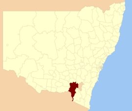
Location in New South Wales
Population
14,395 (2016 census)[1]
14,532 (2018 est.)[2]
• Density
1.6066/km2 (4.1610/sq mi)
Established
12 May 2016 (2016-05-12)
Area
8,960 km2 (3,459.5 sq mi)[3]
Mayor
Ian Chaffey
Region
South West Slopes
State electorate(s)
Albury, Wagga Wagga
Federal division(s)
Eden-Monaro
Website
Snowy Valleys Council
LGAs around Snowy Valleys Council:
Wagga Wagga
Cootamundra-Gundagai
Yass Valley
Greater Hume
Snowy Valleys Council
Snowy Monaro
Towong (Vic.)
Towong (Vic.)
Snowy Monaro
The Snowy Valleys Council is a local government area located in the South West Slopes region of New South Wales, Australia. This area was formed on 12 May 2016 from the merger of the Tumut Shire and Tumbarumba Shire Councils.[3]
The council area comprises 8,960 square kilometres (3,460 sq mi) and covers the western side of the southernmost portion of the Great Dividing Range and foothills in New South Wales. Large sections of the local government area are contained within national parks. At the time of its establishment, the population in the council area was estimated to be 14,953.[3]
Mayor of Snowy Valleys Council is Councillor Ian Chaffey, who a Tumbarumba local won the most recent election
^Australian Bureau of Statistics (27 June 2017). "SNowy Valleys (A)". 2016 Census QuickStats. Retrieved 8 December 2017.
^"3218.0 – Regional Population Growth, Australia, 2017–18". Australian Bureau of Statistics. 27 March 2019. Retrieved 27 March 2019. Estimated resident population (ERP) at 30 June 2018.
^ abcCite error: The named reference sc was invoked but never defined (see the help page).
and 14 Related for: Snowy Valleys Council information
The SnowyValleysCouncil is a local government area located in the South West Slopes region of New South Wales, Australia. This area was formed on 12...
former gold processing site and now picnic reserve at Adelong, SnowyValleysCouncil, New South Wales, Australia. It was designed and built in 1860 by...
Khancoban (/kænˈkoʊbən/) is a small town in SnowyValleysCouncil, New South Wales, Australia. The town is located 567 kilometres (352 mi) from the state...
at Eucumbene, SnowyValleysCouncil, New South Wales, Australia. The town was established in 1830. The reservoir was designed by the Snowy Hydro Electric...
Snowy Monaro Regional Council is a local government area located in the Snowy Mountains and Monaro regions of New South Wales, Australia. The council...
Bimberi, New South Wales is a civil parish of Cowley County, New South Wales. It includes the source of the Murrumbidgee River at Peppercorn Hill. It is...
banks of the Tumut River. Tumut sits on the north-west foothills of the Snowy Mountains and is located on the traditional lands of the Wiradjuri, Wolgalu...
Mount Kosciuszko (in Kosciuszko in SnowyValleysCouncil) through Snowy Monaro Regional Council to Eden (in Bega Valley Shire) in New South Wales, Australia...
provides a convenient base for visiting the Western Snowy Mountains area. The town lies on the SnowyValleys Way which Destination NSW advertises as a more...
the Murray catchment within the Murray–Darling basin, is located in the Snowy Mountains bioregion of New South Wales, Australia. The river rises on the...
Statistics (27 June 2017). "Snow Valleys (A)". 2016 Census QuickStats. Retrieved 7 July 2017. "SnowyValleyCouncil". Stronger Councils. Government of New South...
heritage-listed cinema and community theatre at 46 Russell Street, Tumut, SnowyValleysCouncil, New South Wales, Australia. It was designed by Kaberry & Chard...
heritage-listed former courthouse at Kiandra in the Kosciuszko National Park, SnowyValleysCouncil, New South Wales, Australia. It is also known as Kiandra Courthouse/Chalet...
City of Wagga Wagga and Lockhart Shire. It also covers part of the SnowyValleysCouncil, which was established following the merger of Tumut Shire and Tumbarumba...
 Global Information