 Global Information
Shire of Mornington Peninsula information
| Mornington Peninsula Shire Victoria | |||||||||||||||
|---|---|---|---|---|---|---|---|---|---|---|---|---|---|---|---|
 | |||||||||||||||
| Population | 168,948 (2021)[1] (40th) | ||||||||||||||
| • Density | 233.35/km2 (604.4/sq mi) | ||||||||||||||
| Established | 1994 | ||||||||||||||
| Area | 724 km2 (279.5 sq mi)[1] | ||||||||||||||
| Mayor | Cr Simon Brooks [1] | ||||||||||||||
| Council seat | Rosebud | ||||||||||||||
| Region | Greater Melbourne | ||||||||||||||
| State electorate(s) |
| ||||||||||||||
| Federal division(s) |
| ||||||||||||||
 | |||||||||||||||
| Website | Mornington Peninsula Shire | ||||||||||||||
| |||||||||||||||
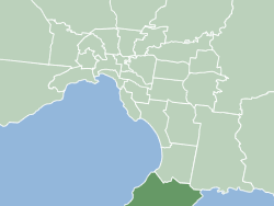
The Shire of Mornington Peninsula is a local government area in southeastern Metropolitan Melbourne, Victoria, Australia. It is located to the south of the Melbourne City Centre. It has an area of 724 square kilometres and in June 2018 it had a population of 165,822.[1]
- ^ a b c "3218.0 – Regional Population Growth, Australia, 2017–18: Population Estimates by Local Government Area (ASGS 2018), Mornington Peninsula Shire has three offices throughout Frankston and Mornington 2017 to 2018". Australian Bureau of Statistics. Australian Bureau of Statistics. 27 March 2019. Retrieved 25 October 2019. Estimated resident population, 30 June 2018.