Local government area in the Wheatbelt region of Western Australia
This article is about a local government area. For the town, see Dandaragan, Western Australia.
Shire of Dandaragan Western Australia
The Dandaragan shire offices in Jurien Bay
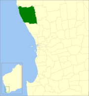
Location in Western Australia
Population
3,355 (LGA 2021)[1]
Established
1890
Area
6,716.3 km2 (2,593.2 sq mi)
Shire President
Tony O'Gorman[2][3]
Council seat
Jurien Bay
Region
Wheatbelt
State electorate(s)
Moore
Federal division(s)
Durack
Website
Shire of Dandaragan
LGAs around Shire of Dandaragan:
Coorow
Coorow
Shire of Dandaragan
Moora
Gingin
Victoria Plains
The Shire of Dandaragan is a local government area located in the Wheatbelt region of Western Australia, about 200 kilometres (124 mi) north of the state capital, Perth. The Shire covers an area of 6,716 square kilometres (2,593 sq mi) and its seat of government is the town of Jurien Bay.
^Australian Bureau of Statistics (28 June 2022). "Dandaragan (Local Government Area)". Australian Census 2021 QuickStats. Retrieved 28 June 2022.
^Cox, Anna; Moroney, Jessica (25 October 2023). "Mid West Gascoyne council elections herald changes in leadership while some remain unchanged". Midwest Times. Retrieved 9 June 2024.
^"O'GORMAN, Tony". Shire of Dandaragan. Retrieved 9 June 2024.
and 19 Related for: Shire of Dandaragan information
The ShireofDandaragan is a local government area located in the Wheatbelt region of Western Australia, about 200 kilometres (124 mi) north of the state...
Dandaragan plateau is a feature between the Darling Scarp and Gingin scarp in Western Australia. Dandaragan locality and ShireofDandaragan council of...
national park in Western Australia, 190 km north of Perth off the Brand Highway adjacent to the town of Badgingarra. The park is 13,108 hectares (32,390...
is a 314 ha tract of land lying about 2 km south of the town of Cataby, adjacent to the Brand Highway, in the Wheatbelt region of Western Australia....
The Shireof Chittering is a local government area in the Wheatbelt region of Western Australia, covering an area of about 1,200 square kilometres (460 sq mi)...
The Shireof Plantagenet is a local government area in the Great Southern region of Western Australia, managed from the town of Mount Barker, 360 kilometres...
off the coast of Western Australia and covers an area of about 35 hectares (86 acres). The nearest settlement is the mainland town of Jurien Bay. It...
999; 115.768 The Shireof Peppermint Grove is a local government area in Perth, Western Australia, 12 kilometres (7.5 mi) southwest of the Perth central...
The Shireof Meekatharra is a local government area in the Mid West region of Western Australia, about halfway between the town of Port Hedland and the...
The Shireof Ashburton is one of the four local government areas in the Pilbara region of Western Australia, covering an area of 105,647 square kilometres...
of Jurien Bay, and has a maximum elevation of 12 metres (39 ft). The island is part of the Turquoise Coast islands nature reserve group, a chain of 40...
The Shireof Dowerin is a local government area in the Wheatbelt region of Western Australia, about 160 kilometres (100 mi) northeast of Perth, the state...
of Jurien Bay, and has a maximum elevation of 10 metres (33 ft). The island is part of the Turquoise Coast islands nature reserve group, a chain of 40...
elevation of 14 metres (46 ft). The island is part of the Turquoise Coast islands nature reserve group, a chain of 40 islands spread over a distance of 150...
The Shireof Christmas Island is a local government area encompassing the Australian external territory of Christmas Island. Under the Christmas Island...
The Shireof Mingenew is a local government area in the Mid West region of Western Australia, about 110 kilometres (68 mi) southeast of the city of Geraldton...
The Shireof Westonia is a local government area in the eastern Wheatbelt region of Western Australia, about 310 kilometres (193 mi) east of Perth, the...
 Global Information