 Global Information
Scarborough Shoal information
| Disputed atoll | |
|---|---|
 Landsat 7 image of Scarborough Shoal in 2000 | |
 Scarborough Shoal  Scarborough Shoal | |
| Other names |
|
| Geography | |
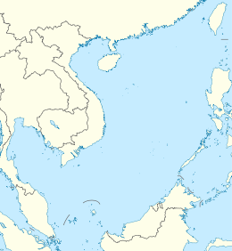
| Location | South China Sea |
| Coordinates | 15°11′N 117°46′E / 15.183°N 117.767°E |
| Total islands | 2 islets with many reefs |
| Major islands | 1 |
| Highest elevation | 1.8 m (5.9 ft) |
| Highest point | South Rock |
| Administration | |
| Province | Hainan |
| Prefecture-level city | Sansha |
| District | Xisha |
| Claimed by | |
| Municipality District | Kaohsiung Cijin[1][2] |
| Province | Zambales |
| Municipality | Masinloc |
| Demographics | |
| Population | 0 |
Scarborough Shoal, also known as Bajo de Masinloc ("Masinloc shoal" in Spanish),[3][4] Huangyan Island (Mandarin Chinese: 黄岩岛; pinyin: Huáng Yán Dǎo; lit. 'yellow rock island'),[5] Minzhu Jiao (Mandarin Chinese: 民主礁; lit. 'Democracy Reef') and Panatag Shoal (Filipino: Buhanginan ng Panatag, lit. 'serene sandbank'),[6] are two skerries (rocks[a]) located between Macclesfield Bank to the west and Luzon to the east. Luzon is 220 kilometres (119 nmi) away and the nearest landmass.[7] The atoll is a disputed territory claimed by the Republic of the Philippines through the 1734 Velarde map, while the People's Republic of China and the Republic of China (Taiwan) claim it through the disputed[8] nine-dash line (referred to as the eleven-dash line by Taiwan, which includes waters in the Gulf of Tonkin[9]). The atoll's status is often discussed in conjunction with other territorial disputes in the South China Sea such as those involving the Spratly Islands, and the 2012 Scarborough Shoal standoff. It was administered by the Philippines as part of its Zambales province, until 2012, when a standoff was initiated by China through the use of warships against fishing boats, resulting in effective capture by the Chinese maritime forces.[10][11]
In 2013, the Philippines solely filed an international case against China in the non-UN arbitration court in The Hague, Netherlands. In 2016, the court declared that China's so-called nine-dash line claim in the entire South China Sea was invalid,[8] while upholding the sovereign rights of the Philippines in the area.[12] China rejected the court's decision, sending more warships to the Scarborough Shoal and the Spratly Islands,[13] while a multitude of nations backed the Tribunal's ruling including the claimants to the area such as Malaysia, the Philippines, and Vietnam.[14][15]
The atoll was named by Captain Philip D'Auvergne, whose East India Company East Indiaman Scarborough grounded on one of the rocks on 12 September 1784, before sailing on to China,[16][17] although it already had a Spanish name recorded in the 1734 Velarde map of Spanish Philippines.[18]
- ^ Lin, Cheng-yi (19 February 2008). "Taiwan's Spratly Initiative in the South China Sea". Association for Asia Research. Archived from the original on 14 May 2011. Retrieved 6 March 2023.
- ^ "Ministry of Foreign Affairs of the Republic of China (Taiwan) reiterates its position on the South China Sea". Taiwan Ministry of Foreign Affairs. 7 July 2015.
- ^ "Philippine position on Bajo de Masinloc (Scarborough Shoal) and the waters within its vicinity". Official Gazette of the Republic of the Philippines. Department of Foreign Affairs. 18 April 2012. Retrieved 6 March 2023.
The name Bajo de Masinloc (translated as "under Masinloc") itself identifies the shoal as a particular political subdivision of the Philippine province of Zambales, known as Masinloc.
- ^ "Republic Act No. 9522". Philippine Supreme Court E-Library. Supreme Court of the Philippines. 12 March 2019. Archived from the original on 7 June 2019. Retrieved 7 June 2019.
- ^ Aning, Jerome (5 May 2012). "PH plane flies over Panatag Shoal". Philippine Daily Inquirer. Archived from the original on 26 February 2014. Retrieved 15 February 2014.
- ^ Zou, Keyuan (1999). "Scarborough Reef: a new flashpoint in Sino-Philippine relations?" (PDF). IBRU Boundary & Security Bulletin, University of Durham. 7 (2): 11. Archived (PDF) from the original on 10 August 2013. Retrieved 15 February 2014.
- ^ Elleman, Bruce; Kotkin, Stephen; Schofield, Clive (18 December 2014). Beijing's Power and China's Borders: Twenty Neighbors in Asia. Routledge. ISBN 978-1-317-51564-7. Retrieved 12 May 2021.
- ^ a b Matikas Santos (12 July 2016). "China's 'nine-dash line, historic rights' invalid–tribunal". Philippine Daily Inquirer. Archived from the original on 13 July 2016. Retrieved 23 May 2020.
- ^ Shicun Wu (2013). Solving Disputes for Regional Cooperation and Development in the South China Sea: A Chinese Perspective. Elsevier Science. p. 79. ISBN 978-1-78063-355-8.
- ^ "Scarborough shoal standoff: A timeline". Philippine Daily Inquirer. 9 May 2012. Archived from the original on 23 April 2020. Retrieved 23 May 2020.
- ^ "TIMELINE: Skirmishes, standoffs, harassment in West Philippine Sea". Rappler. 12 June 2019. Archived from the original on 21 February 2020. Retrieved 23 May 2020.
- ^ "PRESS RELEASE—The South China Sea Arbitration" (PDF) (Press release). Permanent Court of Arbitration. 12 July 2016. Archived from the original (PDF) on 12 July 2016. Retrieved 22 January 2019.
- ^ "Courting trouble". The Economist. 16 July 2016. ISSN 0013-0613. Archived from the original on 17 June 2019. Retrieved 22 January 2019.
- ^ "Declaration by the High Representative on behalf of the EU on the Award rendered in the Arbitration between the Republic of the Philippines and the People's Republic of China" (Press release). Council of the European Union. 15 July 2016. Archived from the original on 9 February 2018.
- ^ "Arbitration Support Tracker". Asia Maritime Transparency Initiative. 16 June 2016. Archived from the original on 22 April 2020. Retrieved 23 May 2020.
- ^ W. Gilbert (1804) A New Nautical Directory for the East-India and China Navigation .., pp.480=482.
- ^ Joseph Huddart (1801). The Oriental Navigator, Or, New Directions for Sailing to and from the East Indies: Also for the Use of Ships Trading in the Indian and China Seas to New Holland, &c. &c. James Humphreys. p. 454. Archived from the original on 10 September 2017. Retrieved 28 February 2016.
- ^ "Ever heard of the 1734 Murillo Velarde map and why it should be renamed?". Rappler. 20 September 2019. Archived from the original on 27 September 2019. Retrieved 6 May 2020.
Cite error: There are <ref group=lower-alpha> tags or {{efn}} templates on this page, but the references will not show without a {{reflist|group=lower-alpha}} template or {{notelist}} template (see the help page).