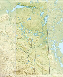
Saskatchewan River Forks is a provincial recreation site[1] in the Canadian province of Saskatchewan at the confluence of the North Saskatchewan and South Saskatchewan Rivers.[2] The rivers, which have their headwaters in the Rocky Mountains, come together to form the Saskatchewan River.[3][4] A major intersection when waterways were important to transportation on the Canadian Prairies, first with the fur trade and then during the riverboat era, today the Saskatchewan River Forks attract tourists, canoeists, and recreational fishermen.[5]
The recreation site, which is maintained by the province of Saskatchewan, is about 50 kilometres (31 mi) east of Prince Albert and 33 kilometres (21 mi) north of Weldon. Access is 13 kilometres (8.1 mi) off Highway 302. The park is on the west side of the river fork and is heavily wooded with steep banks. There is a tourist picnic site, hiking trails, and historic markers.[6]
^"Saskatchewan River Forks Recreation Site". Canadian Geographical Names Database. Government of Canada. Retrieved 13 January 2024.
^"Saskatchewan River". WorldAtlas. Worldatlas.com. 10 September 2021. Retrieved 15 January 2024.
^Newton, Brandi (18 February 2009). "Saskatchewan River". The Canadian Encyclopedia. Retrieved 14 January 2024.
^"The Forks". www.natureprincealbert.ca. Retrieved 23 May 2020.
^"Saskatchewan River Forks Recreation Site, Saskatchewan Map". Geodata.us. Retrieved 14 January 2024.
^"Saskatchewan River Forks Recreation Site | Tourism Saskatchewan". www.tourismsaskatchewan.com. Retrieved 23 May 2020.
and 20 Related for: Saskatchewan River Forks information
was the first European to reach the SaskatchewanRiverForks. While he didn't set up a trading fort at the Forks, his journey helped open up the prairies...
peaking power. The Forks Generating Station would be located 18 km (11 mi) downstream of the North and South SaskatchewanRiverForks, and would be approximately...
Bow and Oldman Rivers in southern Alberta and ends at the SaskatchewanRiverForks in central Saskatchewan. The SaskatchewanRiverForks is the confluence...
at SaskatchewanRiverForks it has a mean discharge of 245 cubic metres per second (8,700 cu ft/s). The yearly discharge at the Alberta–Saskatchewan border...
Forks may refer to: The Forks, Winnipeg, Manitoba, a district around the confluence of the Red River of the North and Assiniboine RiverSaskatchewan River...
North Battleford, to Saskatoon, north to the SaskatchewanRiverForks east of Prince Albert, Saskatchewan. Historically home to the Cree aboriginal people...
Cree-Assiniboine held an annual gathering with the Blackfoot in March near SaskatchewanRiverForks where they would trade and the Blackfoot would ask for volunteers...
North Saskatchewan River at SaskatchewanRiverForks, upstream to its origin at the confluence of the Bow and Oldman Rivers. The pipeline suspension bridge...
Chevalier de la Corne just east of the SaskatchewanRiverForks in what is today the Canadian province of Saskatchewan. This was the furthest westward outpost...
because their tribal lands were along the SaskatchewanRiverForks (the confluence of North and South SaskatchewanRiver). They had to withstand attacks of enemies...
Atlantic Ocean to as far west as the confluence of the North and South Saskatchewanrivers, and as far north as James Bay. Built between the 1640s and the 1750s...
Highway 302 provides access to La Colle Falls and SaskatchewanRiverForks Recreation Site. Saskatchewan Highways and Transportation (SHT), now the Ministry...
Beauval Forks 192O is an Indian reserve of the English River First Nation in Saskatchewan. List of Indian reserves in Saskatchewan "Reserve/Settlement/Village...
of Western Canada in Saskatchewan and Manitoba. It is a tributary of the Red River. The Assiniboine is a typical meandering river with a single main channel...
SaskatchewanRiver fur trade The SaskatchewanRiver was one of the two main axes of Canadian expansion west of Lake Winnipeg. The other and more important...
Nippeween and Fort à la Corne. It was located downstream from the SaskatchewanRiverForks at the mouth of the Pehonan Creek a mile west of the later HBC...
South SaskatchewanRiver. Most trade was on the North SaskatchewanRiver which was closer to the wooded beaver country. West of the SaskatchewanRiver Forks...
Goose River may refer to: in The Bahamas Goose River (Bahamas) in Canada Goose River (Manitoba–Saskatchewan), a river mostly in Manitoba with a mouth...
Plains Area Council. In 1922 the Grand Forks Council (#430) was founded, changing its name to the Grand Forks County Council in 1924. It changed its name...
River Elk River Bull River Vermilion River Clark ForkRiver Clearwater River Coeur d'Alene River Salmon River Snake River Malad River Payette River Selway...
 Global Information