 Global Information
Santiago Papasquiaro Municipality information
This article needs additional citations for verification. (June 2017) |
Santiago Papasquiaro | |
|---|---|
Municipality | |
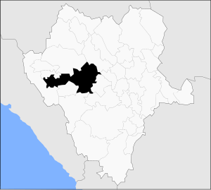 Municipality of Santiago Papasquiaro in Durango | |
 Santiago Papasquiaro 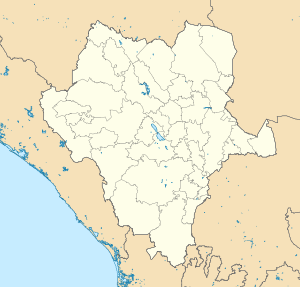 Santiago Papasquiaro | |
| Coordinates: 25°03′N 105°29′W / 25.050°N 105.483°W | |
| Country | |
| State | Durango |
| Municipal seat | Santiago Papasquiaro |
| Area | |
| • Total | 7,238.4 km2 (2,794.8 sq mi) |
| Elevation | 1,730 m (5,675 ft) |
| Population (2020) | |
| • Total | 49,207 |
| • Density | 6.8/km2 (18/sq mi) |
| Time zone | UTC-6 (Central) |
| Website | https://santiagopapasquiaro.gob.mx/ |
Santiago Papasquiaro is a municipality in the Mexican state of Durango. The municipal seat lies at Santiago Papasquiaro. The municipality covers an area of 7,238.4 km2. Santiago Papasquiaro municipality is at an average height of 1,730 m (5,675 ft) over the sea level. The municipality lies east of Sierra Madre Occidental Mountain Range. It neighbors with the municipalities of Canelas and Tepehuanes to the north, San Dimas and Otáez to the south, Nuevo Ideal to the east, Tamazula to the west and El Oro to the northeast.[1]
As of 2020, the municipality had a total population of 49,207,[2] up from 41,539 as of 2005.[3]
As of 2020, the city of Santiago Papasquiaro had a population of 30,063.[2] Other than the city of Santiago Papasquiaro, the municipality had 416 localities, the largest of which (with 2010 populations in parentheses) were: Ciénega de Nuestra Señora de Guadalupe (2,532), and José María Morelos (Chinacates) (1,521), classified as rural.[2]
- ^ "Santiago Papasquiaro, Durango - viveMX". www.vivemx.com (in Spanish). Retrieved 2017-05-03.
- ^ a b c "Santiago Papasquiaro". Catálogo de Localidades. Secretaría de Desarrollo Social (SEDESOL). Retrieved 23 April 2014.
- ^ "Santiago Papasquiaro". Enciclopedia de los Municipios de México. Instituto Nacional para el Federalismo y el Desarrollo Municipal. Archived from the original on May 21, 2007. Retrieved December 19, 2008.