5 x vertical Francis turbines (3 @ 32.5 MW, 1 @ 42.3 MW, 1 @ 67.5 MW)
Installed capacity
207 MW
Annual generation
245,000,000 kWh
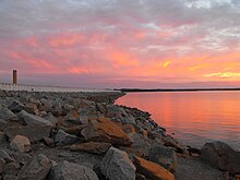
The Saluda Dam[1] or Saluda River Dam,[2] officially the Dreher Shoals Dam,[1][3] commonly referred to as the Lake Murray Dam,[4][5] is an earthen embankment dam located approximately 10 miles (15 km) west of Columbia, South Carolina on the Saluda River. Construction on the dam began in 1927 and was completed in 1930. The purpose of the dam is flood control, hydroelectricity, recreation and water supply. At the time of its completion, the Saluda Dam was the world's largest earthen dam, creating the world's largest man-made lake, Lake Murray. In 2005, construction on a 213 ft (65 m). tall roller-compacted concrete (RCC) dam was completed at the toe of the original dam in order to mitigate an earthquake-caused dam failure.
South Carolina Highway 6 crosses over the dam and is used as a fast connection between the towns of Lexington and Irmo. The yearly football game between rival Lexington High School and Irmo High School is often called "The Battle of the Dam".
^ abFederal Writers Project. South Carolina: A Guide To The Palmetto State. Volume 5 of American Guide. Somerset Publishers, Inc., 1941. p. 377. ISBN 9780403021895
^"Lexington County." The South Carolina Encyclopedia Guide to the Counties of South Carolina. Walter Edgar, ed. University of South Carolina Press, 2012. ISBN 9781611171518
^Cathy Dreher. "Lake Murray Dam becomes Dreher Shoals Dam." Columbia Star. 11 February 2005. Retrieved 20 July 2016.
^"Lake Facts and Conditions"[permanent dead link] at Capital City Lake Murray Country tourism website. Retrieved 20 July 2016.
^Sherman Carmichael. Strange South Carolina. Arcadia Publishing, 2015. ISBN 9781625856043
The SaludaDam or Saluda River Dam, officially the Dreher Shoals Dam, commonly referred to as the Lake Murray Dam, is an earthen embankment dam located...
Congaree River. Dams on the Saluda include: The uppermost dam on the Saluda River, on the border of Greenville and Pickens Counties, forming Saluda Lake the...
William S. Murray. The SaludaDam supplies a large portion of the power to South Carolina. The dam was the largest earthen dam in cubical content for...
Lexington Water Power Company. Lexington Water Power Company had built the SaludaDam, which created the 50,000-acre (202 km2) Lake Murray, and was the largest...
of Georgia SaludaDam – Lake Murray Boone Dam — Boone Lake; on the South Fork Holston River; finished in 1952 by the TVA Burgess Falls Dam; on the Falling...
reservoirs and dams in California Lower Otay Reservoir SaludaDam Hill, Joseph (Winter 2002). "Dry Rivers, Dammed Rivers and Floods: An Early History of the Struggle...
Saluda Lake is a 331-acre (1.34 km2) reservoir formed by a spillway from the uppermost dam on the Saluda River in South Carolina, United States. The lake...
coal-fired Canadys Station". The Colletonian. Retrieved 2020-02-10. "Hartwell Dam and Lake". U.S. Army Corps of Engineers. Retrieved 2021-07-15. "Download...
major projects including several large dams in his native Canada, the Itezhi-Tezhi Dam in Zambia, the SaludaDam in South Carolina, the Wilson Tunnel in...
Lower Saluda River in Columbia, South Carolina. The rapids are a result of the Saluda River running over the remains of a twice-dynamited coffer dam. Blast-O-Matic...
joins the Saluda River in Laurens County, 9 miles (14 km) northeast of Greenwood, as part of Lake Greenwood, which is formed by a dam on the Saluda. The pollution...
concurrency with U.S. Route 378. SC 6 passes just east of Lake Murray (over the SaludaDam as a divided highway). In Irmo, SC 6 changes from N. Lake Drive to Dreher...
This is a list of dams in South Carolina that have been removed as physical impediments to free-flowing rivers or streams. Map all coordinates using OpenStreetMap...
structure, but 10 years is an average. Bluegrass participated in the SaludaDam Remediation project in South Carolina, a requirement by the Federal Energy...
11.510 18.524 Brown Road / Old Cleveland Street north of Golden Grove SaludaDam Road northeast of Easley 01974-01-011974 current Second form SC 154 16...
Parkway's Thunder Hill Overlook. Several parts of the river are impounded by dams for water, power, and flood control. The river becomes the Pee Dee River...
largest island in 50,000-acre (202 km2) Lake Murray, a reservoir of the Saluda River. The park offers boating, hiking, camping, fishing for largemouth...
Statistical Area Richland 416,147 772 Columbia, SC Metropolitan Statistical Area Saluda 18,862 462 Columbia, SC Metropolitan Statistical Area Spartanburg 327,997...
 Global Information