Location in Bangladesh (on the border with Myanmar)
Show map of Bangladesh
Saka Haphong
Saka Haphong (Myanmar)
Show map of Myanmar
Location
Bangladesh–Myanmar border
Country
Bangladesh and Myanmar
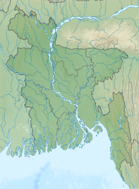
Saka Haphong (Bengali: সাকা হাফং, Burmese: ဆကးအဖောင် တောင်) is a peak in Southeast Asia and South Asia which was discovered by A.K.M Shahidullah Kaiser Sazzad Hossain and many others. Located on the Bangladesh–Myanmar border, it is situated between Thanchi, Bandarban, Bangladesh and the Chin State of Myanmar.
Saka Haphong is believed to be the highest peak of Bangladesh.[3][4] In February 2006 a GPS reading of 1,064 metres was recorded on this summit by Nature And Adventure Club Ginge Fullen. The location he recorded, 21°47′11″N 92°36′36″E / 21.78639°N 92.61°E, accurately matches the location given by Russian topographic mapping and SRTM data, although these sources show its height to be slightly lower, at 1,052 metres.[5] Recently two trekking clubs counted the height of Saka Haphong as 3,488 feet (1,063 m) and 3,461 feet (1,055 m) respectively,[6] both of which exceeds the height of Keokradong which is 3,172 feet (967 m) feet high.
^SRTM data in agreement with 1:200,000 Soviet topographic mapping
^SRTM data in agreement with 1:200,000 Soviet topographic mapping
^Chowdhury, Masud Hasan (2012). "Physiography". In Islam, Sirajul; Jamal, Ahmed A. (eds.). Banglapedia: National Encyclopedia of Bangladesh (Second ed.). Asiatic Society of Bangladesh.
^"Bangladesh". The World Factbook. CIA.
^"Topographic map of Saka Haphong". opentopomap.org. Retrieved 2023-03-05.
^"'Second highest hill' spotted by 4 youths". The Daily Star. 28 February 2011.
SakaHaphong (Bengali: সাকা হাফং, Burmese: ဆကးအဖောင် တောင်) is a peak in Southeast Asia and South Asia which was discovered by A.K.M Shahidullah Kaiser...
and Bangladesh is at 1,063 metres (3,488 ft) at SakaHaphong in the Mowdok mountain range. SakaHaphong is the Tripura tribal name which is the highest...
research this information has been proved wrong. Research proved that SakaHaphong is the highest peak in Bangladesh, but although this research is consistent...
controversy about the highest point of Bangladesh, and some sources indicate SakaHaphong as the most elevated peak of the country. However, Tazing Dong is officially...
global environmental science. The highest point in Bangladesh is the SakaHaphong, located near the border with Myanmar, with an elevation of 1,064 m (3...
(3,451 ft) altitude, the highest elevation in Bangladesh is found at SakaHaphong, in the southeastern part of the hills. Fertile valleys lie between the...
of Smoke 122 m 400 ft Persian Gulf sea level 122 m 400 ft Bangladesh SakaHaphong 1063 m 3,488 ft Bay of Bengal sea level 1063 m 3,488 ft Barbados Mount...
Enterprise ferry disaster whilst serving in the Royal Navy. Tibesti Mountains SakaHaphong "No. 51183". The London Gazette (Supplement). 30 December 1987. p. 61...
Mount Kyaiktiyo, 1,075 m Loi Ponghkut, 1,070 m Nattaga Taung, 1,058 m SakaHaphong, 1,052 m Khao Ten Tuang, 1,034 m Pèyapo, 1,029 m Khao Daen, 1,027 m Ngwe...
Bangladesh Daylight Saving Time (UTC+07) Extreme points of Bangladesh High: SakaHaphong 1,052 m (3,451 ft) Low: Bay of Bengal 0 m Land boundaries: 4,246 km Republic...
 Global Information