32°00′24″S115°32′23″E / 32.0067°S 115.5397°E / -32.0067; 115.5397 (Rottnest Island Airport)
Map
YRTI
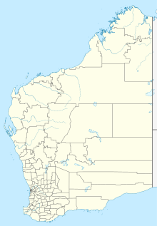
Location in Western Australia
Runways
Direction
Length
Surface
m
ft
09/27
1,293
4,242
Asphalt
Sources: Australian AIP and aerodrome chart[1]
Rottnest Island Airport (IATA: RTS, ICAO: YRTI) is a small airport for light aircraft, situated about 800 m (2,600 ft) from the main settlement at Thomson Bay, Rottnest Island and 10 nautical miles (19 km; 12 mi) northwest of Fremantle.[1] Daily air services operate to the island. In the past these have been from Perth Airport, but in recent years have been mainly from Jandakot.
The single 1,290 m × 18 m (4,232 ft × 59 ft) runway runs east–west and is situated behind Thomsons Bay and south of Government House Lake.[1] Part of the lake was resumed for the construction of the airport runway. The Oliver Hill railway line runs south of and parallel to the runway.
The airport opened in November 1930 and has been used regularly since then for private and small commercial operations, ferrying workers and holiday makers between Perth and the island.[2]
^ abcYRTI – Rottnest (PDF). AIP En Route Supplement from Airservices Australia, effective 21 March 2024, Aeronautical Chart
^"Capt. Jimmy Woods & Lockheed DL-1A Vega Special VH-UVK". The Airways Museum & Civil Aviation Historical Society. Retrieved 20 October 2008.
and 25 Related for: Rottnest Island Airport information
RottnestIslandAirport (IATA: RTS, ICAO: YRTI) is a small airport for light aircraft, situated about 800 m (2,600 ft) from the main settlement at Thomson...
RottnestIsland (Nyungar: Wadjemup), often colloquially referred to as "Rotto", is a 19-square-kilometre (7.3 sq mi) island off the coast of Western Australia...
from the IATA (which assigned RTS to RottnestIslandAirport in RottnestIsland, Western Australia). Reno Stead Airport does not have regularly scheduled...
This is a list of airports in Australia. It includes licensed airports, with the exception of private airports. Aerodromes here are listed with their 4-letter...
civilian airports within the Perth metropolitan area, the others being Jandakot Airport and RottnestIslandAirport. Besides the civilian airports, there...
Transit System, a cross border metro between Singapore and Malaysia RottnestIslandAirport, Australia, IATA code RTS Russian Trading System, a stock exchange...
Retrieved 27 January 2020. "RottnestIsland". World Aero Data. WorldAeroData.com. Retrieved 27 January 2020. "FSIA: Seychelles Int Airport". SkyVector. 27 February...
This is a list of airports in the Australian state of Western Australia. Map all coordinates using OpenStreetMap Download coordinates as: KML GPX (all...
has been going to RottnestIsland since 1931. Primarily the Winnits do work on the island under the direction of the RottnestIsland Authority that benefits...
Australian locations – RottnestIsland". Bureau of Meteorology. Retrieved 15 July 2020. "Monthly highest temperature – RottnestIsland". Bureau of Meteorology...
Broome International Airport (IATA: BME, ICAO: YBRM) is a regional airport located 0.4 nautical miles (0.74 km; 0.46 mi) west of the Broome GPO, Western...
while leading No. 14 Squadron, was killed in a flying accident off RottnestIsland, Western Australia on 6 January 1944. Starting in June 1944, Qantas...
Paraburdoo Airport (IATA: PBO, ICAO: YPBO) is an airport serving Paraburdoo, a town in the Pilbara region of Western Australia. The airport is located...
Monkey Mia Airport (IATA: MJK, ICAO: YSHK) is an airport located on the Peron Peninsula within the Shark Bay World Heritage Site in the Gascoyne region...
Learmonth Airport (IATA: LEA, ICAO: YPLM) is a civil airport, co-located on the site of RAAF Base Learmonth, a Royal Australian Air Force (RAAF) base....
Solomon Airport (IATA: SLJ, ICAO: YSOL) is located 15 kilometres (9 mi) west of the Karijini National Park, Western Australia. List of airports in Western...
Queensland Bathurst Harbour, Tasmania Bathurst Island (Northern Territory) Bathurst Lighthouse, RottnestIsland Bathurst District, a historic district in Upper...
Cozumel (Spanish pronunciation: [kosuˈmel]; Yucatec Maya: Kùutsmil) is an island and municipality in the Caribbean Sea off the eastern coast of Mexico's...
Perth approaches Enlargements of Perth, Fremantle and Mandurah CBDs RottnestIsland, with enlargements of major settlement areas Enlargements of various...
Barrow IslandAirport (IATA: BWB, ICAO: YBWX) is a private airport, located at Barrow Island, Western Australia. The only scheduled service is a fly-in...
Cue Airport (IATA: CUY, ICAO: YCUE) is located 2 nautical miles (3.7 km; 2.3 mi) southeast of Cue, Western Australia. List of airports in Western Australia...
Barimunya Airport (IATA: BYP, ICAO: YBRY) is located at Barimunya, in the Pilbara region of Western Australia and is approximately 8.25 km (5.13 mi) northeast...
Coondewanna Airport (IATA: CJF, ICAO: YCWA) is an airport located near the Area C mine, in the Pilbara region of Western Australia. List of airports in Western...
 Global Information