Global Information Lookup Global Information

Roseveltpiek information


Roseveltpiek
Roseveltpiek as seen from Magneetrots
Highest point
Elevation644 m (2,113 ft)
Coordinates3°21′12″N 55°11′8″W / 3.35333°N 55.18556°W / 3.35333; -55.18556
Geography
Roseveltpiek is located in Suriname
Roseveltpiek
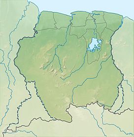
Roseveltpiek
Suriname
LocationSipaliwini District, Suriname
Parent rangeOranje Mountains

Roseveltpiek is a mountain in Suriname at 644 metres (2,113 ft). It is located in the Sipaliwini District. The mountain is named after Johan Cateau van Rosevelt.[1] The Rosevelpiek as well as the Tebutop, the Magneetrots, and the Kasikasima were first mapped in 1904 during the Tapanahony expedition.[2]

  1. ^ "Josephina Leentje Haver". Suriname.nu (in Dutch). Retrieved 25 June 2020.
  2. ^ J.B.Ch. Wekker (1983). HISTORIE, TECHNIEKEN EN MAATSCHAPPELIJKE ACHTERGRONDEN DER KARTERINGSWERKZAAMHEDEN IN SURINAME SINDS 1667. Rijkscommissie voor Geodesie. p. 104. ISBN 9061322286.

and 4 Related for: Roseveltpiek information

Request time (Page generated in 0.5113 seconds.)

Roseveltpiek

Last Update:

Roseveltpiek is a mountain in Suriname at 644 metres (2,113 ft). It is located in the Sipaliwini District. The mountain is named after Johan Cateau van...

Word Count : 85

Oranje Mountains

Last Update:

mountain range in the Sipaliwini District of Suriname. It is named after the House of Orange-Nassau. Mountains on this range include the Roseveltpiek. v t e...

Word Count : 34

Kasikasima

Last Update:

companies. Kasikasima as well as the Tebutop, the Magneetrots, and the Roseveltpiek were first mapped in 1904 during the Tapanahony expedition. In the 1990s...

Word Count : 286

Magneetrots

Last Update:

It measures 310 metres. The Magneetrots as well as the Tebutop, the Roseveltpiek, and the Kasikasima were first explored in 1904 during the Tapanahony...

Word Count : 191

PDF Search Engine © AllGlobal.net