Bureau of Land Management, United States Forest Service, National Park Service
Website
Rio Grande Wild and Scenic River
National Wild and Scenic River
Type
Wild 150.1 miles (241.6 km) Scenic 108.5 miles (174.6 km) Recreational 0.8 miles (1.3 km)
Designated
October 2, 1968[1]
The Rio Grande Wild and Scenic River is a U.S. National Wild and Scenic River that protects 260 miles (420 km) of the Rio Grande in New Mexico and Texas, in the United States. The designation was first applied in 1968 to a 55.7-mile (89.6 km) stretch of the river in New Mexico; an additional 191.2 miles (307.7 km) of the river in Texas was added in 1978, followed by another 12.5 miles (20.1 km) in New Mexico in 1994.
The New Mexico portion of the Wild and Scenic River runs from the New Mexico–Colorado border approximately 68 miles (109 km) south. The lower 4 miles (6 km) of the Red River, a tributary of the Rio Grande in Taos County, New Mexico, was also added to the Wild and Scenic River System. The two rivers intersect in the Wild Rivers Recreation Area.
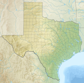
Approximately 69 miles (111 km) of the Wild and Scenic River in Texas is within Big Bend National Park; the remainder is downstream of Big Bend. Three rugged canyons are preserved under this designation: Boquillas Canyon is the most accessible, as it can be reached via a popular RV campground; Mariscal Canyon can only be entered via a high-clearance four-wheel-drive vehicle; and entrance to the Lower Canyon, due to rapid size, is only possible by signing a National Park Service liability or "acknowledgement of risk" waiver. The Wild and Scenic River designation does not include Santa Elena Canyon, which is the most popular recreational area in Big Bend.
^"National Wild and Scenic Rivers System" (PDF). rivers.gov. National Wild and Scenic Rivers System. Retrieved 2023-01-05.
and 24 Related for: Rio Grande Wild and Scenic River information
the river in New Mexico and Texas are designated as the RioGrandeWildandScenicRiver. The RioGrande rises in the western part of the RioGrande National...
the National WildandScenicRivers System to protect outstanding resources values. The WildandScenicRiver flows through the RioGrande Gorge Recreation...
Pecos River (/ˈpeɪkəs/ PAY-kəs) (Spanish: Río Pecos) originates in north-central New Mexico and flows into Texas, emptying into the RioGrande. Its headwaters...
The Rio Chama, a major tributary river of the RioGrande, is located in the U.S. states of Colorado and New Mexico. The river is about 130 miles (210 km)...
This is a list of the designated National WildandScenicRivers in the United States. Each river has been designated by Congress, or, if certain requirements...
The East Fork Jemez is a National WildandScenicRiver. The Jemez River flows generally south to join the RioGrande near Bernalillo, north of Albuquerque...
National WildandScenicRivers System. Five miles of the RioGrandeRiverand 3.25 miles of the Red River were designated as part of the original Wildand Scenic...
Monument located on Bureau of Land Management land in the BLM RioGrandeWildandScenicRiver Recreation Area. There is a private riverside trail, Tune Drive...
have the official U.S. WildandScenicRiver Designation. A quebrada is a stream. An arroyo or ensenada is a creek. A río is a river. A canal or caño is...
Mountains National Park, and the RioGrandeWildandScenicRiver. This area is part of the Chihuahuan Desert. Continental, Mountain, and Modified Marine are...
Mameyes River (Spanish: Río Mameyes) is a river of Luquillo, Puerto Rico and is also in RíoGrande, Puerto Rico. It received the National WildandScenic River...
feet), and Cerro Rito (7,296 feet) The entire plateau is within the watershed of the RioGrande; portions of the Caja drain into the larger river through...
Mexico–United States international park McKittrick Canyon Pecos RiverRioGrandeWildandScenicRiver Terlingua, Texas Trans-Pecos West Texas "Listing of acreage...
Questa and historic santos and retablos are at the St. Anthony's Church. Northeast of Questa, the RioGrandeand Red Rivers intersect in the WildRivers Recreation...
National Register of Historic Places. The WildandScenicRiver in Colorado is: Cache la Poudre WildandScenicRiver The Bureau of Land Management has designated...
The RioGrande Southern Railroad (reporting mark RGS, also referred to as "The Southern") was a 3 ft (914 mm) narrow-gauge railroad which ran in the southwestern...
Grande Southern (US 160, SH 145 and SH 62); and the unconnected Ouray and Silverton Branches of the Denver & RioGrande along US 550 with the Silverton...
trail also follows the course of La Mina River, also included in the National WildandScenicRivers System, and offers opportunities for swimming in the...
and Wisconsin. There are four national rivers (marked with an asterisk) and ten national wildandscenicrivers administered as distinct units of the National...
 Global Information