 Global Information
Raahe information
You can help expand this article with text translated from the corresponding article in Finnish. (June 2023) Click [show] for important translation instructions.
|
Raahe
Brahestad | |
|---|---|
Town | |
| Raahen kaupunki Brahestads stad | |
 Raahe Church and statue of Per Brahe | |
 Coat of arms | |
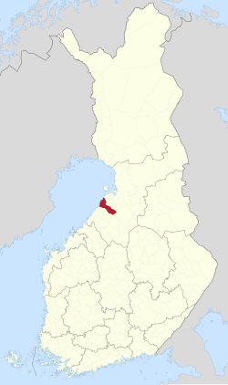 Location of Raahe in Finland | |
| Coordinates: 64°41′N 024°28′E / 64.683°N 24.467°E | |
| Country | |
| Region | North Ostrobothnia |
| Sub-region | Raahe |
| Charter | 1649 |
| Named for | Per Brahe the Younger |
| Government | |
| • City manager | Leena Mikkola-Riekkinen |
| Area (2018-01-01)[1] | |
| • Total | 1,889.00 km2 (729.35 sq mi) |
| • Land | 1,013.78 km2 (391.42 sq mi) |
| • Water | 870.77 km2 (336.21 sq mi) |
| • Rank | 77th largest in Finland |
| Population (2023-12-31)[2] | |
| • Total | 23,797 |
| • Rank | 43rd largest in Finland |
| • Density | 23.47/km2 (60.8/sq mi) |
| Population by native language [3] | |
| • Finnish | 96% (official) |
| • Swedish | 0.1% |
| • Others | 4% |
| Population by age [4] | |
| • 0 to 14 | 18.1% |
| • 15 to 64 | 56% |
| • 65 or older | 25.9% |
| Time zone | UTC+02:00 (EET) |
| • Summer (DST) | UTC+03:00 (EEST) |
| Website | www |
Raahe (Finnish: [ˈrɑːhe]; Swedish: Brahestad; Finland Swedish: [brɑːheˌstɑːd]) is a town in Finland, located on the western coast of the country. Raahe is situated in the North Ostrobothnia region, along the Gulf of Bothnia. The population of Raahe is approximately 24,000, while the sub-region has a population of approximately 32,000. It is the 43rd most populous municipality in Finland.
Founded in 1649 by the Swedish statesman and Governor General of Finland, Count Per Brahe the Younger, it is one of 10 remaining historic wooden towns (or town centres) in Finland. Examples of other historic wooden towns in Finland are Kaskinen (Kaskö), Old Rauma, Porvoo (Borgå), Jakobstad (Pietarsaari) and Vaasa (Vasa). After a devastating fire in 1810, Raahe was rebuilt according to new design principles that minimised the risk of fire and enlarged some of the civic spaces. Old Raahe (or "Wooden Raahe") is notable for its Renaissance-inspired rectilinear town plan with an unusual central square (called Pekkatori) with closed corners.[6][7][8]
Raahe is located 75 kilometres (47 mi) southwest of Oulu and 126 kilometres (78 mi) northeast of Kokkola, and covers an area of 1,889.00 square kilometres (729.35 sq mi) of which 870.77 km2 (336.21 sq mi) is water.[1] The population density is 23.47/km2 (60.8/sq mi).. Historically an agricultural and maritime region, Ostrobothnia supplied the largest number of immigrants from Finland to the USA and other countries such as Canada and Australia during the Great Migration of the late 19th and early 20th centuries.
The neighbouring municipalities of Raahe are Haapavesi, Oulainen, Pyhäjoki, Siikajoki and Siikalatva. Founded as a Swedish- and Finnish-speaking town, the municipality is now unilingually Finnish.
Three parishes have been merged with Raahe: Saloinen in 1973, Pattijoki in 2003 and Vihanti in 2013.
The asteroid 1786 Raahe was named after the town and the municipality.
- ^ a b "Area of Finnish Municipalities 1.1.2018" (PDF). National Land Survey of Finland. Retrieved 30 January 2018.
- ^ "Population growth biggest in nearly 70 years". Population structure. Statistics Finland. 2024-04-26. ISSN 1797-5395. Retrieved 2024-04-29.
- ^ "Population growth biggest in nearly 70 years". Population structure. Statistics Finland. 2024-04-26. ISSN 1797-5395. Retrieved 2024-04-29.
- ^ "Population according to age (1-year) and sex by area and the regional division of each statistical reference year, 2003–2020". StatFin. Statistics Finland. Retrieved 2 May 2021.
- ^ a b "Luettelo kuntien ja seurakuntien tuloveroprosenteista vuonna 2023". Tax Administration of Finland. 14 November 2022. Retrieved 7 May 2023.
- ^ Wanha Raahe – Raahe.fi (in Finnish)
- ^ Pekkatori Square – Visit Raahe (in English)
- ^ Ukkonen, Risto (2023-04-09). "Pohjoisessa on ainutlaatuisen arvokas puukaupunki, jonka ränsistymistä vastaan taistellaan nyt uusin keinoin" [There is a uniquely valuable wooden town in the north, whose dilapidation is now being fought with new means]. Yle (in Finnish). Retrieved 2023-04-09.