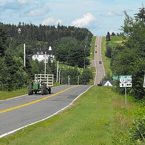
Route 13 is a 39 km (24 mi) two-lane uncontrolled access secondary highway traversing the central portion of Prince Edward Island, Canada in a more or less north–south direction between Crapaud and Cavendish. It passes through a mainly rural area of Prince Edward Island. A portion of Route 13 (south of Hunter River) is commonly called the "Hopalong Road."
There is an important intersection with Route 2 at Hunter River. There are minor intersections with Route 225 in the rural community of Hopedale (where it is called Hopedale Road), Route 246 in Kellys Cross and Route 224 in New Glasgow. Route 13 intersects with Route 235 (Kingston Road) east of Brookvale. In Cavendish it intersects with Route 6 and terminates at Gulf Shore Road inside Prince Edward Island National Park.[2]
^Google (September 27, 2019). "PEI Route 13" (Map). Google Maps. Google. Retrieved September 27, 2019.
^Prince Edward Island Provincial Road Atlas(PDF) (Map) (2014 ed.). Government of Prince Edward Island. pp. 22–24. Retrieved September 27, 2019.
and 23 Related for: Prince Edward Island Route 13 information
highways in the province of PrinceEdwardIsland. PrinceEdwardIsland relies mostly on arterial roads for major inter-city routes. The only expressway in...
The PrinceEdwardIslands are two small uninhabited islands in the sub-Antarctic Indian Ocean that are administered by South Africa. They are named Marion...
Route 1 is a 120-kilometre (75 mi) long provincial highway that serves as the PrinceEdwardIsland section of the Trans-Canada Highway. Route 1 traverses...
PrinceEdwardIslandRoute 248 (also known as Route 248) is a 13.9-kilometre (8.6 mi) long north–south collector highway and local road in Queens County...
PrinceEdwardIslandRoute 8 is a 21.5 km (13.4 mi) secondary highway in central PrinceEdwardIsland, Canada. Route 8 begins at Route 1A south of Summerside...
two-lane uncontrolled access highway traversing PrinceEdwardIsland, Canada from Tignish to Souris. Route 2 was recognized as the first numbered highway...
or Peterville Road, labelled Route 159, is a 2-lane collector highway in western Prince County, PrinceEdwardIsland, Canada. It is near the community...
Trans-Canada Highway between Borden-Carleton, PrinceEdwardIsland (at Route 1) and Cape Jourimain, New Brunswick (at Route 16). It is a multi-span balanced cantilever...
Palmer Road, labelled Route 156, is a 2-lane collector highway in western Prince County, PrinceEdwardIsland, Canada. It is between the communities of...
Route 9 is a 13.1 km (8.1 mi), two-lane, uncontrolled-access, secondary highway in central PrinceEdwardIsland. Its southern terminus is at Route 19A...
0360278 Pridham Road, labelled Route 154, is a 2-lane collector highway in western Prince County, PrinceEdwardIsland, Canada. It is near the town of...
PrinceEdwardIsland (PEI; French: Île-du-Prince-Édouard; Scottish Gaelic: Eilean a' Phrionnsa; colloquially known as The Island) is one of the thirteen...
Route 19 is a secondary highway, that runs along the shoreline of the Northumberland Strait in Queens County, PrinceEdwardIsland, Canada. There are two...
Route 3 is a 33 km (21 mi) long, two-lane uncontrolled access secondary highway in PrinceEdwardIsland, Canada. Its maximum speed limit is 90 km/h (55 mph)...
Greenmount Road, labelled Route 153, is a 2-lane collector highway in western Prince County, PrinceEdwardIsland, Canada. It is between the communities...
unincorporated community in Charlotte County Mayfield, PrinceEdwardIsland, a community on PrinceEdwardIslandRoute13 Rural Municipality of Mayfield No. 406, Saskatchewan...
Ascension Road, labelled Route 160, is a 2-lane collector highway in western Prince County, PrinceEdwardIsland, Canada. It is located 2 miles (3.2 km)...
Road (see below), is a 2-lane collector highway in western Prince County, PrinceEdwardIsland, Canada. It is located 0–4 miles SW of the community of Tignish...
 Global Information