This article is about the range of hills. For the local government district, see Preseli Pembrokeshire.
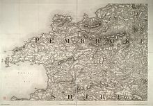
Northern moorlands of the Preselis, near Carn Ingli, PembrokeshireThe Preselis are the elevated areas to the north-east of Pembrokeshire. Inset shows location of Pembrokeshire in Wales.Highest part of range labelled within Pembrokeshire Coast National Park1819 Ordnance Survey map of PembrokeshireThe western Preselis viewed from the northeastView from Carn Menyn eastwards towards Foel Drygarn (centre-left) and Y Frenni (centre-right) in the distance
The Preseli Mountains (English: /prəˈsɛli/, prə-SEL-ee; Welsh: Mynyddoedd y Preseli or Y Preselau), also known as the Preseli Hills, or just the Preselis, is a range of hills in western Wales, mostly within the Pembrokeshire Coast National Park and entirely within the county of Pembrokeshire.
The range stretches from the proximity of Newport in the west to Crymych in the east, some 13 miles (21 km) in extent. The highest point at 1,759 feet (536 m) above sea level is Foel Cwmcerwyn. The ancient 8 miles (13 km) of track along the top of the range is known as the Golden Road.[1][2]
The Preselis have a diverse ecosystem, many prehistoric sites, and are a popular tourist destination. There are scattered settlements and small villages; the uplands provide extensive unenclosed grazing, and the lower slopes are mainly enclosed pasture.
Slate quarrying was once an important industry. More recently, igneous rock is being extracted. The Preselis have Special Area of Conservation status, and there are three sites of special scientific interest (SSSIs).
^"BBC: Wales nature and outdoors". BBC. Retrieved 22 November 2013.
^"The Golden Road". Pembrokeshire Coast National Park Authority. Retrieved 14 February 2023.
PreseliMountains (English: /prəˈsɛli/, prə-SEL-ee; Welsh: Mynyddoedd y Preseli or Y Preselau), also known as the Preseli Hills, or just the Preselis...
exception of the PreseliMountains in the north. There are many prehistoric sites in Pembrokeshire, particularly in the PreseliMountains. During the Middle...
Galar (or Pentregalar, Pentre-Galar) is a small settlement in the PreseliMountains south of the village of Crymych, north Pembrokeshire, Wales, on the...
is the site of a possible dismantled Neolithic stone circle in the PreseliMountains of Pembrokeshire, Wales. The diameter of the postulated circle is...
approximately 800 feet (240 m) above sea level at the eastern end of the PreseliMountains, on the old Tenby to Cardigan turnpike road, now the A478. The village...
parish in the community of New Moat on the southern slopes of the PreseliMountains in Pembrokeshire, Wales. The parish includes the small settlement...
largest settlement in the community. It is at the eastern end of the PreseliMountains, 1 mile (1.6 km) north of Llanfyrnach, with much of the village around...
translates from the Welsh as 'bluestone', a rock found locally in the PreseliMountains, of which it is said Stonehenge was constructed. Blackface and Morris...
roads, including the B4329 running northwards to Eglwyswrw across the PreseliMountains. The A40 connects Haverfordwest with Carmarthen to the east and Fishguard...
southwest Wales. It sits below the mountain known as Castlebythe (English: Cow Castle), one of the peaks in the PreseliMountains, just outside the Pembrokeshire...
south, in an approximately southwesterly direction, crossing the PreseliMountains. Before the 20th century, it was the main road linking Cardigan and...
its junction with the B4329 scenic route to Haverfordwest over the PreseliMountains. The farm has provided horses for military parades, and H.M. The Queen...
small village in north Pembrokeshire, Wales, in the foothills of the PreseliMountains in the Pembrokeshire Coast National Park. It is in the community of...
the entire retriangulation, measuring 98 miles (158 km) between the Preselimountains (Wales) and Ballycreen in County Wicklow. The statutory three nights...
the bluestone used at Stonehenge, Salisbury, as originating in the PreseliMountains in Wales. Many items denoting 'rank and prestige' were deposited in...
age to be found in the British Isles." The River Gwaun rises in the PreseliMountains near the village and its tributaries have carved heavily wooded steep...
or Morfil is a remote upland parish on the southern slopes of the PreseliMountains in north Pembrokeshire, Wales. Fishguard is 6 miles (10 km) to the...
drawing inspiration from the local landscapes of Cardigan Bay and the PreseliMountains and the rich, ancient heritage of the region. The group’s first EP...
tides. The parish extended from Dinas Head on Dinas Island into the PreseliMountains and included several small settlements to the north and south of the...
represented. One of the most common rocks in the assemblage is known as Preseli Spotted Dolerite—a chemically altered igneous rock containing spots or...
forms the eastern boundary. The area is part of the foothills of the PreseliMountains rising to an altitude of 248 metres and is dissected by deep valleys...
 Global Information