 Global Information
Penobscot Bay information
| Penobscot Bay | |
|---|---|
 Penobscot Bay (Maine) | |
 Penobscot Bay | |
| Location | Maine, United States |
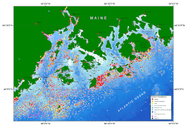
| Coordinates | 44°11′14″N 68°55′16″W / 44.18722°N 68.92111°W |
| River sources | Penobscot River |
| Ocean/sea sources | Atlantic Ocean |
| Max. depth | 145 m (476 ft) |
| Salinity | approx. 31 psu |
| Settlements | Rockland, Maine Camden, Maine |
Penobscot Bay (French: Baie de Penobscot) is an inlet of the Gulf of Maine and Atlantic Ocean in south central Maine. The bay originates from the mouth of Maine's Penobscot River, downriver from Belfast. Penobscot Bay has many working waterfronts including Rockland, Rockport, and Stonington, and Belfast upriver. Penobscot Bay is between Muscongus Bay and Blue Hill Bay, just west of Acadia National Park.
11,000 years ago, at the beginning of the Holocene epoch, the Gulf of Maine's sea level fell as low as 180 feet (55 m) below its present height. Penobscot Bay was then a continuation of Penobscot River that meandered through a broad lowland extending past present day Matinicus Island.[1][2]
Penobscot Bay and its chief tributary, Penobscot River are named for the Penobscot Indian Nation, which has continuously inhabited the area for more than ten thousand years, fishing, hunting and shellfish gathering in and around the bay and river. A part of the Wabanaki Confederacy, the Penobscot Indian Nation's present reservation includes Indian Island, north of Orono, Maine, and all the islands of Penobscot River above it. Ancient remains of their campsites dating back millennia have been found on the bay's shores and islands.[3] The bay was the site of a humiliating American defeat during the Revolutionary War. A Continental Navy flotilla consisting of 19 warships and 25 support vessels was dispatched on July 24 to recapture the mid-coast of Maine from the British who had captured part of the territory and constructed fortifications near the bay, naming the newly captured territory New Ireland. The American besiegers became stalled in their assaults due to dissension between Solomon Lovell and Dudley Saltonstall, two of the expeditions commanders, and after a British flotilla led by George Collier arrived on August 13, the American fleet fled, beaching and burning their ships in the face of a superior British force. All 44 ships were either destroyed or captured, in what proved to be America's worst naval defeat until Pearl Harbor, 162 years later.[4]
There are many islands in this bay, and on them, some of the country's most well-known summer colonies.
- ^ Barnhardt, Walter. A., Gehrels, W. Roland, Belknap, Daniel F., and Kelley, Joseph T., 1995, Late Quaternary relative sea-level change in the western Gulf of Maine: Evidence for a migrating glacial forebulge: Geology, v. 23, no. 4, p. 317-320.
- ^ Maine Department of Conservation. "Penobscot Bay 10,000 Years Ago. http://www.maine.gov/doc/nrimc/mgs/explore/marine/sites/may99.htm
- ^ "The Wabanaki: People of the Dawnland - Acadia National Park (U.S. National Park Service)". www.nps.gov. Retrieved March 31, 2017.
- ^ Bicheno, p.149