Soda lake dimictic lake (east basin)[1] cold monomictic lake (west basin)[citation needed]
Basin countries
China, India
Max. length
134 km (83 mi)
Max. width
5 km (3.1 mi)
Surface area
approx. 700 km2 (270 sq mi)
Max. depth
330 ft. (100 m)
Surface elevation
4,225 metres (13,862 ft)[2]
Frozen
during winter
Pangong Tso
Chinese name
Traditional Chinese
班公錯
Simplified Chinese
班公错
Transcriptions
Standard Mandarin
Hanyu Pinyin
Bāngōng cuò
Wade–Giles
Pan-kung ts'o
Tibetan name
Tibetan
སྤང་གོང་མཚོ
Transcriptions
Wylie
spang gong mtsho
THL
pangongtso
Tibetan Pinyin
Banggong Co
Tsomo Nganglha Ringpo
Chinese name
Traditional Chinese
錯木昂拉仁波
Simplified Chinese
錯木昂拉仁波
Transcriptions
Standard Mandarin
Hanyu Pinyin
Cuòmù ánglā rénbō
Tibetan name
Tibetan
མཚོ་མོ་ངང་ལྷ་རིང་པོ
Transcriptions
Wylie
mtsho mo ngang lha ring po
THL
tsomo nganglha ringpo
Tibetan Pinyin
Como Nganglharingbo
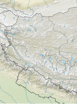
Pangong Tso or Pangong Lake (Tibetan: སྤང་གོང་མཚོ;[3] Chinese: 班公错; pinyin: Bān gōng cuò; Hindi: पैंगोंग झील, romanized: Paiṅgoṅg jhīl) is an endorheic lake spanning eastern Ladakh and West Tibet situated at an elevation of 4,225 m (13,862 ft). It is 134 km (83 mi) long and divided into five sublakes, called Pangong Tso, Tso Nyak, Rum Tso (twin lakes) and Nyak Tso. Approximately 50% of the length of the overall lake lies within Tibet administered by China, 40% in Indian-administered Ladakh, and the remaining 10% is disputed and is a de facto buffer zone between India and China. The lake is 5 km (3.1 mi) wide at its broadest point. All together it covers almost 700 km2. During winter the lake freezes completely, despite being saline water. It has a land-locked basin separated from the Indus River basin by a small elevated ridge, but is believed to have been part of the latter in prehistoric times.[4]
^Wang, M., Hou, J. and Lei, Y., 2014. Classification of Tibetan lakes based on variations in seasonal lake water temperature. Chinese Science Bulletin, 59(34): 4847-4855.
^Dortch et al., Catastrophic partial drainage of Pangong Tso (2011), p. 111.
^"Ngari prefecture". Geographical names of Tibet AR (China). Institute of the Estonian Language. 3 June 2018. Archived from the original on 10 January 2020. Retrieved 9 January 2020.
^
"River basins with Major and medium dams & barrages location map in India, WRIS" (Adobe Flash Player version 10.0.0 or greater). Archived from the original on 4 March 2016.
of Actual Control runs. To the north is the much larger lake PangongTso. Spanggur Tso is at an elevation of 4305 meters, and has an area of 61.6 square...
beyond the Man - Merak villages on PangongTso as permits are not issued for them. The distance between PangongTso and Tso Moriri is 235 km and there are...
southern bank of PangongTso, from centre of PangongTso at Lukung to the west to Phursook Bay and Mount Kailash. Main features on pangong range, from northwest...
La Kongta La pass. Lakes PangongTso Spanggur Tso Kailash Range (Gangdise Shan range): on the southern bank of PangongTso begins from Lukung, runs eastward...
border areas, such as Nubra Valley; PangongTso & Durbuk block (north of the Chang La pass); Tso-Moriri and Tso Kar lakes; Dah & Hanu villages; areas...
PangongTso threw rocks at each other. On 11 September 2019, People's Liberation Army troops confronted Indian troops on the northern bank of Pangong...
tributary) towards PangongTsoPangong Range, a sub range of Karakoram Range, runs from Chushul along southern shore of Panggong Tso on India-China LAC...
since 1958. The "Khurnak Bridges" are the twin adjacent bridges over the PangongTso/lake, one smaller and a bigger one for the heavier vehicle, built by...
Panchahat (village administration), which covers the entire PangongTso region of Ladakh till Man Pangong. Phobrang was apparently lightly populated in the 19th...
around Gurung Hill, Rezang La including the capture of heights in South PangongTso range. In another incident, an official statement by the Indian Army...
falls between Chang La mountain pass and Tangste village on the way to PangongTso Lake. Darbok is a strategic location as the 255 km long Darbuk–Shyok–DBO...
boat to Army for PangongTso patrol by July", Times of India, 15 June 2021 "Army buys 17 boats to move troops faster at PangongTso amid India-China stalemate...
Boats on Naini Lake in Nainital city Lotus Temple in Delhi PangongTso lake in Ladakh Tso Moriri in Ladakh Golden Temple, Amritsar Khajjiar, Himachal...
0928D on PangongTso the Indian Navy upgraded the caliber of assault boat they were using on PangongTso. Basic model, deployed to PangongTso before C...
Indian Army deployed troops along the Line of Actual Control south of the PangongTso, including at Rezang La and Rechin La. This was said to give them a commanding...
Phursook Bay (Chinese: 普尔楚; pinyin: Pǔ'ěr chǔ) is a bay in the PangongTso that is said to have formed the border between Ladakh and Tibet's Rutog County...
of actual control, particularly after the Galwan Valley skirmish near PangongTso in the Ladakh region. In September 2021, France agreed to sell some of...
Village. Peaks around the PangongTso at Spangmik (September 2013) Peaks around the PangongTso at Spangmik (September 2013) PangongTso on a bright sunny day...
lake." Dortch et al., Catastrophic partial drainage of PangongTso (2011), p. 111: "PangongTso is in a closed basin (Shi et al., 2001), but it fed the...
of PangongTso, near Line of Actual Control in the Leh District, Ladakh. Lukung is located 142 km east of Leh and is known as Gateway to PangongTso. Its...
 Global Information