 Global Information
Pahremau information
Pahremau | |
|---|---|
Village | |
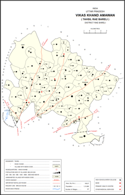 Map showing Pahremau (#283) in Amawan CD block | |
 Pahremau Location in Uttar Pradesh, India | |
| Coordinates: 26°21′03″N 81°18′47″E / 26.350742°N 81.313042°E[1] | |
| Country India | |
| State | Uttar Pradesh |
| District | Raebareli |
| Area [2] | |
| • Total | 3.952 km2 (1.526 sq mi) |
| Population (2011)[2] | |
| • Total | 3,165 |
| • Density | 800/km2 (2,100/sq mi) |
| Languages | |
| • Official | Hindi |
| Time zone | UTC+5:30 (IST) |
| Vehicle registration | UP-35 |
Pahremau is a village in Amawan block of Rae Bareli district, Uttar Pradesh, India.[2] Located 5 km[3] from Maharajganj on the road to Nigohan, it is an old Muslim centre that historically served as the headquarters of a taluqdari estate.[4] As of 2011, its population is 3,165, in 577 households.[2] It has 3 primary schools and no healthcare facilities.[2]
- ^ "GeoNames Search". geonames.nga.mil. Archived from the original on 12 April 2014.
- ^ a b c d e "Census of India 2011: Uttar Pradesh District Census Handbook – Rae Bareli, Part A (Village and Town Directory)" (PDF). Census 2011 India. pp. 185–201. Retrieved 4 August 2021.
- ^ Cite error: The named reference
Census 1981was invoked but never defined (see the help page). - ^ Nevill, H.R. (1905). Rai Bareli: A Gazetteer, Being Volume XXXIX Of The District Gazetteers Of The United Provinces Of Agra And Oudh. Allahabad: Government Press. pp. 97–9, 201. Retrieved 4 August 2021.