Global Information Lookup Global Information

Paelau information


3°51′25″N 159°21′42″W / 3.857048°N 159.361599°W / 3.857048; -159.361599

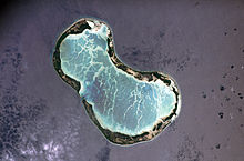
Paelau is a settlement located on Tabuaeran atoll, Kiribati.[1] It is located on the western side of the atoll, south of a passage into the lagoon, with Betania to the north and Aontenaa to the south.

It is the administrative centre of the atoll, where the main health clinic is located. In the 2010 census 200 people were recorded as living in Paelau.[1]

It was formerly known as Napia or English Harbour.[1]

  1. ^ a b c "21. Tabuaeran" (PDF). Office of Te Beretitent - Republic of Kiribati Island Report Series. 2012. Retrieved 28 April 2015.

and 3 Related for: Paelau information

Request time (Page generated in 0.518 seconds.)

Paelau

Last Update:

3°51′25″N 159°21′42″W / 3.857048°N 159.361599°W / 3.857048; -159.361599 Paelau is a settlement located on Tabuaeran atoll, Kiribati. It is located on the...

Word Count : 111

Tabuaeran

Last Update:

domestic flights to Kiritimati. The administrative centre of the atoll is Paelau, on the west side. Tabuaeran had a population of 1,960 at the 2010 census...

Word Count : 1354

Aontenaa

Last Update:

-159.360967 Aontenaa is a settlement located on Tabuaeran atoll, Kiribati. Paelau is to the north; with Tenenebo to the south. In the 2010 census 190 people...

Word Count : 79

PDF Search Engine © AllGlobal.net