This article needs additional citations for verification. Please help improve this article by adding citations to reliable sources. Unsourced material may be challenged and removed. Find sources: "Nottinghamshire" – news · newspapers · books · scholar · JSTOR(December 2017) (Learn how and when to remove this template message)
Ceremonial county in England
Nottinghamshire
Ceremonial county
Sherwood Forest, Southwell Minster, Thoresby Hall
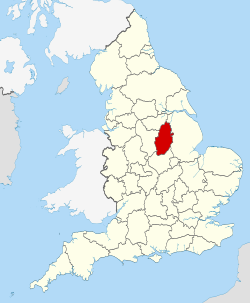
Nottinghamshire within England
Coordinates: 53°N1°W / 53°N 1°W / 53; -1
Sovereign state
United Kingdom
Constituent country
England
Region
East Midlands
Established
Ancient
Time zone
UTC±00:00 (Greenwich Mean Time)
• Summer (DST)
UTC+01:00 (British Summer Time)
Members of Parliament
Ruth Edwards (C)
Tom Randall (C)
Lee Anderson (R)
Brendan Clarke-Smith (C)
Ben Bradley (C)
Robert Jenrick (C)
Darren Henry (C)
Mark Spencer (C)
Police
Nottinghamshire Police
Ceremonial county
Lord Lieutenant
Sir John Peace
High Sheriff
Professor Dame Elizabeth Fradd[1] (2020/21)
Area
2,160 km2 (830 sq mi)
• Ranked
27th of 48
Population (2021)
1,154,195
• Ranked
15th of 48
Density
535/km2 (1,390/sq mi)
Ethnicity
93% White
3% Asian
2.1% Mixed
1.2% Black
0.7% Other
[2]
Non-metropolitan county
County council
Nottinghamshire County Council
Executive
Conservative/Independent
Admin HQ
County Hall, West Bridgford
Area
2,085 km2 (805 sq mi)
• Ranked
14th of 21
Population
826,257
• Ranked
10th of 21
Density
396/km2 (1,030/sq mi)
ISO 3166-2
GB-NTT
ONS code
37
ITL
UKF15/16
Website
nottinghamshire.gov.uk
Districts
Districts of Nottinghamshire Unitary County council area
Districts
Nottingham
Bassetlaw
Mansfield
Newark and Sherwood
Ashfield
Gedling
Broxtowe
Rushcliffe
Nottinghamshire (/ˈnɒtɪŋəmʃər,-ʃɪər/;[3] abbreviated Notts.) is a ceremonial county in the East Midlands of England. The county borders South Yorkshire to the north-west, Lincolnshire to the east, Leicestershire to the south, and Derbyshire to the west. The largest settlement is the city of Nottingham (323,632).
The county has an area of 2,160 km2 (830 sq mi) and a population of 1,154,195. The latter is concentrated in the Nottingham built-up area in the south-west, which extends into Derbyshire and has a population of 729,997. The north-east of the county is more rural, and contains the towns of Worksop (44,733) and Newark-on-Trent (27,700). For local government purposes Nottinghamshire comprises a non-metropolitan county, with seven districts, and the Nottingham unitary authority area. The East Midlands Combined County Authority includes Nottinghamshire County Council and Nottingham City Council.
The geography of Nottinghamshire is largely defined by the River Trent, which forms a wide valley which crosses the county from the south-west to the north-east. North of this, in the centre of the county, is Sherwood Forest, the remnant of a large ancient woodland.
^"No. 62943". The London Gazette. 13 March 2020. p. 5161.
^"Definition of 'Nottinghamshire' – British English pronunciation". www.CollinsDictionary.com. Collins English Dictionary. Archived from the original on 24 December 2017. Retrieved 23 December 2017.
Nottinghamshire (/ˈnɒtɪŋəmʃər, -ʃɪər/; abbreviated Notts.) is a ceremonial county in the East Midlands of England. The county borders South Yorkshire...
Nottinghamshire Police is the territorial police force responsible for policing the shire county of Nottinghamshire and the unitary authority of Nottingham...
NOT-ing-əm, locally /ˈnɒtnʊm/) is a city and unitary authority area in Nottinghamshire, East Midlands, England. It is located 110 miles (180 km) north-west...
Nottinghamshire County Cricket Club is one of eighteen first-class county clubs within the domestic cricket structure of England and Wales. It represents...
originally the Nottinghamshire Militia, was an auxiliary regiment of the British Army from the English Midland county of Nottinghamshire. From its formal...
Nottinghamshire Yeomanry may refer to one of two Yeomanry cavalry regiments of the British Army: Nottinghamshire Yeomanry (Sherwood Rangers), one of the...
The Nottinghamshire Senior League is an English football league. The competition is a feeder to the Northern Counties East League and the United Counties...
Sherwood Forest is the remnants of an ancient royal forest in Nottinghamshire, England, having a historic association with the legend of Robin Hood. The...
1826 and 1848. The earliest reference to cricket in the county of Nottinghamshire is a match between Nottingham and Sheffield Cricket Club at the Forest...
Retford, in the north of Nottinghamshire, England Gamston, Rushcliffe, near West Bridgford, in the south of Nottinghamshire, England Retford Gamston Airport...
District in Nottinghamshire, England. It is the largest town in the wider Mansfield Urban Area and the second largest settlement in Nottinghamshire (following...
and Nottinghamshire Electric Power Company Limited provided electricity to consumers in the English midland counties of Derbyshire and Nottinghamshire. Electricity...
North Lincolnshire and North East Lincolnshire), Northamptonshire, Nottinghamshire, and Rutland. The region has an area of 15,627 km2 (6,034 sq mi), with...
is a former mining village in the Newark and Sherwood district of Nottinghamshire, England. The population of the civil parish was 3,469 at the 2001...
Nottinghamshire is a county that is situated in the East Midlands of England. The county has history within the Palaeolithic period, dating anywhere between...
Healthcare in Nottinghamshire was, until July 2022, the responsibility of six clinical commissioning groups, covering Nottingham City, Nottingham North...
The South Nottinghamshire Hussars is a unit of the British Army formed as volunteer cavalry in 1794. Converted to artillery in 1922, it presently forms...
Norfolk Upton, Northamptonshire Upton, Bassetlaw, Nottinghamshire Upton, Newark and Sherwood, Nottinghamshire Upton, Vale of White Horse, Oxfordshire (in Berkshire...
Nottinghamshire County Council is the upper-tier local authority for the non-metropolitan county of Nottinghamshire in England. It consists of 66 county...
 Global Information