Natchaug Trail northern trailhead at intersection with Nipmuck Trail in Ashford, CT
Length
19.5 miles (31.4 km) [1]
Location
Windham County, Connecticut, USA
Designation
CFPA Blue-Blazed Trail
Use
hiking, cross-country skiing, snowshoeing, fishing, geocaching, other
Hazards
hunters, deer ticks, poison ivy
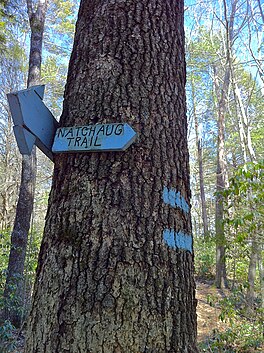
The Natchaug Trail is a Blue-Blazed hiking trail "system" which meanders through 19.5 miles (31.4 km) of forests in northeast Connecticut—primarily in Windham County. It is maintained by the Connecticut Forest and Park Association. Its southern trailhead begins in the James L. Goodwin State Forest in the towns of Chaplin, Connecticut and Hampton, Connecticut and the northern terminus is at its intersection with the Nipmuck Trail in Natchaug State Forest in Eastford, Connecticut.
For much of its length the Natchaug Trail travels through two Connecticut state forests—the James L. Goodwin State Forest and Natchaug State Forest as well as the much smaller Nathaniel Lyons Memorial Park. Camping permits may be obtained by backpackers for both state forests.
In addition to the Nipmuck Trail there are several smaller hiking trails which connect to the Natchaug Trail as well as several park and forest roads and the multi-use Airline State Park Linear Trail.
In Natchaug State Forest the CCC Trail is a historic loop trail which was built by the Civilian Conservation Corps during the Great Depression in the 1930s.
Two of the several trails inside the James L. Goodwin State Forest are connected to the Natchaug Trail have recently been blazed as official CFPA trails. According to signs at the James L. Goodwin State Forest the White Trail is being (or has been) re-blazed as a blue-white trail named the "Pine Acres Lake View Trail". A CFPA blue-orange blazed trail also intersects with the Natchaug Trail during the stretch between Pine Acres Lake and Black Spruce Pond.
^Colson, Ann T. (2006). Connecticut Walk Book West (19th ed.). Connecticut Forest and Park Association. ISBN 0-9619052-6-3.
The NatchaugTrail is a Blue-Blazed hiking trail "system" which meanders through 19.5 miles (31.4 km) of forests in northeast Connecticut—primarily in...
Natchaug may refer to: Natchaug River, in Connecticut Natchaug State Forest, in Connecticut NatchaugTrail, in Connecticut Natchaug School, in Connecticut...
The Natchaug River is a 17.9-mile-long (28.8 km) river in Windham and Tolland Counties in northeastern Connecticut. The name Natchaug comes from the Nipmuc...
side trail from Nipmuck Trail. Pixie Falls in Natchaug State Forest in Ashford via side trail from Nipmuck Trail. Fenton River along Nipmuck Trail just...
Westwoods Trails is an extensive hiking trail system in Guilford, Connecticut. The trail system has approximately 39 miles (63 km) of trails with features...
million restoration. It now includes a visitors' center and museum, hiking trails, and a picnic area. William Gillette's "castle", called Seventh Sister and...
first table lists state parks and reserves, the second lists state park trails, the third lists state forests, the fourth lists Wildlife Management Areas...
Farmington Canal Heritage Trail is an 82-mile (132 km) multi-use rail trail located in Connecticut and Massachusetts. The trail was built on former New...
Regicides Trail is a Blue-Blazed hiking trail, about 7 miles (11 km) long, roughly following the edge of a diabase, or traprock, cliff northwest of New...
mountain biking trails in the state. Among them are the Lookout Trail and the Pond Trail, which is a side trail that loops off the Deep Woods Trail. Rock climbing...
The Ives Trail and Greenway is a 20-mile (32 km) hiking trail in the Housatonic Valley Region (also known as Greater Danbury). Its route connects Ridgefield...
the wolf was codified. Today, the Wolf Den is accessible from a hiking trail off of Wolf Den drive in Mashamoquet Brook State Park, a +1,000-acre (400 ha)...
1970s, trail reconstruction was done by the Youth Conservation Corps of America. In 2006, observation platforms were constructed along a trail next to...
center. The park's hiking trails grant access to the adjacent Pootatuck State Forest. Trails From the west side, the main trail starts from the north end...
State Park Trail is a rail trail and linear state park located in Connecticut. The trail is divided into sections designated South (a 25-mile trail from East...
allow. Events and activities The park offers educational films, guided trail walks, and lectures. Warm-month activities include footprint track casting...
watershed land stretching from the Glastonbury border north to Case Pond. Some trails lead south across the Glastonbury border to a larger area of land owned...
Wintergreen; and the 7-mile (11 km) Regicides Trail, part of the Connecticut Forest and Park Association's Blue Trail system. The park is part of a larger area...
bird sanctuary of Charles Island. The park offers swimming, picnicking, trails, boardwalks, and opportunities for bird-watching. It is managed by the Connecticut...
coastal forests ecoregion. The forest's extensive trail system includes the NatchaugTrail and CCC Loop. Trails are used for hiking, horseback riding, mountain...
The Metacomet Trail is a 62.7-mile (100.9 km) Blue-Blazed hiking trail that traverses the Metacomet Ridge of central Connecticut and is a part of the newly...
The Nehantic Trail is a 13-mile (21 km) Connecticut hiking trail and is one of the Blue-Blazed hiking trails maintained by the Connecticut Forest and...
 Global Information