Location of Muztagh Ata within the Pamir range in Xinjiang, China
Location
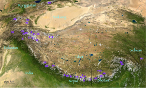
Xinjiang, China
Parent range
Pamir Range
Climbing
First ascent
1956 by E. A. Beletskiy et al.
Easiest route
Glacier/snow climb
Muztagh Ata is #43 (top left area) on this location map from List of highest mountains
Muztagh Ata or Muztagata (Uyghur: مۇز تاغ ئاتا, Музтағ Ата, literally "ice-mountain-father"; Chinese: 慕士塔格峰; pinyin: Mùshìtǎgé Fēng; formerly known as Mount Tagharma or Taghalma and Wi-tagh) is the second highest (7546 metres)[2] of the mountains which form the northern edge of the Tibetan Plateau in China (not the second highest of the mountains of the Tibetan Plateau). It is sometimes regarded as being part of the Kunlun Mountains, although physically it is more closely connected to the Pamirs. It is also one of the relatively easier 7,000 m peaks in the world to climb, due to its gentle western slope and the comparatively drier weather of Xinjiang, though a thorough acclimatization period and a very strong physical condition are crucial for success.
^ abNote: The footnote in this source states: "The frequently cited 7546m elevation should be replaced by the newer 7509m elevation that appears on Chinese maps, and is more compatible with SRTM." "China II: Sinkiang – Xinjiang". Footnote#9. Peaklist.org. Retrieved 26 May 2014.
Baltoro Muztagh The Mountains MuztaghAta (Chinese: 慕士塔格峰) in the Pamir Mountains Muztagh Tower (Chinese: 慕士塔格塔峰) in the Baltoro Muztagh Ulugh Muztagh (Chinese:...
from those elsewhere in this encyclopedia. As an extreme example, Ulugh Muztagh on the north Tibetan Plateau is often listed as 7,723 m (25,338 ft) to...
Aconcagua in Argentina (6960 m), Lenin Peak in Kyrgyzstan (7134 m), MuztaghAta (7546 m) and Kuksay Peak (7134 m) in China and Cho Oyu in Tibet (8201...
Karakoram Highway Slopes of Pamir Mountains on the Chinese side and MuztaghAta Pamir Mountains from a NASA satellite image, April 2012 The three highest...
higher. Two mountains in the Pamirs in China, Kongur Tagh (7,649 m) and MuztaghAta (7,546 m), are higher than the Tajik summits. Lenin Peak was originally...
mountaineer Slader Oviatt carried the Sealandic flag to the top of MuztaghAta. Also in 2007, Michael Martelle represented the Principality of Sealand...
公格尔山; pinyin: Gōnggé'ěr Shān.) Kongur Tagh is located just north of MuztaghAta and visible from Karakul Lake. Some sources use "Kongur Shan" mistakenly...
high-altitude porter with a Korean expedition. In 1997, he summited MuztaghAta (7,546 m [24,757 ft]) with a Japanese team. Baig's first expedition to...
Consul General, and during a visit from Bill Tilman they tried to climb MuztaghAta, 7546 metres, reaching the broad summit dome. In 1947 Shipton explored...
further northwest-wards as far as Kongur Tagh (7,649 m) and the famous MuztaghAta (7,546 m). But these mountains are physically much more closely linked...
the southeast, the K'un-lun system on the south, the Sarygol and Muztay-ata on the west, the main range of the T'ien-shan system on the north to the...
Also formerly known as Mt Jie. Mount Mogan Zhejiang Moon Hill Guangxi MuztaghAta Xinjiang 7,546 metres (24,757 ft) Nairamdal Peak Xinjiang 4,180 metres...
training in the Soviet Union, he reached the summit of Mount Elbrus and MuztaghAta (making the first ascent in the world) in 1956. He became one of the...
India (Ladakh) Mamostong Kangri 7,516 24,659 Karakoram India (Ladakh) MuztaghAta 7,509 24,636 Pamir or Kunlun Mountains China (Xinjiang) Ismoil Somoni...
Karakorum, China's tallest peaks are Kongur Tagh (7649 m, 37th) and MuztaghAta (7546 m, 43rd) in the Pamirs of western Xinjiang, Gongga Shan (7556 m...
face. Wang died in Beijing on 18 July 2015. 1958 — Lenin Peak 1959 — MuztaghAta 1960 — Mount Everest (first ascent via the northeast ridge) 1964 — Shishapangma...
719 meters above sea level, Kongur Tiube (公格尔九别峰) is 7,530 meters, and MuztaghAta (慕士塔格峰) is 7,541 meters. There are 66 snow-capped peaks in the territory...
claim it as part of the state of Jammu and Kashmir.[citation needed] The MuztaghAta, at 7,546 metres (24,757 ft), and the Kongur Tagh, at 7,719 metres (25...
to Kashgar to join up with Eric Shipton in a lightweight attempt on MuztaghAta, 7546 metres, which nearly succeeded. On his way back to India, he detoured...
and climbed a 7,546-meter high mountain in China's Xinjiang Province, MuztaghAta, the same year. After graduating at Seoul National University, he started...
Soma) refer to Hindukush–Pamirs (the Kamboja region) and possibly the MuztaghAta mountain. The post-Vedic Atharvaveda-Parisista (Ed Bolling & Negelein)...
Archived 2013-12-15 at the Wayback Machine (in Chinese) Kongur Tagh-MuztaghAta Topographic Map, 1:100,000, by the Lanzhou Institute of Glaciology and...
of 20 because of her excellent physical condition. Her 1959 ascent of MuztaghAta in Xinjiang, with an elevation of 7,509 meters (24,636 ft), broke the...
 Global Information