South Western Highway (National Route 1), Manjimup, Western Australia
Rocky Gully–Frankland Road
Denmark–Mount Barker Road
East end
Albany Highway (State Route 30), Mount Barker, Western Australia
Location(s)
Major settlements
Lake Muir, Rocky Gully
Highway system
Highways in Australia
National Highway • Freeways in Australia
Highways in Western Australia
----
Infobox instructions
guidelines
examples
talk
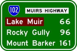
Muirs Highway is a Western Australian highway linking Manjimup and Mount Barker, which is on the Albany Highway. It is signed as State Route 102[1] and is 161 kilometres (100 mi) long. It provides a shorter distance between Manjimup and Albany. It is a lonely highway surrounded with karri and jarrah forests with no settlements in between except the small farming settlement of Rocky Gully.[clarification needed]
It is primarily used as a freight route for plantation timber trucks and interstate long vehicles servicing the horticultural areas of the South West. The road is a two way, single carriageway bitumen surfaced highway.[2]
The Muirs Highway passes through several localities including Manjimup, Dingup, Nyamup, Strachan, Murtinup, Rocky Gully and Mount Barker.[2][clarification needed]
Muirs Highway was named after brothers Thomas and John Muir, the first European settlers in the Warren district, who settled at Deeside in 1852 and built a rush hut there in 1856.[3]
^South West Region map(PDF) (PDF). Version 1.0. Cartography by Main Roads Western Australia. Main Roads Western Australia. 13 August 2013. Archived from the original (PDF) on 28 September 2013. Retrieved 28 December 2012.
^ abPaul Rands. "Muirs Highway (State Route 102)". Road Photos & Information: Western Australia. Retrieved 19 January 2018.
^Shire of Manjimup (1 January 2017). "Deeside Homestead Group". inHerit. Perth, WA: Heritage Council of Western Australia. Retrieved 22 January 2017.
MuirsHighway is a Western Australian highway linking Manjimup and Mount Barker, which is on the Albany Highway. It is signed as State Route 102 and is...
Places Muir Homes, a privately owned housebuilding company in Scotland Muir Island, a fictional island in the Marvel Comics universe MuirsHighway, Western...
lies near MuirsHighway, north of Walpole and southeast of Manjimup. The lake has a surface area of 46 square kilometres (18 sq mi). Lake Muir and its surrounding...
University of California, San Diego John Muir High School, an Early College Magnet in Pasadena, California John MuirHighway, a section of California State Route...
along the route, including Coalfields Highway at Arthur River, Great Southern Highway at Cranbrook, and MuirsHighway at Mount Barker. Prior to European...
crosses the MuirsHighway east of Rocky Gully, flows through Mount Roe and Mount Lindesay national parks, crosses the South Coast Highway near Kenton...
Lake Muir National Park is a national park in Western Australia, located 290 kilometres (180 mi) south east of Perth to the south of MuirsHighway in the...
on the flower parts. The Lake Muir spider orchid is only known from a small area between Rocky Gully on MuirsHighway and Collie in the Jarrah Forest...
as a highway, but without a highway name. For example, Great Southern Highway is classified as a main road, not as a highway, or Hereward Highway in the...
substrates. MuirsHighway passes through the northern end of the reserve, north of Lake Muir. Lake Muir Observatory is located off the highway at the north...
Western Highway is a highway in the South West region of Western Australia connecting Perth's southeast with Walpole. It is a part of the Highway 1 network...
permits. Anne Beadell Highway Connie Sue Highway Eagle Highway Gary Highway Gunbarrel Highway Heather Highway Buntine HighwayHighway 1 is a route that circumnavigates...
popularity of Muir Woods as a tourist destination has created a great deal of congestion and delay on the two lane California State Highway 1. As a result...
in Australian Orchid Review, from a specimen collected by Jones near MuirsHighway, 17 km (11 mi) west of the Frankland River crossing in 1985. The specific...
composed of National Highways, National Routes, State Routes, and Tourist Drives. Each route has a unique number, except for National Highway 1 and National...
Perth. Main Roads Western Australia controls and maintains these roads and highways. Some of these roads, or portions of them, are designated and signposted...
Retrieved August 6, 2011. Muir 2011, pp. 233–234. Ankeny, Jason. "Highway to Hell". Allmovie. Retrieved August 6, 2011. Muir 2011, p. 238. Ankeny, Jason...
overlook is located 0.5 miles (0.8 km) north of Muir Beach on Highway One in Marin County, California. Muir Beach Overlook contains several historic base-end...
Byway. SR 4, an east–west highway, begins in Hercules at San Pablo Avenue next to the Interstate 80 junction as part of John Muir Parkway. (The actual parkway...
Montana Highway 200. SR 1 has several portions designated as either Pacific Coast Highway (PCH), Cabrillo Highway, Shoreline Highway, or Coast Highway. Its...
Trail, First transcontinental railroad, Overland Route, Lincoln Highway and Victory Highway (both later U.S. Route 40 and still later Donner Pass Road),...
eastern edge of the burgh muir. It was deliberately placed to face down the road to Dalkeith, presumably to deter highway robbers. It is known that a...
 Global Information