 Global Information
Monatiquot River information
This article has multiple issues. Please help improve it or discuss these issues on the talk page. (Learn how and when to remove these template messages)
|
| Monatiquot River | |
|---|---|
| Location | |
| Country | United States |
| Physical characteristics | |
| Source | |
| • location | Braintree, Massachusetts |
| • elevation | 30 feet (9 m) |
| Mouth | |
• location | Weymouth Fore River |
• coordinates | 42°13′25″N 70°58′03″W / 42.2236°N 70.9676°W |
• elevation | sea level |
| Length | 4.9 miles (7.9 km) |
| Basin size | 28.7 square miles (74 km2) |
The Monatiquot River is a 4.9-mile-long (7.9 km)[1] river in Braintree, Massachusetts, formed by the confluence of the Farm River and Cochato River (42°11′41″N 71°00′46″W / 42.19475°N 71.0127°W) in the Braintree Municipal Golf Course, flowing in swampy meanders to the northeast, and emptying into the tidal Weymouth Fore River estuary. The name roughly translates to either “at the deep tidal place” or “lookout place”.[2] Its drainage area is 28.7 square miles (74 km2).
The river was a key aspect of colonial Braintree for its river herring. Later its strong flow was useful for early industry such as grist mills. It has remained a relatively clean river to date, with wildlife including birds, turtles, muskrats and fish, but recently has been polluted by sediments from the Graziano Inc. concrete batching operation.[citation needed]
The river was also where Paul Revere opened a nail mill, which remained open after his death until the 1860s, when the Mill was retooled. That nail company has since moved to southeastern Massachusetts and is still in business today producing nails on the same equipment installed during that 1860s retooling.[citation needed]
The river is home to a variety of aquatic life. Rainbow smelt use the river as a spawning ground and the smelt that spawn here provide fishing opportunities in the surrounding area. [3]
-
 Weymouth watershed
 -
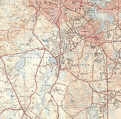 Monatiquot River and environs


- ^ U.S. Geological Survey. National Hydrography Dataset high-resolution flowline data. The National Map, accessed April 1, 2011
- ^ Huden, John Charles; Museum of the American Indian, Heye Foundation (1962). Indian place names of New England. Smithsonian Libraries. New York : Museum of the American Indian, Heye Foundation.
- ^ Chase, Bradford (September 2001). "Rainbow Smelt (Osmerus mordax) Spawning Habitat in the Weymouth Fore River" (PDF). Massachusetts Division of Marine Fisheries Technical Report TR-5.