View of BrandwijkWindmills near KinderdijkPolder and cycling-bridge near Streefkerk
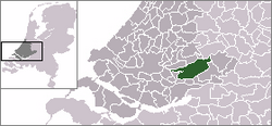
Molenwaard[5](Dutch pronunciation:[ˈmoːlə(ɱ)ˌʋaːrt]) is a former municipality in the western Netherlands, in the southeastern part of the province of South Holland, and the northwestern part of the region of Alblasserwaard. It was the result of a merger of the municipalities of Graafstroom, Liesveld, and Nieuw-Lekkerland on 1 January 2013. On 1 January 2019 it merged with Giessenlanden, together they form the new municipality of Molenlanden.[6] Molenwaard had about 29,000 inhabitants and an area of about 126 km2 (49 sq mi). The largest settlements are Bleskensgraaf, Groot-Ammers, and Nieuw-Lekkerland.
Molenwaard can be characterized as a landscape of polders existing of vast pastures traversed by ditches and canals, like the Groote- of Achterwaterschap, and the Ammersche Boezem. In the outermost northwest one can find the famous windmills of Kinderdijk. About 1.5 m below sea level, the municipality is bordered by the Lek river in the north and briefly the Noord river in the west. On its area flows the Graafstroom or the Alblas.
Religiously, the municipality is part of the Bible Belt, resulting in the dominance of the Christian parties in politics.
^"Gemeentelijke indeling op 1 januari 2013" [Municipal divisions on 1 January 2013]. cbs.nl (in Dutch). CBS. Retrieved 14 August 2013.
^"Kerncijfers wijken en buurten 2020" [Key figures for neighbourhoods 2020]. StatLine (in Dutch). CBS. 24 July 2020. Retrieved 19 September 2020.
^"Postcodetool for 2971VR". Actueel Hoogtebestand Nederland (in Dutch). Het Waterschapshuis. Retrieved 14 August 2013.
^"Bevolkingsontwikkeling; regio per maand" [Population growth; regions per month]. CBS Statline (in Dutch). CBS. 1 January 2021. Retrieved 2 January 2022.
^Molenwaard is derived from 'molen' (mill) and 'waard' (flat riverland). The flat municipality of Molenwaard consists of a lot of windmills.
^"Herindeling Molenwaard-Giessenlanden". Retrieved 3 January 2019.
Molenwaard (Dutch pronunciation: [ˈmoːlə(ɱ)ˌʋaːrt]) is a former municipality in the western Netherlands, in the southeastern part of the province of South...
Hoornaar, Noordeloos and Schelluinen. On 1 January 2019, it merged with Molenwaard to form the new municipality of Molenlanden. Dutch topographic map of...
created on 1 January 2019 by merging the municipalities of Giessenlanden en Molenwaard. It is located east of Rotterdam along the Lek. The World Heritage Site...
mayor of Molenwaard from 2013 to 2018, and mayor of Graafstroom from 2006 to 2012. Graafstroom became part of the new municipality of Molenwaard on 1 January...
since 2013 part of the new municipality of Molenwaard Liesveld (hamlet), a hamlet in the municipality of Molenwaard Liesveld (polder), a polder and former...
and Woltersum. Dirk van der Borg (born 1955), mayor of Graafstroom and Molenwaard Paul Drewes (born 1982), Olympic rower Hendrik Nienhuis (1790-1862), jurist...
part of the new municipality of Molenwaard Graafstroom (river), a canal which flows through the municipality of Molenwaard This disambiguation page lists...
of Doetinchem Langerak, South Holland, a place in the municipality of Molenwaard Willige Langerak, a place in the Utrecht municipality of Lopik Langerak...
1986, until it became part of Graafstroom. Last one has made part of Molenwaard since 2013. Until the 1980s Ottoland had only two streets, simply called...
the Lek River connects Schoonhoven with Gelkenes in the municipality of Molenwaard. From here, the towns of Gorinchem, Dordrecht and Kinderdijk can each...
1986, when it became part of Graafstroom., which in turn became part of Molenwaard in 2013. Wijngaarden's economy has seen substantial growth in the public...
Graafstroom was located in Bleskensgraaf. From 2013 Graafstroom was part of Molenwaard, till 2019 when it merged into Molenlanden. The town got its name because...
1986, when it became part of Graafstroom. Latterly it has been part of Molenwaard since 2013. The village contains the War Grave of a Royal Air Force Avro...
1986, when it became part of Graafstroom. Last one has become part of Molenwaard in 2013. Statistics Netherlands (CBS), Statline: Kerncijfers wijken en...
until 1986, when it became part of Liesveld. The latter has been part of Molenwaard since 2013. Windmill De Liefde Cycle bridge Statistics Netherlands (CBS)...
Liesveld and Nieuw-Lekkerland were merged into the new municipality of Molenwaard. On 1 January 2013 the municipalities of Dirksland, Goedereede, Middelharnis...
and 2014 or were intended to amalgamate in 2015. Goeree-Overflakkee, Molenwaard and Schagen elected their councils late 2012; Alphen aan den Rijn, De...
1986, when it became part of Graafstroom. Last one has become a part of Molenwaard in 2013. Gemeente Graafstroom , Goudriaan Archived 2006-09-27 at the Wayback...
municipality of Graafstroom. Last one has become part of the new municipality of Molenwaard in 2013. Ad van der Meer and Onno Boonstra, "Repertorium van Nederlandse...
century ↑ Goudriaan, Molenwaard Protestant church (NL), RCE 17034 15th century later parts demolished ↓ Groot-Ammers, Molenwaard Protestant church, RCE 18766...
 Global Information