Suburb of Cape Town, in Western Cape, South Africa
Place in Western Cape, South Africa
Mitchells Plain
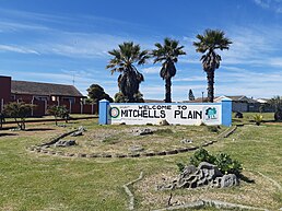
From top, Mitchells Plain sign at the intersection of the M7 and R300. An aerial view of Mitchells Plain (centre right). A view over Westridge from the dunes at the Westridge Gardens (centre left). The notable Luco Meyer town centre taxi rank (bottom left). Mitchells Plain town centre market (bottom right).
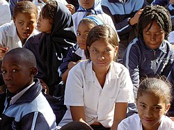
School children at Mitchells Plain school. They draw learners from Khayelitsha and Philippi as well.Taxis from Cape Town station to Mitchells Plain
Mitchells Plain is a large census designated sub-place[2] located within the City of Cape Town, Western Cape, South Africa and situated about 28 km (17 mi) from the Cape Town city centre. It is one of South Africa's largest residential areas and contains multiple smaller suburbs. It is located on the Cape Flats on the False Bay coast between Muizenberg and Khayelitsha. Conceived of as a "model suburb" by the apartheid government, it was built during the 1970s to provide housing for Coloured victims of forced removal due to the implementation of the Group Areas Act.
At an estimated population of 290,000–305,000[3] people, it comprises a number of sub-sections which reflect the diverse class backgrounds of the population. It was once a major stronghold of the United Democratic Front, the broad-based ANC-sponsored anti-apartheid body. It also has one of greater Cape Town's biggest shopping centres, known as the Liberty Promenade.
^ abcd"Main Place Mitchells Plain". Census 2011.
^"City of Cape Town – 2011 Census Suburb Mitchells Plain" (PDF). City of Cape Town. July 2013. Retrieved 22 December 2021.
^"Archived copy" (PDF). Archived from the original (PDF) on 2011-05-15. Retrieved 2013-03-11.{{cite web}}: CS1 maint: archived copy as title (link)
MitchellsPlain is a large census designated sub-place located within the City of Cape Town, Western Cape, South Africa and situated about 28 km (17 mi)...
Lentegeur is a neighbourhood located within the MitchellsPlain urban area of the City of Cape Town in the Western Cape province of South Africa. It is...
Good Hope SPCA recently secured a victory for animal rights in the MitchellsPlain Magistrate’s Court, when a resident was found guilty of animal cruelty...
The MitchellPlain is a karst area in Indiana of relatively low relief. The extensive underlying cave system developed in Mississippian age limestone bedrock...
Melkbosstrand, Dunoon, Milnerton, Paarden Eiland, Century City, Khayelitsha, MitchellsPlain and Cape Town Central. It also provided feeder services in most of...
helped establish the MitchellsPlain Bursary and Role Model Trust, as well as the MitchellsPlain Skills Centre and the MitchellsPlain Education Forum. He...
Chiefs. Fleurs was born in Cape Town on 3 March 2000. He was from MitchellsPlain but moved to Fish Hoek after signing for Ubuntu Cape Town's academy...
Eastern Cape province and the ninth largest in South Africa after MitchellsPlain near Cape Town in the Western Cape. In January 2023 a residential home...
Cape Town International Airport, Cape Town and Somerset West) and MitchellsPlain in the south. Kuils River is served by a network of metropolitan routes...
Strand. Khayelitsha/MitchellsPlain, which includes subdistricts: Blackheath, Blue Downs, Eerste River, Khayelitsha, Mitchell'sPlain, and part of Guguletu...
President Nelson Mandela at the re-opening of Beacon Hill High School, MitchellsPlain". anc.org.za. Archived from the original on 29 November 2014. Retrieved...
R300 is an expressway linking the N1 at Brackenfell to the N2 near MitchellsPlain and the Cape Town International Airport. The R302 runs from the R102...
 Global Information