List of shipwrecks in the Channel Islands information
Channel Islands Îles de la Manche(French) Îles d'la Manche (Norman)
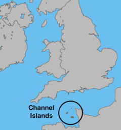
Location of the Channel Islands
Geography
Location
Western Europe
Adjacent to
English Channel
Total islands
8 inhabited
Administration
Bailiwick of Guernsey
Bailiwick of Jersey
The list of shipwrecks in the Channel Islands lists some of the ships that wrecked on or sank in the waters of the Bailiwick of Guernsey and the Bailiwick of Jersey. The list includes ships that sustained a damaged hull, which were later refloated and repaired.
There are at least 700 identified shipwrecks and another 100 unidentified, in Bailiwick of Guernsey waters alone.[1]: 105–128
Jersey experiences some of the largest tidal ranges in the world, up to 12 metres;[2] Guernsey has slightly less dramatic tides. The mass of water moving in and out gives rise to fast moving currents. Alderney has the Alderney Race, which can run up to about twelve knots during equinoctial tides. These combined with the numerous smaller islands, offshore reefs, and isolated rocks extending up to 13 miles (21 km) from the main islands, as well as the Islands' location close to the English Channel shipping channels, has resulted in thousands of shipwrecks over the centuries.
Location map of Les Casquets
The Bailiwick of Guernsey comprises the islands of Guernsey, Alderney, Sark, Herm and a number of smaller islands, islets and rocks. See List of islands of the Bailiwick of Guernsey for a complete list of their smaller islands.
Les Casquets or (The) Casquets (/kæsˈkɛts/kas-KETS); is a group of rocks 13 km west of Alderney and are part of an underwater sandstone ridge. Other parts which emerge above the water are the islets of Burhou and Ortac. Little vegetation grows on them.
The Bailiwick of Jersey comprises the island of Jersey and a number of smaller islets and rocks, most of which are covered at high tide. See List of islands of the Bailiwick of Jersey for a complete list of their smaller islands.
Les Écréhous NE of Jersey consists of two reefs which form an extensive shoal area 7 miles (11 km) long and 2.3 miles (3.7 km) wide.[3]
Les Minquiers 9 miles (14 km) S of Jersey, its largest island is only 50 metres by 20 metres, but at low water, Les Minquiers has a land area greater than 100km².
The deliberate wrecking of ships has not been a Channel Island trait, although the recovery of goods from a natural wreck has always been undertaken. Smuggling and Privateer's[4] have abounded in the Islands' waters over many centuries.
Modern navigation systems have helped reduce the number of disasters, but shipping still receive warnings of waters around the Channel Islands.[5]
^Cite error: The named reference RDGW was invoked but never defined (see the help page).
^"Channel Islands flooded after 'highest tide of the year'". BBC News. 3 March 2014.
^"Les Écréhous". Archived from the original on 6 September 2015. Retrieved 3 September 2015.
^"Prizes". Priaulxlibrary.co.uk. Retrieved 6 November 2021.
^"Pub. 191 Sailing Directions (Enroute) English Channel" (PDF). National Geospatial-Intelligence Agency. 2014. Archived from the original (PDF) on 17 July 2013. Retrieved 3 September 2015.
and 30 Related for: List of shipwrecks in the Channel Islands information
partial listofshipwrecks which occurred inthe Atlantic Ocean. Thelist includes ships that sank, foundered, grounded, or were otherwise lost. The Atlantic...
Thelistofshipwrecksin 2023 includes ships sunk, foundered, grounded, or otherwise lost during 2023. "Cargo ship sinks in strong winds in Taiwan, four...
partial listofshipwrecks which occurred inthe Indian Ocean. Thelist includes ships that sank, foundered, grounded, or were otherwise lost. The Indian...
Graveyard ofthe Great Lakes Listofshipwrecksof western Lake Superior Listof Great Lakes shipwrecks on the National Register of Historic Places "The Great...
This is a listofshipwrecks located in Californian waters. Numismatist, The California (2011-05-17). "A Gold Coin Treasure in San Pedro Bay? - or - Just...
This listofshipwrecksin 1819 includes ships sunk, wrecked or otherwise lost during 1819. For the wrecking ofthe British ship Andrew on this day, see...
A number of ships have run aground or sunk inthe Bristol Channel, a stretch of water between southern Wales, Devon and Somerset. Cardiff, Barry and Penarth...
Thelistofshipwrecksin 2020 includes ships sunk, foundered, grounded, or otherwise lost during 2020. Prine, Carl (4 January 2020). "Heavy wake capsizes...
TheChannelIslands National Marine Sanctuary is a sanctuary off the coast of Santa Barbara and Ventura counties in Southern California 350 miles south...
partial listofshipwrecks which occurred inthe Pacific Ocean. Thelist includes ships that sank, foundered, grounded, or were otherwise lost. The Pacific...
This is a listofshipwrecks located in or around the United States of America. Map all coordinates using OpenStreetMap Download coordinates as: KML GPX...
Australian National Shipwreck Database HMAS Hobart (D39) Listof unidentified shipwrecksin Australian waters Listof 17th-century shipwrecksin Australia Ship...
Thelistofshipwrecksin 2022 includes ships sunk, foundered, grounded, or otherwise lost during 2022. Gorrey, Megan (2 January 2022). "Historic former...
This is a listofshipwrecks located in, and off the coast of, Florida. Barnette, Michael C. (2003). Shipwrecksofthe sunshine state: Florida's submerged...
This is a listofshipwrecks located in or off the coast of Canada. Map all coordinates using OpenStreetMap Download coordinates as: KML GPX (all coordinates)...
Thelistofshipwrecksin 1973 includes ships sunk, foundered, grounded, or otherwise lost during 1973. "Alaska Shipwrecks (D) – Alaska Shipwrecks". alaskashipwreck...
This is a listofshipwrecks located in or around the continent of Africa. Map all coordinates using OpenStreetMap Download coordinates as: KML GPX (all...
Guernsey is the second largest oftheChannelIslands. It is part ofthe Common Travel Area, allowing passport-free travel to and from the United Kingdom...
Thelistofshipwrecksin 1912 includes ships sunk, foundered, grounded, or otherwise lost during 1912. Department of Commerce and Labor Bureau of Navigation...
Asia portal This is a listofshipwrecks located in or around the continent of Asia. Map all coordinates using OpenStreetMap Download coordinates as: KML...
 Global Information