 Global Information
List of rivers of Wiltshire information
This is a list of rivers and natural waterways that flow either wholly or partially through the ceremonial county of Wiltshire. The list is not comprehensive as there are many small brooks and streams without a recorded name on most official maps. There are three notable rivers that flow through the county: the River Avon (Bristol), the River Avon (Hampshire) and the River Thames.
Due to the geology of the county, the rivers and waterways discharge to the west, east and south. In addition to the natural waterways, the Kennet and Avon Canal crosses the county.
| Name | Source | Mouth | Image |
|---|---|---|---|
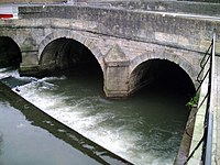
| Bristol Avon | Acton Turville 51°31′49″N 2°16′26″W / 51.53028°N 2.27389°W |
Severn Estuary, Avonmouth, Bristol 51°30′22″N 2°43′06″W / 51.50611°N 2.71833°W |
 |
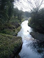
| Hampshire Avon | Pewsey, Wiltshire 51°22′10″N 1°41′42″W / 51.36944°N 1.69500°W |
English Channel, Mudeford, Dorset 50°43′23″N 1°44′53″W / 50.72306°N 1.74806°W |
 |
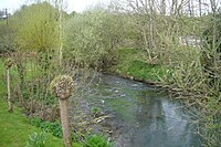
| Biss | near Upton Scudamore, Wiltshire 51°13′42″N 2°11′40″W / 51.22833°N 2.19444°W |
River Avon at Staverton, Wiltshire 51°20′12″N 2°12′56″W / 51.33667°N 2.21556°W |
 |
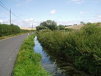
| Blackwater | Redlynch, Wiltshire 50°59′23″N 1°42′44″W / 50.98972°N 1.71222°W |
Totton, Hampshire 50°55′36″N 1°29′31″W / 50.92667°N 1.49194°W |
 |
| Bourne | Burbage 51°21′09″N 1°40′17″W / 51.35250°N 1.67139°W |
Salisbury 51°03′44″N 1°47′22″W / 51.06222°N 1.78944°W |
 |
| Broadmead Brook | west of Marshfield, Gloucestershire 51°27′24″N 2°21′45″W / 51.45667°N 2.36250°W |
Bybrook River north west of Castle Combe 51°29′54″N 2°14′13″W / 51.49833°N 2.23694°W |
 |
| Brinkworth Brook | Broad Hinton, Wiltshire 51°30′7.92″N 1°52′24.6″W / 51.5022000°N 1.873500°W |
Bristol Avon, Great Somerford, Wiltshire 51°32′43.44″N 2°2′17.52″W / 51.5454000°N 2.0382000°W |
 |
| Bybrook River | Prime: Lower Lapdown Farm, Tormarton, South Gloucestershire 51°29′53.88″N 2°20′34.44″W / 51.4983000°N 2.3429000°W Secondary: Folly Farm, Cold Ashton, South Gloucestershire 51°27′23.4″N 2°21′43.56″W / 51.456500°N 2.3621000°W |
Bristol Avon, Batheaston 51°24′5.76″N 2°18′36.72″W / 51.4016000°N 2.3102000°W |
 |
| Bydemill Brook | Stanton Country Park, south of Stanton Fitzwarren 51°36′01″N 1°44′50″W / 51.600328°N 1.747239°W |
confluence with River Thames 51°40′11″N 1°43′10″W / 51.669759°N 1.719348°W |
 |
| Chalke | Mead End, near Bowerchalke, Wiltshire 51°0′44″N 1°57′56″W / 51.01222°N 1.96556°W |
confluence with River Ebble at Broad Chalke 51°1′35″N 1°57′27″W / 51.02639°N 1.95750°W |
 |
| River Churn | Seven Springs, Gloucestershire 51°51′4″N 2°3′1″W / 51.85111°N 2.05028°W |
confluence with River Thames 51°39′14″N 1°51′12″W / 51.65389°N 1.85333°W |
 |
| Cocklemore Brook | Studley, Wiltshire 51°25′2″N 2°4′6″W / 51.41722°N 2.06833°W |
River Avon (Bristol) south of Chippenham 51°25′56″N 2°6′7″W / 51.43222°N 2.10194°W |
 |
| Cole | Wanborough, Wiltshire 51°32′34″N 1°41′54″W / 51.54278°N 1.69833°W |
River Thames 51°41′19″N 1°4′37″W / 51.68861°N 1.07694°W |
 |
| Damson Brook | Milston 51°12′22″N 1°46′08″W / 51.20611°N 1.76889°W |
confluence with Nine Mile River 51°11′20″N 1°45′36″W / 51.18889°N 1.76000°W |
No picture available |
| Derry Brook | Ravensroost Wood, Minety Common 51°35′43″N 1°58′23″W / 51.595278°N 1.973032°W |
confluence with Swill Brook south of Ashton Keynes 51°38′17″N 1°55′20″W / 51.638041°N 1.922296°W |
No picture available |
| Doncombe Brook | south of Marshfield, Gloucestershire 51°27′33″N 2°18′45″W / 51.459253°N 2.312498°W |
confluence with Bybrook River at Ford 51°28′14″N 2°14′01″W / 51.470562°N 2.233651°W |
 |
| River Dun (River Kennet) | Great Bedwyn 51°22′16″N 1°36′25″W / 51.37111°N 1.60694°W |
River Kennet near Hungerford 51°24′44″N 1°29′39″W / 51.41222°N 1.49417°W |
 |
| River Dun (River Test) | 51°3′12.05″N 1°40′57.62″W / 51.0533472°N 1.6826722°W | Confluence with River Test near Kimbridge in Hampshire 51°01′50″N 1°32′01″W / 51.030672°N 1.533504°W |
 |
| River Ebble | Alvediston 51°00′46″N 2°02′20″W / 51.0127°N 2.039°W |
confluence with River Avon 51°02′00″N 1°45′30″W / 51.0334°N 1.7582°W |
 |
| Gauze Brook | Littleton Drew 51°31′35″N 2°14′21″W / 51.5265°N 2.2391°W |
River Avon (Bristol) south of Malmesbury 51°33′44″N 2°04′49″W / 51.5623°N 2.0802°W |
 |
| River Kennet | Swallowhead Spring near Silbury Hill 51°30′10″N 1°50′42″W / 51.50276°N 1.84507°W |
confluence with River Thames at Reading 51°27′33″N 0°56′58″W / 51.459148°N 0.94947°W |
 |
| Key | Braydon Forest near Purton 51°35′11″N 1°51′57″W / 51.58639°N 1.86583°W |
confluence with River Thames near Cricklade 51°38′22″N 1°51′27″W / 51.63944°N 1.85750°W |
 |
| Lambrok Stream | Hoopers Pool between Southwick and Rode 51°17′07″N 2°14′57″W / 51.285141°N 2.249281°W |
confluence with River Biss at Trowbridge 51°19′18″N 2°13′14″W / 51.321743°N 2.220678°W |
 |
| River Marden | Ranscombe Bottom, Calstone Wellington, near Calne 51°24′56″N 2°0′48″W / 51.41556°N 2.01333°W |
Bristol Avon near Chippenham 51°27′56″N 2°05′33″W / 51.46556°N 2.09250°W |
 |
| River Nadder | Springs at Nadder Head near Donhead St Mary 51°01′01″N 2°10′33″W / 51.016951°N 2.175815°W |
Confluence with River Avon (Hampshire) in Salisbury 51°03′38″N 1°47′58″W / 51.060677°N 1.799525°W |
 |
| Nine Mile | Brigmerston Down northeast of Bulford Camp 51°13′34″N 1°42′51″W / 51.226017°N 1.714214°W |
Confluence of River Avon at Bulford 51°11′20″N 1°46′07″W / 51.188797°N 1.768739°W |
 |
| Oddford Brook | Bitham Lake northwest of Tisbury 51°04′26″N 2°06′58″W / 51.073844°N 2.116175°W |
confluence with River Nadder at Tisbury 51°03′39″N 2°04′55″W / 51.060750°N 2.082072°W |
No picture available |
| River Og | Draycot Foliat 51°29′53″N 1°44′25″W / 51.49806°N 1.74028°W |
River Kennet near Marlborough 51°25′13″N 1°43′43″W / 51.42028°N 1.72861°W |
 |
| River Ray | Wroughton 51°31′24″N 1°47′29″W / 51.52333°N 1.79139°W |
Confluence with River Thames
51°38′39″N 1°49′20″W / 51.64417°N 1.82222°W |
 |
| River Sem | near Sedgehill 51°02′51″N 2°11′04″W / 51.047620°N 2.184409°W |
near Wardour 51°02′45″N 2°06′37″W / 51.045790°N 2.110142°W |
No picture available |
| Semington Brook | The Warren south of West Lavington 51°15′53″N 1°59′46″W / 51.264651°N 1.996125°W |
confluence with River Avon (Bristol) near Whaddon 51°21′11″N 2°10′19″W / 51.353071°N 2.171855°W |
 |
| River Stour, Dorset | Stourhead 51°06′17″N 2°19′36″W / 51.104584°N 2.326786°W |
English Channel at Christchurch, Dorset 50°43′41″N 1°46′23″W / 50.72796°N 1.77295°W |
 |
| Summerham Brook | north of Rowde 51°21′39″N 2°00′51″W / 51.360947°N 2.014142°W |
confluence with Semington Brook, south of Seend Cleeve 51°19′56″N 2°05′54″W / 51.332359°N 2.098262°W |
 |
| Swill Brook | confluence of Braydon Brook and Flagham Brook near Somerford Keynes 51°38′19″N 1°58′36″W / 51.638517°N 1.976646°W |
confluence with River Thames at Ashton Keynes 51°38′20″N 1°55′25″W / 51.638890°N 1.923656°W |
 |
| Tetbury Avon | Wor Well, Tetbury 51°38′36″N 2°08′33″W / 51.6432°N 2.1424°W |
River Avon (Bristol) at Malmesbury 51°34′56″N 2°05′34″W / 51.5821°N 2.09289°W |
 |
| Thames | enters Wiltshire to the east of Ashton Keynes | leaves Wiltshire to the southwest of Lechlade-on-Thames | |
| Till | near Tilshead 51°13′49″N 1°57′21″W / 51.23028°N 1.95583°W |
confluence with River Wylye near Stapleford 51°08′09″N 1°54′07″W / 51.13583°N 1.90194°W |
 |
| Woodbridge Brook | Midgehall Copse near Lydiard Millicent 51°33′38″N 1°54′41″W / 51.5605°N 1.9115°W |
confluence with River Avon (Bristol) near Malmesbury | No picture available |
| Wylye | Rodmead Farm near Maiden Bradley 51°07′25″N 2°18′11″W / 51.12361°N 2.30306°W |
Confluence with River Nadder 51°04′45″N 1°51′45″W / 51.07917°N 1.86250°W |
 |