Long-distance footpath in Somerset and Gloucestershire, England
This article is about the path in Somerset and Gloucestershire. For the path in Cumbria, see Limestone Link (Cumbria). For the path in Derbyshire, see Limestone Way.
Limestone Link
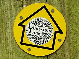
Footpath waymark sign for the Limestone Link
Length
36 mi (58 km)
Location
South West England
Trailheads
Mendip Hills / Cotswolds
Use
Hiking
Difficulty
Moderate to strenuous
Sights
Mendip Hills
Limestone Link at Dolebury Warren
The Limestone Link is a 36-mile (58 km) long-distance footpath in England, from the Mendip Hills in Somerset to Cold Ashton in Gloucestershire. It is marked by an ammonite waymarker.
The Mendip section starts between Churchill and Rowberrow, near Dolebury Warren and travels roughly west to east, passing above the villages of Blagdon and Compton Martin, close to the northern boundary of the Mendip Area of Outstanding Natural Beauty; it then passes through West Harptree. It passes through Temple Cloud, Hallatrow and Camerton before turning north through Dunkerton and Southstoke, south of Bath.
The path then follows Cam Brook to Midford and then follows Midford Brook before joining the Avon Walkway at the Dundas Aqueduct. It continues north alongside the River Avon and the Kennet and Avon Canal, past Claverton and the Claverton Pumping Station to Bathampton. Here it crosses the A4 and goes through Batheaston and then, following a stream, through Northend and St Catherine. The final part of the path goes past Monkswood reservoir and alongside St Catherines Brook to reach Cold Ashton.
The footpath connects with the Mendip Way and the Cotswold Way.
The LimestoneLink is a 36-mile (58 km) long-distance footpath in England, from the Mendip Hills in Somerset to Cold Ashton in Gloucestershire. It is marked...
Limestone (calcium carbonate CaCO3) is a type of carbonate sedimentary rock which is the main source of the material lime. It is composed mostly of the...
Members, Goreville Limestone, Cave Hill Shale, and Negli Creek Limestone. A formation in Illinois containing 4 members that are linked to other formations...
The Mendip Hills (commonly called the Mendips) is a range of limestone hills to the south of Bristol and Bath in Somerset, England. Running from Weston-super-Mare...
Limestone County is the name of two counties in the United States: Limestone County, Alabama Limestone County, Texas This disambiguation page lists articles...
Music, he released his first single and EP in 2013; his debut album The Limestone Kid was released on February 24, 2015. The Austin Chronicle gave the release...
Indiana limestone (also known as Bedford limestone) is a form of limestone used as a building material, particularly for monumental public structures....
The Solnhofen Limestone or Solnhofen Plattenkalk, formally known as the Altmühltal Formation, is a Jurassic Konservat-Lagerstätte that preserves a rare...
The Southern Limestone Alps (Italian: Alpi Sud-orientali, German: Südliche Kalkalpen), also called the Southern Calcareous Alps, are the ranges of the...
topography formed from the dissolution of soluble carbonate rocks such as limestone, dolomite, and gypsum. It is characterized by features like poljes above...
Mosta and Naxxar. This is a hard limestone which is pale grey in colour, and comparable to the Upper Coralline Limestone. At the top of this unit a hardground...
the original texture in limestone. Oolitic hematite occurs at Red Mountain near Birmingham, Alabama, along with oolitic limestone. They are usually formed...
Illinois Limestone Township, Peoria County, Illinois Limestone Township, Jewell County, Kansas Limestone Township, Alger County, Michigan Limestone Township...
articles associated with the title Bedford limestone. If an internal link led you here, you may wish to change the link to point directly to the intended article...
Fossiliferous limestone Ostracod This disambiguation page lists articles associated with the title Ostracod Limestone. If an internal link led you here...
border runs through the reservoir and SSSI. The SSSI is adjacent to the LimestoneLink long-distance footpath. "Monkswood Valley (SSSI)" (PDF). English Nature...
articles associated with the title Limestone Run. If an internal link led you here, you may wish to change the link to point directly to the intended article...
The Northern Limestone Alps (German: Nördliche Kalkalpen), also called the Northern Calcareous Alps, are the ranges of the Eastern Alps north of the Central...
Monarch's Way, and Samaritans Way South West. The western trailhead of the LimestoneLink is within 2 kilometres (1.2 mi) of the Mendip Way near Shipham. The...
was a United States Air Force installation in northeastern Maine, near Limestone and Caribou in Aroostook County. It was one of the largest bases of the...
Limestone Generating Station is a run-of-the-river hydroelectric dam on the Nelson River approximately 750 kilometres (470 mi) north of Winnipeg near...
 Global Information