 Global Information
Las Cachas Airport information
Las Cachas Airport | |||||||||||
|---|---|---|---|---|---|---|---|---|---|---|---|
| |||||||||||
| Summary | |||||||||||
| Airport type | Public | ||||||||||
| Serves | Cangrejera, El Salvador | ||||||||||
| Elevation AMSL | 51 ft / 16 m | ||||||||||
| Coordinates | 13°28′00″N 89°11′29″W / 13.46667°N 89.19139°W | ||||||||||
| Map | |||||||||||
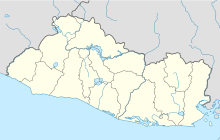 MSCS Location of the airport in El Salvador | |||||||||||
| Runways | |||||||||||
| |||||||||||
Source: Google Maps[1] | |||||||||||
Las Cachas Airport (ICAO: MSCS) is an airstrip serving the hamlet of Cangrejera in La Libertad Department, El Salvador.
The Amatecampo non-directional beacon (Ident: LAN) is located 4.5 nautical miles (8.3 km) southeast of the airstrip. The El Salvador VOR-DME (Ident: CAT) is located 8.5 nautical miles (15.7 km) east of the airstrip.[2][3]
- ^ Google Maps - Las Cachas
- ^ El Salvador VOR
- ^ Amatecampo NDB