underground sources, several streams, largest is Hamua Creek
Primary outflows
Soro River
Catchment area
250 km2 (97 sq mi)
Basin countries
Papua New Guinea
Max. length
19 km (12 mi)
Max. width
4.5 km (2.8 mi)
Surface area
49.24 km2 (19.01 sq mi)
Max. depth
70 m (230 ft)
Surface elevation
808 m (2,651 ft)
Ramsar Wetland
Designated
25 September 1998
Reference no.
961[1]
Map
Lake Kutubu is the second-largest lake in Papua New Guinea,[2] after Lake Murray, and, at 800 m above sea level,[2] the largest upland body of water,[3] with an area of 49.24 km²,[2] and a total catchment area of 250 km².[3] Lake Kutubu and Lake Sentani form an ecoregion on the WWF's Global 200.[4]
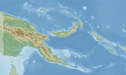
Kutubu lies in the Southern Highlands Province of Papua New Guinea, east of the Kikori River into which it drains, and about 50 km southwest of Mendi, the provincial capital. It is one of the few lakes in the country that occurs in a depression in the rugged interior mountains.[5]
The lake has a few islands, the largest of which is Wasemi in its northern part. The water of Lake Kutubu, fed by several streams originating mostly from underground sources,[4] is clear and reaches a depth of 70 m (230 feet). The catchment is inhabited by two main ethnic groups, the Foe to the south and the Fasu to the north. Thirty-three villages lie in the catchment area, with a total estimated population of 10,885.[3]
The lake gave its name to the nearby Kutubu Oil Project, Papua New Guinea's first commercial oilfield development, operated by Oil Search Limited, and which began production in 1992.[6] The development has supported the local economy, and caused a general in-migration to the area, as well as ecological problems resulting from rapid population growth, including pollution, forest destruction and overfishing. A proposed gas pipeline and road are expected to exacerbate these problems unless they are well-managed.[3]
^"Lake Kutubu". Ramsar Sites Information Service. Retrieved 25 April 2018.
^ abcLake Kutubu at Ramsar site
^ abcdPilot and Demonstration Activities: Integrated Catchment Management in Lake Kutubu, Papua New Guinea at Asian Development Bank website
^ abLakes Kutubu and Sentani at WWF
^Brian Essai. Papua and New Guinea: A Contemporary Survey. Melbourne: Oxford University Press, 1961. Page 21.
^Kutubu Archived 2007-03-16 at the Wayback Machine on Oil Search Limited website
LakeKutubu is the second-largest lake in Papua New Guinea, after Lake Murray, and, at 800 m above sea level, the largest upland body of water, with an...
The LakeKutubu rainbowfish (Melanotaenia lacustris) is a species of fish in the family Melanotaeniidae. It is also known as turquoise rainbowfish. It...
neighboring languages families in Papua New Guinea. They are named after LakeKutubu in Papua New Guinea. There has been some debate over whether they are...
spoken along LakeKutubu and Mubi River, located in the Southern Highlands Province of Papua New Guinea. Dialects of Foi are Ifigi, Kafa, Kutubu, Mubi. A...
from the volcanic peaks of Mount Bosavi to include the oilfields of LakeKutubu, and includes the language groups of Biami (shared with Western Province)...
Only the Beginnings St. Conrad Archives Center. 2016 Lake Kopiago Floating islands LakeKutubu - newest Ramsar site in Papua New Guinea Gudmundur (Gummi)...
the South Pacific (APIA Convention). PNG has two listed Ramsar sites: LakeKutubu and Tonda Wildlife Management Area. National parks of Papua New Guinea...
LakeKutubu Rural LLG is a local-level government (LLG) of Southern Highlands Province, Papua New Guinea. Kutubuan languages are spoken in the LLG. Lake...
Ramu River in the north and the Fly River in the south, and lakes including LakeKutubu, near which oil has been extracted since 1992 by Chevron. Mining...
confluence of the Hegigio with the Mubi (river) or Digimu, into which LakeKutubu drained. The average rainfall in the Kikori catchment is 5,900 millimetres...
The Kutubu tandan (Oloplotosus torobo) is a species of fish in the family Plotosidae. It is endemic to LakeKutubu in the Kikori River system, Papua New...
lower elevations – as low as 610 meters on New Britain, and 700–800 m at LakeKutubu in Southern Highlands Province of Papua New Guinea. In lower montane...
L-100s, as no roads reached the massive oil recovery operation near LakeKutubu. Papua New Guinea provides some of the world's most challenging flying...
The Kutubu hardyhead (Craterocephalus lacustris) is a species of fish in the family Atherinidae. It is endemic to LakeKutubu and its outlet, the Soro...
the South Pacific (APIA Convention). PNG has two listed Ramsar sites: LakeKutubu and Tonda Wildlife Management Area. Despite the provision for conservation...
separate pipeline to Oil Search's loading facilities for the oilfield at LakeKutubu: the Kumul Marine Terminal offshore in Gulf Province. The construction...
Loeweke, Eunice and Jean May. 1980. General Grammar of Fasu (Namo me): LakeKutubu, Southern Highlands Province. In Don Hutchisson (ed.), Grammatical studies...
and northern Australia and New Guinea. Several species are endemic to LakeKutubu in Papua New Guinea. The currently recognized species in this genus are:...
Siwi-Utame Wildlife Management Area Jimi (Ruti) Valley National Park LakeKutubu Wildlife Management Area Crater Mountain Wildlife Management Area Hunstein...
occurs in torrents in the New Guinea Highlands.: 184 It can be found in LakeKutubu. Palmer-Newton, A. (2020). "Neosilurus equinus". IUCN Red List of Threatened...
Highlands Province Kamiali Wildlife Management Area, Morobe Province LakeKutubu Wildlife Management Area, Southern Highlands Province Oi Mada Wara Wildlife...
(Mogurnda spilota) is a species of fish in the family Eleotridae endemic to LakeKutubu. This species can reach a standard length of 13 cm (5.1 in). Allen, G...
Guinea, where it occurs in the Southern Highlands between Mendi and LakeKutubu, in the Purari River system. Larson, H.; Kolkolo, U.; Mungkaje, A.; Ebner...
 Global Information