 Global Information
Lake Amtkeli information
| Lake Amtkeli | |
|---|---|
 | |
 Lake Amtkeli 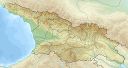 Lake Amtkeli | |
| Location | Gulripshi District |
| Coordinates | 43°05′42″N 41°17′54″E / 43.09500°N 41.29833°E |
| Lake type | Glacial lake |
| Primary inflows | Amtkeli |
| Primary outflows | Jampali (through sinkholes) Amtkeli |
| Catchment area | 153 km2 (59 sq mi) |
| Basin countries | Georgia, (Abkhazia[1]) |
| Built | 3 October 1891 |
| Max. length | 2.4 km (1.5 mi) |
| Surface area | 0.58 km2 (0.22 sq mi) |
| Max. depth | 65 m (213 ft) |
| Surface elevation | 512 m (1,680 ft) |
| Frozen | very rarely |
| Settlements | Azanta |
 | |
Lake Amtkeli or Amtkel[2] (Abkhaz: Амтҟьал; Georgian: ამტყელის ტბა; Russian: Амткел) is a lake in the Gulripshi District of Abkhazia, Georgia that was formed on 3 October 1891 when an earthquake caused a landslide on the south-western slope of Mt. little Shkhapach into the valley of the Amtkeli River.[3][4][5]
- ^ The political status of Abkhazia is disputed. Having unilaterally declared independence from Georgia in 1992, Abkhazia is formally recognised as an independent state by 5 UN member states (two other states previously recognised it but then withdrew their recognition), while the remainder of the international community recognizes it as as de jure Georgian territory. Georgia continues to claim the area as its own territory, designating it as Russian-occupied territory.
- ^ "Lake Amtkel", page 63, A Checklist of the Ground-beetles of Russia and Adjacent Lands
- ^ Solonenko, V.P. (1979). "Mapping the After-Effects of Disastrous Earthquakes and Estimation of Hazard for Engineering Constructions". Bulletin of the International Association of Engineering Geology. 19. Krefeld: 138–142. doi:10.1007/bf02600466. S2CID 129509677.
- ^ Озеро, рожденное обвалом (in Russian). bluekaz.ru. 2009. Retrieved 18 February 2010.[permanent dead link]
- ^ Bondyrev, I. V.; Z. K. Tatashidz; V. P. Singh; E. D. Tsereteli; A. Yilmaz (2004). "Impediments to the Sustainable Development of the Caucasus-Pontdes Region". Journal of Comparative Social Welfare. 20 (1). London: Routledge: 33–48. doi:10.1080/17486830408417009. S2CID 153365107.