Location in the Far Eastern Federal District, Russia
Show map of Far Eastern Federal District
Kolyma Mountains
Kolyma Mountains (Magadan Oblast)
Show map of Magadan Oblast
Country
Russia
Oblast/Okrug/Krai
Magadan, Chukotka and Kamchatka
Range coordinates
64°N159°E / 64°N 159°E / 64; 159
Parent range
East Siberian System
Geology
Age of rock
Jurassic, Triassic, Permian and Proterozoic
Type of rock
Granite, Gneiss, Schist, Siltstone and Sandstone
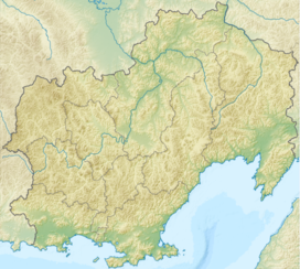
The Kolyma Mountains or Kolyma Upland (Russian: Колымское нагорье, romanized: Kolymskoye Nagorye), is a system of mountain ranges in northeastern Siberia, lying mostly within the Magadan Oblast, along the shores of the Sea of Okhotsk in the Kolyma region.[1] It constitutes the watershed between the basins of Kolyma River and of the Sea of Okhotsk / Pacific Ocean.[2]
The range's highest point is Mount Nevskaya (гора Невская) in the Omsukchan Range at 1,828 meters (5,997 ft).[3]
^"Kolyma Upland". Encyclopædia Britannica. July 20, 1998.
^Cite error: The named reference ЭСБЕ was invoked but never defined (see the help page).
^Sedov RV, Kolyma highland / Hvorov A. Yu . - Khabarovsk, 2003. - p. 418. - ISBN 5-901725-05-0 .
The KolymaMountains or Kolyma Upland (Russian: Колымское нагорье, romanized: Kolymskoye Nagorye), is a system of mountain ranges in northeastern Siberia...
River and the northern shores of the Sea of Okhotsk, as well as the KolymaMountains (the watershed of the two). It is bounded to the north by the East...
Ulakhan-Sis Range Alazeya Plateau Yukaghir Highlands Nera Plateau KolymaMountains Omsukchan Range Oloy Range Ush-Urekchen Kedon Range Kongin Range Maymandzhin...
Mantiqueira Mountains/Espinhaço Mountains – 1,320 km (820 mi) KolymaMountains – 1,300 km (810 mi) (section of the East Siberian System of mountains) Alps –...
incomplete list of notable mountains on Earth, sorted by elevation in metres above sea level. For a complete list of mountains over 7200 m high, with at...
was a tin, gold and uranium mine and a former forced labour camp in the Kolyma region of North-Eastern Russia, present-day Magadan Oblast. The Butugychag...
This is a list of mountain ranges in Asia. "Mountains in Oman". omantourism.gov.om. Ministry of Tourism, Sultanate of Oman. Retrieved 10 November 2017...
ecoregion that covers a portion of northeastern Russia, between the KolymaMountains on the west, and the Bering Sea coast to the east. The area is an important...
Antarctica Ellsworth Land tundra Ellsworth Land Ellsworth Mountains tundra Ellsworth Mountains Enderby Land tundra Enderby Land Marie Byrd Land tundra Marie...
forested with birch, willow, mountain ash, larch and alder. Inland there are mountain ranges belonging to the KolymaMountains, as well as the Chersky Range...
to the south with the Dzhagdy Range, and to the northeast with the KolymaMountains. The Maya, the Maymakan, and the Mati are among the rivers having their...
confluence of the Left Balygychan and Right Balygychan rivers of the KolymaMountains. It flows roughly northwards along the western flank of the Omsukchan...
The river has its source in the confluence of two small rivers of the Kolyma Highlands at an elevation of 515 metres (1,690 ft) and flows roughly westwards...
Southern, Kolyma or Forest Yukaghir language is one of two extant Yukaghir languages. Last spoken in the forest zone near the sources of the Kolyma, divided...
This 1,828 m (5,997 ft) high mountain is the highest point of the KolymaMountains, part of the East Siberian Mountains. The highest point in Magadan...
The Maymandzhin Range rises at the western limit of the Kolyma Highlands system. The mountains are of moderate height, the highest summit of the range...
of mountains and hills of Russia. Russia portal Mountains portal Volcanoes portal Highest points of Russian Federal subjects List of Altai mountains List...
Anadyr Lowlands in the southeast, the KolymaMountains in the southwest and the Kolyma Lowlands, where the Kolyma River flows, in the west. Among the rivers...
mine Location Goltsovoye mine Location in Magadan Oblast Location KolymaMountains Magadan Oblast Country Russia Coordinates 62°0′34″N 155°39′13″E /...
the south of the range rises the roughly parallel Oloy Range of the KolymaMountains. Although there are no glaciers in the range in present times, there...
ecoregion, but internally the Verhkoyansk and Chersky mountains (which are in the "Cherskii-Kolymamountain tundra" ecoregion) confines the ecoregion into valleys...
language word "Khesen", meaning "herd". The river has its source in the KolymaMountains, 15 km (9.3 mi) to the north of Karamken at an elevation of about 800...
(Мыгыкивэем), meaning "stormy river". The source of the Penzhina is in the KolymaMountains, and it flows eastwards across the Ichigem Range. After bending southwards...
Khasyn, flowing from the KolymaMountains. Karamken was established in the 1930s in connection with the construction of the Kolyma Highway. After a gold...
 Global Information