 Global Information
Kharistvala information
Kharistvala
ხარისთვალა | |
|---|---|
Townlet | |
 Kharistvali left on the shore of Shaori Reservoir | |
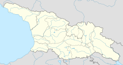 Kharistvala Location of Kharistvala in Georgia  Kharistvala Kharistvala (Racha-Lechkhumi and Kvemo Svaneti) | |
| Coordinates: 42°24′44″N 43°2′41″E / 42.41222°N 43.04472°E | |
| Country | |
| Mkhare | Racha-Lechkhumi and Kvemo Svaneti |
| Municipality | Ambrolauri |
| Elevation | 1,150 m (3,770 ft) |
| Population (2021)[1] | |
| • Total | 0 |
| Time zone | UTC+4 (Georgian Time) |
Kharistvala (Georgian: ხარისთვალა) is a so called daba (urban-type settlement) in Georgia’s northern Ambrolauri Municipality (Racha-Lechkhumi and Kvemo Svaneti region), at an elevation of 1,150 metres (3,770 ft) above sea level on the western shore of Shaori Reservoir. It is located about 20 kilometres (12 mi) south of the municipal center Ambrolauri, and 5 kilometres (3.1 mi) north of the 1,217 metres (3,993 ft) high Nakerala Pass. Remarkably, the settlement has no permanent population (2021[1]), while still registered as a daba. Kharistvala is administratively part of the Nikortsminda community (თემი, temi) which also consists of villages Kachaeti and Nikortsminda, known for the Nikortsminda Cathedral.[2] It acquired the daba status in 1956.
- ^ a b "Population and Demography - Population by cities and boroughs (daba), as of 1 January". National Statistics Office of Georgia, Geostat. 2021-01-01. Retrieved 2022-03-29.
- ^ "Main Results of the 2014 Census (Publication)" (PDF). Census.ge, National Statistics Office of Georgia (Geostat) (in Georgian). 2016-04-28. p. 212. Archived from the original (PDF) on 2020-02-13. Retrieved 2022-03-26.