Global Information Lookup Global Information

Kelbrook and Sough information


Kelbrook and Sough
Kelbrook countryside
Kelbrook and Sough is located in the Borough of Pendle
Kelbrook and Sough
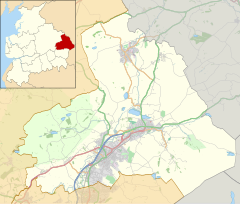
Kelbrook and Sough
Location in Pendle Borough
Kelbrook and Sough is located in Lancashire
Kelbrook and Sough
Kelbrook and Sough
Location within Lancashire
Population1,008 (2011)
OS grid referenceSD9044
Civil parish
  • Kelbrook and Sough
District
  • Pendle
Shire county
  • Lancashire
Region
  • North West
CountryEngland
Sovereign stateUnited Kingdom
Post townBARNOLDSWICK
Postcode districtBB18
Dialling code01282
PoliceLancashire
FireLancashire
AmbulanceNorth West
UK Parliament
  • Pendle
List of places
UK
England
Lancashire
53°53′53″N 2°09′04″W / 53.898°N 2.151°W / 53.898; -2.151

Kelbrook and Sough is a civil parish in the Pendle district of Lancashire, England. It has a population of 1,008,[1] and contains the village of Kelbrook and neighbouring hamlet of Sough.

The parish adjoins the Pendle parishes of Laneshaw Bridge, Foulridge, Salterforth and Earby and West Yorkshire.

Prior to 1974 the area was part of the West Riding of Yorkshire.

According to the United Kingdom Census 2011, the parish has a population of 1,008,[1] a decrease from 1,026 in the 2001 census.[2]

The civil parish was created in 1992, from part of the unparished area that before 1974 had been the urban district of Earby.

On May 4, 2023, Kelbrook and Sough Parish Council held their first ever election.

Voted on to the Parish Council were:

Sharon Ashley, Christine Elley, Darren Galway, Val Kimberly, Debbie Richardson, Gary Slinger, Garry Wilson. [3][4]

  1. ^ a b UK Census (2011). "Local Area Report – Kelbrook and Sough Parish (1170215080)". Nomis. Office for National Statistics. Retrieved 23 February 2018.
  2. ^ Office for National Statistics : Census 2001 : Parish Headcounts : Pendle Retrieved 2009-09-18
  3. ^ "The Pendle (Parishes) Order 1991" (PDF). Lgbce. 13 November 1991. Retrieved 6 March 2021.
  4. ^ "Earby UD through time". visionofbritain.org.uk. GB Historical GIS / University of Portsmouth. Retrieved 6 March 2021.

and 13 Related for: Kelbrook and Sough information

Request time (Page generated in 0.7834 seconds.)

Kelbrook and Sough

Last Update:

Kelbrook and Sough is a civil parish in the Pendle district of Lancashire, England. It has a population of 1,008, and contains the village of Kelbrook...

Word Count : 253

Kelbrook

Last Update:

Kelbrook is a village in the civil parish of Kelbrook and Sough, Borough of Pendle, in Lancashire, England. It lies on the A56 road between Colne and...

Word Count : 466

Listed buildings in Kelbrook and Sough

Last Update:

Kelbrook and Sough is a civil parish in Pendle, Lancashire, England. It contains eight listed buildings that are recorded in the National Heritage List...

Word Count : 296

Borough of Pendle

Last Update:

Fence Foulridge Higham Higherford Kelbrook Laneshaw Bridge Newchurch in Pendle Reedley Roughlee Salterforth Sough Trawden Wheatley Lane Winewall Wycoller...

Word Count : 1709

Listed buildings in England

Last Update:

Listed buildings in Higham with West Close Booth Listed buildings in Kelbrook and Sough Listed buildings in Laneshaw Bridge Listed buildings in Nelson, Lancashire...

Word Count : 12698

BB postcode area

Last Update:

Blackburn, Burnley, Accrington, Barnoldswick, Clitheroe, Colne, Darwen, Nelson and Rossendale. The approximate coverage of the postcode districts: The BB18...

Word Count : 199

Foulridge

Last Update:

Foulridge adjoins the Pendle parishes of Salterforth, Kelbrook and Sough, Laneshaw Bridge, Colne and Blacko. Foulridge was once a township in the ancient...

Word Count : 437

Listed buildings in Lancashire

Last Update:

Listed buildings in Higham with West Close Booth Listed buildings in Kelbrook and Sough Listed buildings in Laneshaw Bridge Listed buildings in Nelson, Lancashire...

Word Count : 1403

Civil parishes in Lancashire

Last Update:

ceremonial county of Lancashire; Blackpool is completely unparished; Pendle and Ribble Valley are entirely parished. At the 2001 census, there were 587,074...

Word Count : 3365

Unparished area

Last Update:

towns and some cities in otherwise rural districts are also unparished areas and therefore no longer have a town council or city council, and are instead...

Word Count : 5165

List of places in Lancashire

Last Update:

Hothersall Howick Cross Huncoat Hundred End Hutton Inglewhite Ingol Inskip Kelbrook Kirkham Knott End-on-Sea Lancaster Laneshaw Bridge Langho Larbreck Lathom...

Word Count : 503

West Craven

Last Update:

links with Yorkshire. Towns and villages in West Craven are: Barnoldswick, Earby, Sough, Kelbrook, Salterforth and Bracewell and Brogden. There is a West...

Word Count : 237

Craven District

Last Update:

came to be known as West Craven: Barnoldswick, Earby, Sough, Kelbrook, Salterforth and Bracewell and Brogden. (Other more westerly parts of Craven that became...

Word Count : 8517

PDF Search Engine © AllGlobal.net