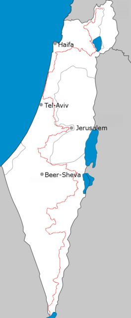
The Israel National Trail (Hebrew: שביל ישראל, Shvil Yisra'el) is a hiking trail that crosses the entire length of the country of Israel,[2] with its northern end at Kibbutz Kfar Giladi, near the Lebanese border in the far north of the country, extending to Eilat at the southernmost tip of Israel on the Red Sea, with a total length of 1,040 km (650 mi).[3][4] The trail was inaugurated in 1995.
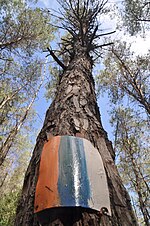
Israel Trail marker on a tree
The trail is marked with three stripes (white, blue, and orange), and takes an average of 45–60 days to complete.[5] In October 2019, the trail was extended to include Masada and the Dead Sea area, and in August 2023, it was extended to include a short portion in the Golan Heights. [6]
The Israel National Trail has been listed in National Geographic's 20 most "epic trails." It is described as a trail that "delves into the grand scale of biblical landscapes as well as the everyday lives of the modern Israeli."[7]
Since January 2016, the Israel National Trail can be explored on Google Street View. Israel National Trail on Google Street View.[8]
The best hiking seasons are either from mid-February to mid-May or from September to December. The summer months (mid-May to the end of August) are considered too hot. Winter is less popular due to rain, low temperatures and, in the southern sections of the trail, potential flash floods.
^Schnitzspahn, Doug. "World's Best Hikes: Epic Trails". National Geographic. Archived from the original on August 1, 2012. Retrieved June 16, 2013.
^"Israel National Trail". Society for the Protection of Nature in Israel. Retrieved 21 April 2013.
^National Geographic names Israel National Trail as one of world's best, Haaretz
^Google Street View cameras to bring Israel National Trail alive, Jerusalem Post
^Porcupines, Emperors, and the New Middle East, Eretz Magazine
^backpackisrael (2020-10-10). "The Israel National Trail: Ultimate Preparation Guide". Backpack Israel. Retrieved 2023-08-27.
^Udasin, Sharon (August 13, 2012). "'National Geographic' calls Israel Trail 'epic'". The Jerusalem Post. Retrieved August 13, 2012.
^Leichman, Abigail Klein (2015-05-11). "Israel National Trail gets Google Street View". ISRAEL21c. Retrieved 2023-11-04.
and 21 Related for: Israel National Trail information
The IsraelNationalTrail (Hebrew: שביל ישראל, Shvil Yisra'el) is a hiking trail that crosses the entire length of the country of Israel, with its northern...
Israel Bike Trail is a trail for mountain bikers in Israel. When complete, the trail will extend over 1,200 kilometers across Israel, like the Israel...
The Jesus Trail (Hebrew: שביל ישו, Sh'víl Yeshú) is a 65 km (40 mi) hiking and pilgrimage route in the Galilee region of Israel that traces the route...
combinations such as the Golan Trail (white, blue, green), the Jerusalem Trail (blue, gold, blue), and the IsraelNationalTrail (white, blue, orange). Blazes...
Jerusalem Trail, (Hebrew: שביל ירושלים, Shvil Yerushalaim) is a hiking and cycling path that extends the IsraelNationalTrail into Jerusalem. The trail, opened...
Protection of Nature in Israel (SPNI), announced plans to photograph the full length of the 1,100 km (683 mi) IsraelNationalTrail Beginning in the Bar...
Trail – 40 kilometres (25 mi) trail, connects the IsraelNationalTrail with Jerusalem and the area of the Old City. Jesus Trail – a 65 kilometres (40 mi)...
of IsraelNationalTrail with a person carrying Google Street View camera called "Trekker", it took 10 weeks of hiking to finish the trail. The trail was...
became the Appalachian National Scenic Trail under the NationalTrails System Act of 1968. The trail is maintained by 31 trail clubs and multiple partnerships...
by National Geographic, the British Sunday Times, the Guardian, Condenast, Vogue US and Lonely Planet. IsraelNationalTrail "About Jordan Trail". jordantrail...
backpacking on the IsraelNationaltrail, are part of israeli nationhood, culture, and history. National parks and nature reserves across Israel register some...
Anglia. The route was adapted and extended as a NationalTrail, created in 1972. The Ridgeway NationalTrail follows the ancient Ridgeway from Overton Hill...
kilometers of which represents the IsraelNationalTrail. A few full-time SPNI employees out in the field mark and repair trail markers, from the Galilee to...
Haifa Wadis Trail, (Hebrew: שביל ואדיות חיפה, Shvil Vadiot Haifa) is a hiking path that extends the IsraelNationalTrail into Haifa. This trail that was...
five countries. In 2019, he set the speed record for the 631-mile IsraelNationalTrail. Wardian is known for the vast number of marathons he participates...
The California Trail was an emigrant trail of about 1,600 mi (2,600 km) across the western half of the North American continent from Missouri River towns...
Mediterranean crossing by cargo ship, Wilson connected with the IsraelNationalTrail, a well-marked footpath that led from outside Haifa nearly all the...
The North Country Trail (NCT, officially designated the North Country National Scenic Trail) is a long-distance hiking trail in the Midwestern and Northeastern...
becoming the first person to complete it. In 2013 Bowles ran the IsraelNationalTrail, covering its 1,009 km length in 13 days after a life-threatening...
The Pinhoti Trail is a Southern Appalachian Mountains long-distance trail, 335 miles (540 km) in length, located in the United States within the states...
 Global Information