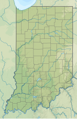
Indianapolis Regional Airport[1][2] (ICAO: KMQJ, FAA LID: MQJ) is a public use airport in Hancock County, Indiana, United States.[1] Owned by Indianapolis Airport Authority, it is 12 nautical miles (22 km) east of the central business district of Indianapolis.[1] The airport is also 7 nautical miles (13 km) northwest of Greenfield[3] and 3 nautical miles (6 km) southwest of McCordsville.[4] It was known as Mount Comfort Airport until March 2011.[2][5]
This facility is included in the National Plan of Integrated Airport Systems for 2017–2021, which categorized it as a general aviation reliever airport[6] for Indianapolis International Airport. Although many U.S. airports use the same three-letter location identifier for the FAA and IATA, Indianapolis Regional Airport is assigned MQJ by the FAA[1] but has no designation from the IATA[7] (which assigned MQJ to Moma Airport in Khonuu, Russia).[8]
^ abcdeFAA Airport Form 5010 for MQJ PDF. Federal Aviation Administration. effective July 13, 2023.
^ abc"Indianapolis Regional Airport". Indianapolis Airport Authority. Archived from the original on August 15, 2010. Retrieved August 8, 2013.
^
"Distance and heading from Greenfield to KMQJ". Great Circle Mapper. Retrieved August 8, 2013.
^"Distance and heading from McCordsville to KMQJ". Great Circle Mapper. Retrieved August 8, 2013.
^"Mount Comfort Airport becomes Indianapolis Regional on Friday, March 11, 2011" (PDF) (Press release). Indianapolis Airport Authority. March 9, 2011. Archived from the original (PDF) on July 12, 2012. Retrieved August 8, 2013.
^"Appendix A: List of NPIAS Airports with 5-Year Forecast Activity and Development Cost". National Plan of Integrated Airport Systems (NPIAS) Reports. Federal Aviation Administration. October 4, 2010. Archived from the original on 2012-10-27.
^
"Indianapolis Regional (IATA: none, ICAO: KMQJ, FAA: MQJ)". Great Circle Mapper. Retrieved August 8, 2013.
^
"IATA Airport Code Search (MQJ – City: Khonuu, Airport: Moma)". International Air Transport Association. Retrieved August 8, 2013.
and 22 Related for: Indianapolis Regional Airport information
IndianapolisRegionalAirport (ICAO: KMQJ, FAA LID: MQJ) is a public use airport in Hancock County, Indiana, United States. Owned by Indianapolis Airport...
Indianapolis International Airport (IATA: IND, ICAO: KIND, FAA LID: IND) is an international airport located seven miles (11 km) southwest of downtown...
Airpark (EYE), Indianapolis Metropolitan Airport (UMP), IndianapolisRegionalAirport (MQJ), Hendricks County Airport (2R2), Indianapolis Downtown Heliport...
facilities: Indianapolis International Airport (IND) Eagle Creek Airpark (EYE) Indianapolis Metropolitan Airport (UMP) IndianapolisRegionalAirport (formerly...
largest airport in the State of Indiana after Fort Wayne International Airport, South Bend International Airport, and Indianapolis International Airport. The...
second busiest airport in terms of passenger traffic after Indianapolis International Airport. The National Plan of Integrated Airport Systems for 2015–2019...
(Fishers) IndianapolisRegionalAirport (Greenfield) Four other publicly owned general aviation airports are located elsewhere in the Indianapolis metropolitan...
Eagle Creek Airpark Indianapolis International AirportIndianapolis Metropolitan AirportIndianapolisRegional (Mount Comfort) Airport Massachusetts Port...
Contour Airlines is an independent regional airline headquartered at Smyrna Airport in Smyrna, Tennessee, United States. Contour Airlines is set up as...
November 2022). "Pilot makes emergency aircraft landing near IndianapolisRegionalAirport in Hancock County". WRTV. "Vision Jet". Cirrus Aircraft. Matt...
Barkley RegionalAirport (IATA: PAH, ICAO: KPAH, FAA LID: PAH) is an American domestic airport in West Paducah, Kentucky, 14 miles west of Paducah in McCracken...
Encyclopedia of Indianapolis. Indianapolis Public Library. Retrieved January 23, 2022. Hale, Michelle D. (2021) [1994]. "IndianapolisAirport Authority"....
is a list of airports in Indiana (a U.S. state), grouped by type and sorted by location. It contains all public-use and military airports in the state...
Terre Haute RegionalAirport (IATA: HUF, ICAO: KHUF, FAA LID: HUF) is a civil-military public airport in Terre Haute, in Vigo County, Indiana, six miles...
Delaware County RegionalAirport (IATA: MIE, ICAO: KMIE, FAA LID: MIE) is in Delaware County, Indiana three miles northwest of Muncie. Owned by the Delaware...
serving the airport. In 1986, American Trans Air (later known as ATA) began service to Fort Myers with flights to Indianapolis International Airport, which...
war between Southwest Airlines, ATA Airlines, and others at Indianapolis International Airport, two and a half hours from Fort Wayne. In late 2003, ATA Connection...
Sioux Falls RegionalAirport (IATA: FSD, ICAO: KFSD, FAA LID: FSD), also known as Joe Foss Field, is a public and military use airport three miles northwest...
Williamsport RegionalAirport (IATA: IPT, ICAO: KIPT, FAA LID: IPT) serves Williamsport, Pennsylvania, and the surrounding area with a population of roughly...
MQJ may refer to: IndianapolisRegionalAirport (FAA LID: MQJ), Indiana, United States MQJ, ISO language code for Mamasa Moma Airport (IATA: MQJ), Sakha...
directly from the Speedway to Indianapolis International Airport. From there they would fly to Concord RegionalAirport, and ride a helicopter to the...
the new North Texas RegionalAirport, which was named after the North Texas Commission that was instrumental in the regionalairport coming to fruition...
 Global Information