This article contains content that is written like an advertisement. Please help improve it by removing promotional content and inappropriate external links, and by adding encyclopedic content written from a neutral point of view.(April 2024) (Learn how and when to remove this message)
County in Republic of China
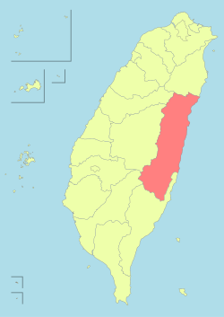
Hualien County
花蓮縣
County
Top:Liyu Lake, Second left:A cigarette product house in Fenglin, Second right:Taroco Gorge in Cross Island Highway, Third left:Qixingtan Beach in Xincheng, Third right:Hualien Railroad Station, Bottom left:Cingshui Cliffs near Suhua Highway, Bottom right:A paddy field in Shoufeng, backyard in Central Mountain Range
Hualien County (Mandarin Wade–Giles: Hua¹-lien² Hsien⁴; Pīnyīn: Huālián Xiàn; Hokkien POJ: Hoa-lian-koān or Hoa-liân-koān; Hakka PFS: Fâ-lièn-yen; Amis: Kalingko) is a county on the east coast of Taiwan. It is Taiwan's largest county by area, yet due to its mountainous terrain, has one of the lowest populations in the country. The county seat and largest city is Hualien City. Hualien County is located in the eastern part of Taiwan; the Pacific Ocean is to its east and the Central Mountain Range is to its west. Hualien is the largest county in Taiwan in terms of area, with a long, narrow and mountainous terrain.
Most of the population resides in the Huadong Valley, which runs north to south, sandwiched between the Central and Hai'an mountain ranges. Due to the rural nature of the county, Hualien attracts many visitors for its natural environment, which includes Taroko Gorge, Qingshui Cliff and Qixingtan Beach.
Much of the modern day Hualien County was populated by the Sakizaya people prior to the arrival of the Spanish, Dutch and Han Chinese, who later joined the Qing. The region was renamed Karenkō Prefecture in 1895 during Japanese colonial rule. After the end of the World War II, the Republic of China, established in 1911 after the fall of the Qing, took control of Taiwan and reorganized the former Karenkō Prefecture as Hualien County of Taiwan Province in 1945. Taiwan Province would later be downsized in 1998 and Hualien County became directly governed by the Executive Yuan.
As of February 2023, Hualien's organic cultivation area has reached 3,175 hectares, and the organic cultivation area is the largest in the country, accounting for 23% of the total area. Hualien is the largest organic agricultural production base in Taiwan.[2]
^Yu, Tai-lang; Pan, Jason (17 February 2014). "Aborigines Now Make up 28% of Hualien County". Taipei Times. Archived from the original on 2015-02-16. Retrieved 2014-02-17.
^"國內有機及友善耕作種植面積概況". www.afa.gov.tw (in Chinese). 2013-05-14. Retrieved 2023-03-25.
a Mw 7.4 earthquake struck 16 km (9.9 mi) south-southwest of Hualien City, HualienCounty, Taiwan. At least 18 people were killed and over 1,100 were injured...
Hualien City (pinyin: Huālián Shì; Wade-Giles: Hua¹-lien² Shih⁴; Hokkien POJ: Hoa-lian-chhī or Hoa-liân-chhī) is a county-administered city and the county...
Taiwan HualienCounty Constituency Hualien railway station Hualien Airport Hualian AFB Hualien City, a port city and the seat of HualienCounty, Taiwan...
On June 5, 1920, a shallow magnitude 8.2 earthquake struck offshore HualienCounty, Empire of Japan (now Taiwan). It is currently the largest earthquake...
spans Taichung Municipality, Nantou County, and HualienCounty and is located in Xiulin Township, HualienCounty, Taiwan. This national park was originally...
5-hectare (28-acre) civilian area of Chiashan Air Force Base in Xincheng, HualienCounty, Taiwan. With flights to Taipei, Kaohsiung and Taichung, it served 235...
recorded on 4 February 2018, at 21:56:40. The epicenter was located at HualienCounty, Taiwan, reaching a scale of ML 5.8. Taiwan has a history of many strong...
dàlóu) is a partially collapsed ten-story tower building in Hualien City, HualienCounty, Taiwan. The building was constructed in 1986 and houses shops...
This is a list of notable temples in Taiwan associated with Chinese folk religion, mostly Buddhism, Taoism, and Confucianism. Religious affiliation is...
HualienCounty - 37 km (23 mi) Lekuleku River - HualienCounty - 54 km (34 mi) Hualien River - HualienCounty - 57 km (35 mi) Mukua River - Hualien County...
Night Market Dongdamen Night Market, Hualien City (東大門夜市) Nanpin Night Market, Hualien City Ziqiang Night Market, Hualien City List of tourist attractions...
The 2019 Hualien earthquake (Chinese: 418花蓮地震) struck HualienCounty, Taiwan with a moment magnitude of 6.1 on 18 April at 13:01 local time (05:01 UTC)...
passenger flight between Taipei and Hualien that suffered a fire following an explosion after landing at Hualien Airport, Taiwan, on 24 August 1999, resulting...
Hualien (Chinese: 花蓮; pinyin: Huālián; Pe̍h-ōe-jī: Hoa-lian) is a railway station in Hualien City, HualienCounty, Taiwan served by Taiwan Railways Administration...
Donggang Township, Pingtung County called An-Nur Tongkang Mosque and another in Hualien City, HualienCounty called Hualien Al-Falah Mosque were built...
people of Taiwan. Most of them moved to the coastal area of HualienCounty and Taitung County in the 19th century due to encroachment by Han settlers. Their...
West Bengal, India Ruisui Tropic of Cancer Marker in Ruisui Township, HualienCounty, Taiwan Tower of the Tropic of Cancer in Guangzhou, Guangdong Province...
nun, she went to Pu Ming Temple (普明寺; Pe̍h-ōe-jī: Phó͘-bêng-sī) in HualienCounty to continue her spiritual formation. As a part of that formation, she...
the Republic of China Air Force in HualienCounty, Taiwan. It is known for its extensive underground hangars. Hualien Airport operates within a 28-acre...
Shoufeng Township is a rural Township in HualienCounty, Taiwan. The township sits in the north segment of East Rift Valley between Taiwan's Central Range...
are a Taiwanese indigenous people who live primarily in Nantou County and HualienCounty. Their language is also known as Seediq. They were officially...
 Global Information