 Global Information
Hastings Micropolitan Statistical Area information
Hastings Micropolitan Area | ||
|---|---|---|
Micropolitan Statistical Area | ||
| Hastings, NE Micropolitan Statistical Area | ||
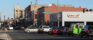 Downtown Hastings: 2nd Street, looking eastward, November 2012 | ||
 Interactive Map of Hastings, NE μSA
| ||
| Country | United States | |
| State | Nebraska | |
| Largest city | Hastings | |
| Time zone | UTC−6 (CST) | |
| • Summer (DST) | UTC−5 (CDT) | |
The Hastings Micropolitan Statistical Area, as defined by the United States Census Bureau, is an area consisting of two counties in Nebraska, anchored by the city of Hastings.
As of the 2000 census, the μSA had a population of 38,190 (though a July 1, 2009 estimate placed the population at 39,529).[1]
- ^ "Table 1. Annual Estimates of the Population of Metropolitan and Micropolitan Statistical Areas: April 1, 2000 to July 1, 2009 (CBSA-EST2009-01)". 2009 Population Estimates. United States Census Bureau, Population Division. 2010-03-23. Archived from the original (CSV) on June 15, 2010. Retrieved 2010-03-25.