 Global Information
Hafslovatnet information
| Hafslovatnet | |
|---|---|
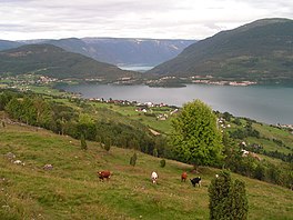
 Hafslovatnet with the Lustrafjord in the background | |
 Hafslovatnet Location of the lake  Hafslovatnet Hafslovatnet (Norway) | |
| Location | Luster, Vestland |
| Coordinates | 61°18′07″N 07°10′19″E / 61.30194°N 7.17194°E |
| Primary inflows | Soget |
| Primary outflows | Årøyelvi |
| Basin countries | Norway |
| Max. length | 8 km (5.0 mi) |
| Max. width | 1.5 km (0.93 mi) |
| Surface area | 5.97 km2 (2.31 sq mi) |
| Average depth | 22 m (72 ft) |
| Max. depth | 72.5 m (238 ft) |
| Water volume | 130,432,000 m3 (4.6062×10⁹ cu ft) |
| Surface elevation | 168 m (551 ft) |
| Settlements | Hafslo |
| References | NVE |
Hafslovatnet is a lake in the municipality of Luster in Vestland county, Norway.
The lake lies at an elevation of 168 m (551 ft),[1] has a surface area of 5.97 km2 (2.31 sq mi), and a water volume of 130,432,000 m3 (4.6062×10⁹ cu ft).[2] It serves as a reservoir for the hydroelectric power station in Årøy.[1] The primary inflow of the Hafslovatnet is via the short river Soget from the lake Veitastrondsvatnet. The primary outflow is the river Årøyelvi, which flows south into the Barsnesfjord, an inner part of the Sogndalsfjord, which, in turn, is a northern branch of the Sognefjord.[3]
The eponymous village of Hafslo lies at the northern shore of the lake. The eastern end of the lake lies at a distance of less than 2 km (1.2 mi) from the village of Solvorn, which lies at the northern shore of the Lustrafjord. The western part of the lake lies in the bird reserve Hafslovatnet.[3]
- ^ a b "NVE Atlas" (in Norwegian). Norwegian Water Resources and Energy Directorate. Map layer: Vannkraft – Utbygd vannkraft – Magasin. Retrieved 2021-05-26.
- ^ "NVE Atlas" (in Norwegian). Norwegian Water Resources and Energy Directorate. Map layer: Vassdrag – Innsjødatabase – Dybdekart. Retrieved 2021-05-26.
- ^ a b Store norske leksikon. "Hafslovatnet" (in Norwegian). Retrieved 2021-05-26.