The interim Australian bioregions, with Gulf Fall and Uplands in red
Area
118,479.09 km2 (45,745.0 sq mi)
Localities around Gulf Fall and Uplands:
Arnhem Plateau
Gulf Coastal
Gulf Plains
Sturt Plateau
Gulf Fall and Uplands
Gulf Plains
Mitchell Grass Downs
Mitchell Grass Downs
Mount Isa Inlier
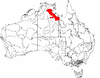
The Gulf Fall and Uplands, an interim Australian bioregion, is located in the Northern Territory and Queensland,[1][2] comprising 11,847,909 hectares (29,276,820 acres).[3]
Described in IBRA5.1[1] as "undulating terrain with scattered low, steep hills on Proterozoic and Palaeozoic sedimentary rocks, often overlain by lateritised Tertiary material; skeletal soils and shallow sands; Darwin box (Eucalyptus tectifica) and variable-barked bloodwood (Corymbia erythrophloia) woodland to low open woodland with spinifex understorey."
The abbreviation for the bioregion is GFU.[3]
IBRA regions and subregions: IBRA7
IBRA region / subregion
IBRA code
Area
States
Location in Australia
Gulf Fall and Uplands
GFU
11,847,909 hectares (29,276,820 acres)
NT / Qld
McArthur
GFU01
9,330,938 hectares (23,057,250 acres)
Nicholson
GFU02
2,516,971 hectares (6,219,570 acres)
^ abEnvironment Australia. "Revision of the Interim Biogeographic Regionalisation for Australia (IBRA) and Development of Version 5.1 - Summary Report". Department of the Environment and Water Resources, Australian Government. Archived from the original on 5 September 2006. Retrieved 31 January 2007.
^IBRA Version 6.1 data
^ ab"Interim Biogeographic Regionalisation for Australia (IBRA7) regions and codes". Department of Sustainability, Environment, Water, Population and Communities. Commonwealth of Australia. 2012. Retrieved 13 January 2013.
and 28 Related for: Gulf Fall and Uplands information
The GulfFallandUplands, an interim Australian bioregion, is located in the Northern Territory and Queensland, comprising 11,847,909 hectares (29,276...
York Peninsula, Einasleigh Uplands, GulfFallandUplands, Gulf Plains, Northern Kimberley, Pine Creek, Tiwi Cobourg, and Wet Tropics. in the Territory...
"The Snowies", is an IBRA subregion in southern New South Wales, Australia, and is the tallest mountain range in mainland Australia, being part of the continent's...
bioregion, and is the highest mountain range in Australia. The range straddles the borders of eastern Victoria, southeastern New South Wales, and the Australian...
The Gulf Plains, an interim Australian bioregion (IBRA), is located in the Northern Territory and Queensland, comprising 22,041,825 hectares (54,466,540...
landmass and run for 600 km from the Brindabella Ranges near Canberra along the borders of the Australian Capital Territory, New South Wales and Victoria...
the Wet Tropics bioregion, and is just east of the Einasleigh Uplands. The middle section is centred on Mackay, Queensland, and the southern section is just...
kilometres wide, transitioning to gently undulating uplands made up of weathered granite, gneiss and laterite. Bluff Knoll in the Stirling Range is the...
include wetlands, river edges, heathland and rocky outcrops. Leaf litter (i.e. twigs, leaves and branches which fall from trees to the ground) plays a substantial...
The Gulf Coastal, an interim Australian bioregion, is located in the Northern Territory, comprising 2,711,718 hectares (6,700,800 acres). The code for...
Einasleigh Uplands, Gulf Coastal, GulfFallandUplands, Gulf Plains, Northern Kimberley, Ord Victoria Plain, Pine Creek, Tiwi Cobourg, and Victoria Bonaparte...
The Liverpool Range is a mountain range and a lava-field province in New South Wales, Australia. The eastern peaks of the range were the traditional territory...
bioregion which includes Norfolk Island and Lord Howe Island (both part of New South Wales). Its IBRA code is PSI. Norfolk and Lord Howe Islands constitute the...
Dampierland, GulfFallandUplands, Northern Kimberley, Ord Victoria Plain, Pine Creek, Victoria Bonaparte in the Northern Territory., and the bioregions...
The Southeast Australia temperate forests is a temperate broadleaf and mixed forests ecoregion of south-eastern Australia. It includes the temperate lowland...
low hills and valleys of which the southern section is the wheat-growing plain known as the Riverina and the northern section is low hills and plains mostly...
part of the range in the vicinity of Adelaide is called the Adelaide Hills and defines the eastern border of the Adelaide Plains. The Mount Lofty Ranges...
vegetation is woodlands and mallee scrub. The ecoregion is a transitional zone between the Mediterranean-climate forests, woodlands, and shrublands of Southwest...
climate ecoregions of Australia's southwest corner and the deserts and xeric shrublands to the north and inland. Much of the area is now converted to wheat-growing...
Society and are based on satellite data of the region's natural ecosystems and vegetation types. The vegetation in this region is botanically diverse, and ranges...
trees and shrubs. A part of the Mediterranean forests, woodlands, and scrub biome, Esperance mallee is an aggregation of the Esperance Plains and Mallee...
Darwin Coastal, Gulf Coastal, GulfFallandUplands, Northern Kimberley, Ord Victoria Plain, Pine Creek, Sturt Plateau, Tiwi Cobourg, and Victoria Bonaparte...
sandstone ridges and gorges. It is found in the Bioregions of Arnhem Coast, Arnhem Plateau, Central Arnhem, GulfFallandUplands, Pine Creek, and Tiwi Cobourg...
Coastal, Gulf Coastal, GulfFallandUplands, Gulf Plains, and Pine Creek. It grows on sandstone and sand, in gullies and creekbeds, and in woodland and forest...
government's Department of Sustainability, Environment, Water, Population, and Communities. It was developed for use as a planning tool, for example for...
 Global Information