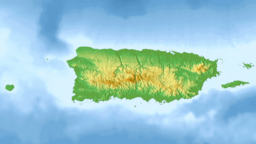
Guajataca Lake, or Lago Guajataca, is a reservoir of the Guajataca River created by the Puerto Rico Electric Power Authority in 1929. It is located between the municipalities of San Sebastián, Quebradillas, and Isabela in Puerto Rico,[3][4] and receives most of its water from the Rio Guajataca and Rio Chiquito de Cibao rivers. The lake primarily functions as a water reservoir as well as for recreational activities such as boating and fishing.[5][6] Various species of fish such as peacock bass, largemouth bass, sunfish, perch, catfish, tilapia and threadfin shad can be found in the lake.[7] The Guajataka Scout Reservation partially borders the southern portion of the lake. The dam at Guajataca Lake experienced a structural failure on September 22, 2017, due to the hit from Hurricane Maria.[8][9][10]
The reservoir is considered a touristic area.[11]
^ abcLuis R. Soler-López1 (2001). "SEDIMENTATION SURVEY RESULTS of the Principal Water-Supply Reservoirs of Puerto Rico". pr.water.usgs.gov. U.S. Geological Survey. USGS Water Resources of the Caribbean. TABLE 1. Results of bathymetric surveys of 14 reservoirs in Puerto Rico. Retrieved 2017-09-22.{{cite web}}: CS1 maint: numeric names: authors list (link)
^Puerto Rico Dam Failing; Flash Flood Emergency Declared: "This is an EXTREMELY DANGEROUS SITUATION," NWS San Juan said in a tweet. Asher Klein. NBC10-TV. Philadelphia, Pennsylvania, USA. 22 September 2017. Access 22 September 2017.
^"Lago Guajataca". pr.gov - Quebradillas. Archived from the original on 2021-12-30. Retrieved 2021-12-30.
^"Un pasadía en... Lago Guajataca". Primera Hora. July 2015. Retrieved 2021-12-30.
^"Refugio Vida Silvestre, Embalse Guajataca". Discover Puerto Rico. Retrieved 2021-12-30.
^"Lago Guajataca". 3 May 2013. Retrieved 2022-02-10.
^"Lago Guajataca at Damsite". Water Resources of the Caribbean. United States Geological Survey. Retrieved September 22, 2017.
^Ellis, Ralph (22 September 2017). "Puerto Rico dam: Evacuations begin along Guajataca River". CNN. CNN News. Retrieved September 22, 2017.
^Schmidt, Samantha. "'Thousands of people could die': 70,000 in Puerto Rico urged to evacuate with dam in 'imminent' danger". Washington Post. Retrieved September 23, 2017.
^"El embalse Guajataca entraría en nivel de ajustes operacionales este jueves o viernes". 22 June 2022.
2km 1.2miles 3 2 1 GuajatacaLake, or Lago Guajataca, is a reservoir of the Guajataca River created by the Puerto Rico Electric Power Authority in 1929...
Guajataca may refer to: GuajatacaLake, a reservoir located between the municipalities of San Sebastián, Quebradillas and Isabela, Puerto Rico Guajataca...
Isabela forming GuajatacaLake on its path. The river also gives name to one of the principal lodgings in the area, Parador Guajataca. Guajataca, sometimes...
Guajataca State Forest (Spanish: Bosque Estatal de Guajataca) is one of the 20 forests that make up the public forest system of Puerto Rico. The Guajataca...
Rico, in the northwest, and partially borders the southern portion of GuajatacaLake, from which the camp takes part of its name. The camp was founded in...
PR-2. Between Camuy and San Sebastián it passes near GuajatacaLake, the largest artificial lake in western Puerto Rico. Puerto Rico Highway 119 south...
66.9054550°W / 18.3668935; -66.9054550 Sedimentation Survey of Lago Guajataca, Puerto Rico, January 1999 (PDF). U.S. Geological Survey, U.S. Department...
island in San Sebastián and partially borders the southern portion of GuajatacaLake, from which the camp takes part of its name. Yokahu Lodge 506 is the...
Rojo National Wildlife Refuge, Crash Boat Beach, Domes Beach, GuajatacaLake, Guajataca State Forest, Guánica State Forest, Hacienda Juanita, Jobos Beach...
House Zona Historica de Ponce Blanco Historic Bridge Guajataca Beach and tunnel GuajatacaLakeGuajataca State Forest Liberty Theater Puerto Hermina Beach...
begins at downtown Isabela and ends at its intersection with PR-119 near GuajatacaLake. Eastbound sign for PR-113 in Isabela Kilometer markers represent the...
located nearby. The Guajataca River flows into the Atlantic passing through a canyon called the Guajataca Valley (Spanish: Valle de Guajataca), between the...
requiring the construction of tunnels and tall bridges, including the Guajataca Tunnel completed in 1904. In 1907, the northern line of San Juan was connected...
Forest) Cerrillos Lake Wildlife Refuge El Buey Natural Wildlife Refuge LakeGuajataca Wildlife Refuge Lake La Plata Wildlife Refuge Lake Luchetti Wildlife...
electricity. The rate of suicides doubled over the pre-Maria rate. The Guajataca Dam was structurally damaged, and on September 22, the National Weather...
State Forests Aguirre Boquerón Cambalache Carite Ceiba Cerrillos Guajataca Guánica Guilarte Los Tres Picachos Maricao Monte Choca Nuevo Milenio Piñones...
was being pumped by AAA to homes from Guajataca. The damage to the reservoir and further rumors that the lake was going to run dry increased levels of...
highest peaks in the island. Nested among these mountains is Lake Guineo, the island's highest lake. The forest has 18 kilometers (11 mi) of trails, an observation...
Lago Dos Bocas, between Arecibo and Utuado municipalities, PREPA Lago Guajataca, between San Sebastián, Quebradillas and Isabela municipalities, PREPA...
following decades, previously designated natural reserves such as Carite, Guajataca and Rio Abajo were given the additional designation of state forest. Several...
picnic areas, complete with gazeebos and a man-made reservoir, Lake Cerrillos and the Lake Cerrillos dam. The forest is located at 18.08842 N, 66.58058...
 Global Information